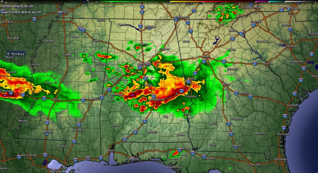
Good morning! A RUDE AWAKENING. EARLY this morning, the storm threat begins early as a cluster of strong storms migrates southward across the area, some strong/severe with lots of lightning. There has been several warnings. This storm cluster was expected.
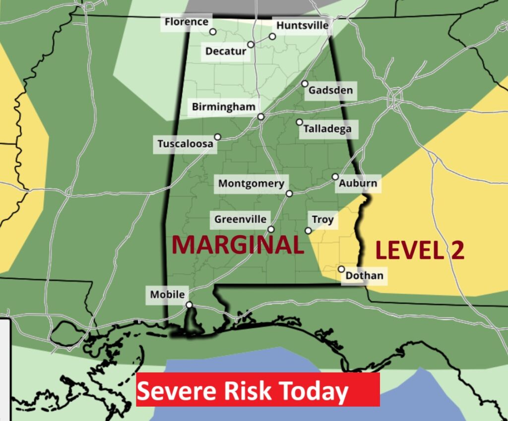
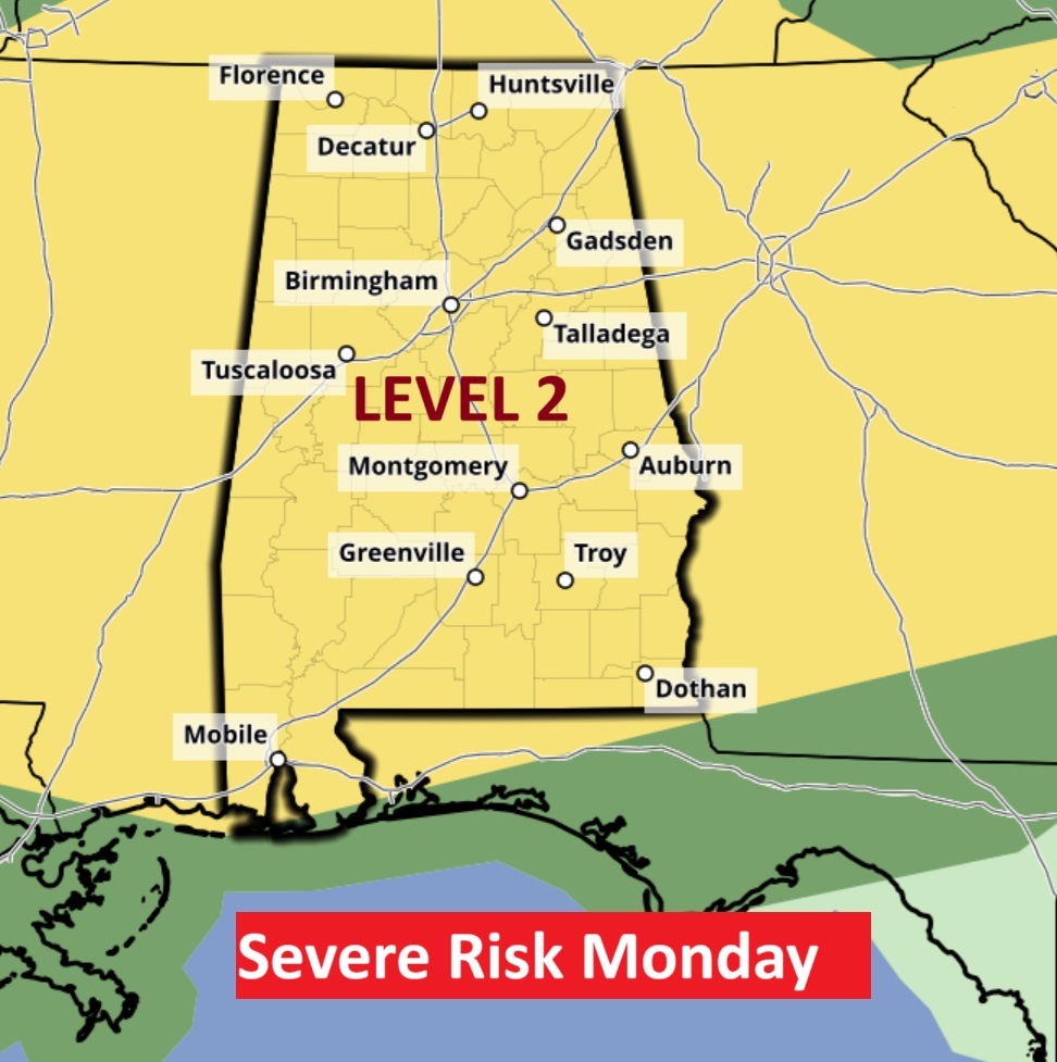
It will be stormy at time on this Sunday. This Future radar starts at 4AM and goes till 9pm tonight. Expect yet another round of strong to severe storms Monday. Level 2 severe risk for most of the state.