
Good Morning! Get ready for a beautiful weekend as February ends and March begins. Widespread Dense Morning fog starts our day. Cloudy skies will gradually start to clear later, leading to a nice afternoon on this last day of February.
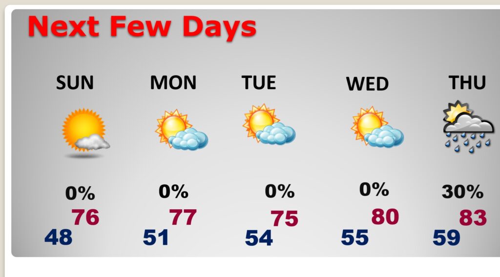
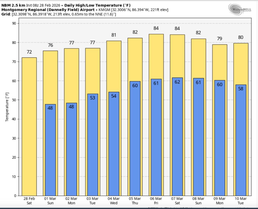
Sunshine will be in abundance on the first day of March tomorrow. Highs in the middle 70’s. Spring Fever is back on the menu for several days. Much of next week will be storm-free and dry. Lots of sunshine. Highs well into the 70’s. Lower 80’s by mid to late next week. The next chance of showers arrives Thursday.
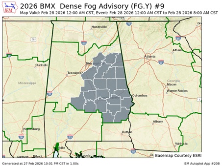
TODAY: Widespread dense fog, mainly before 9am. Otherwise, cloudy through mid morning, then gradual clearing, with a high near 73. (Normal 68/43)
DENSE FOG ADVISORY till about 9. Visibility under a quarter of a mile in spots.
TONIGHT: Mainly clear. Low 48. (see info about the planetary alignment below)
NEXT FEW DAYS: We have a rather spectacular weekend forecast. Expect plenty of sunshine Sunday. Highs in the 70’s. Most of next week will be storm-free and dry. Lots of sunshine. Highs well into the 70’s. 80’s by late next week.
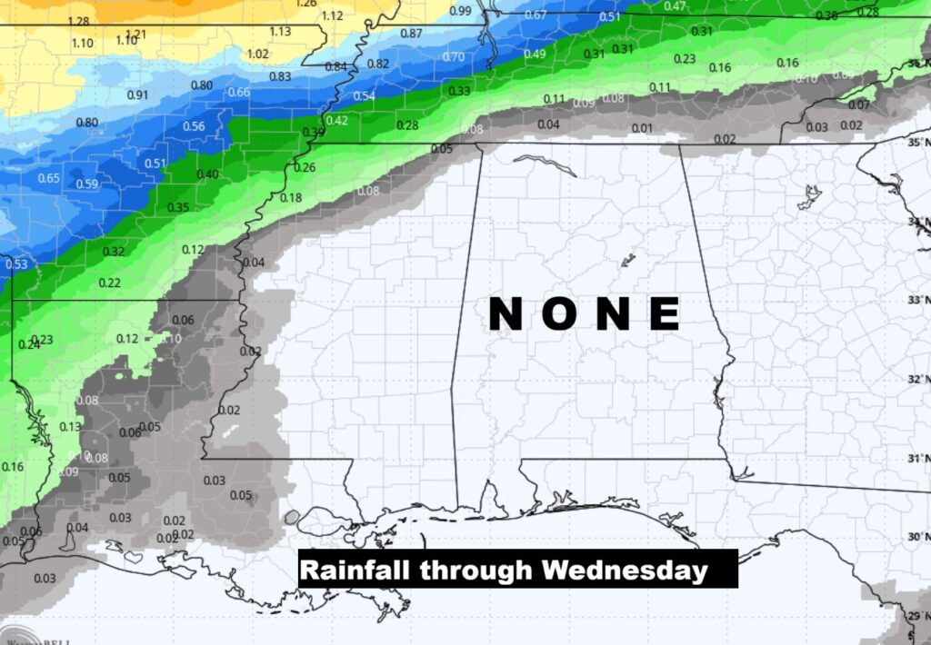
Expected rainfall through Wednesday.
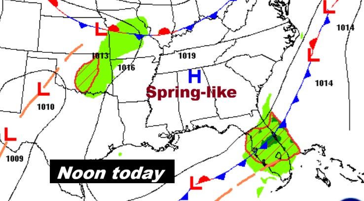
The 10 Day model Blend Temperature Trend. Much above normal temperatures will continue. Spring-like.
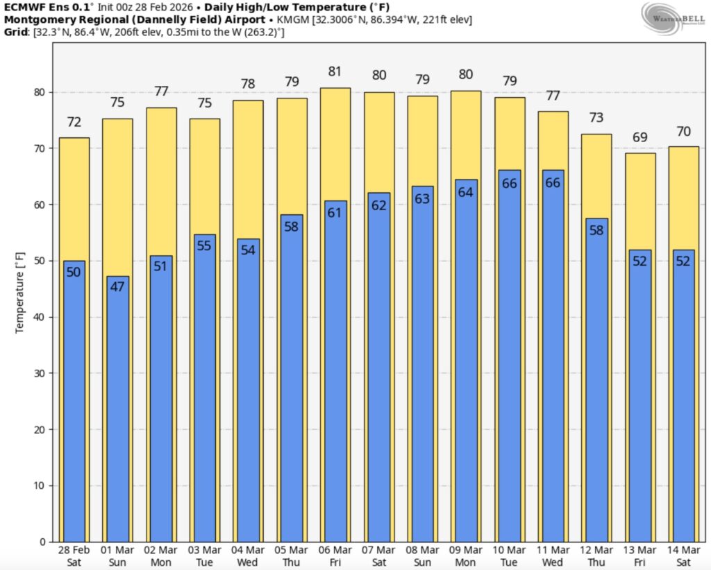
The Euro Ensemble 16 Day model temperature trend. No cold air . Somewhat cooler toward mid month.
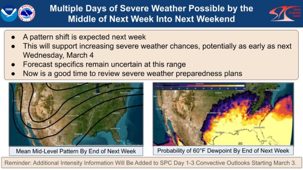
GROWING FUTURE SEVERE WEATHER THREATS:
Rare — strongly worded message from the folks at the Storm Prediction Center.
SPC: A pattern shift will support increasing severe weather chances starting the middle of next week & beyond. Mid-level troughing in the west, w/ 60+°F dewpoints in the east should result in an extended period of active severe weather from the S Plains to SE & perhaps OH Valley.
—
We’ll continue to watch this growing threat. It appears our greatest threat window here in Alabama would be somewhere in the vicinity of next weekend March 7-8.
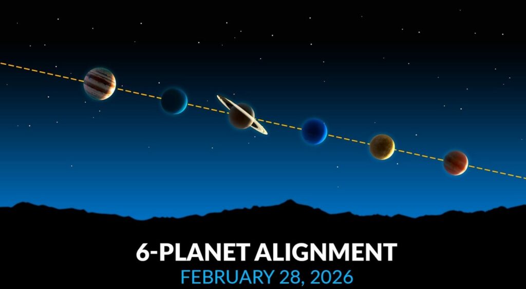
PLANETS WILL ALLIGN: A rare “planet parade” featuring six planets—Mercury, Venus, Jupiter, Saturn, Uranus, and Neptune—will align in the night sky around tonight. Visible just after sunset in the western sky, this celestial event will form an arc along the ecliptic, with Venus and Jupiter being the brightest, while Uranus and Neptune will require binoculars. Looks like the weather will cooperate!
Best Time: Shortly after sunset, looking towards the western horizon. About an hour after sunset which would be about 6:45PM.
Visibility: Venus and Jupiter will be very bright, with Mercury and Saturn also visible to the naked eye. Uranus and Neptune will likely require optical aid.
DAYS TILL Officially SPRING: 21 days! Meteorological Spring starts Sunday.
Thanks for reading this Blog this morning. The next scheduled complete Blog update and Video Forecast Discussion is scheduled for the 4 o’clock hour on Monday morning. Have a great weekend.
-Rich