
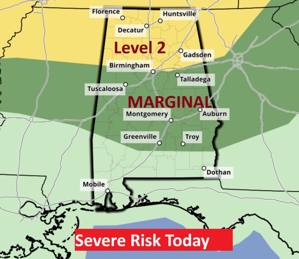
Good morning! It’s a pretty typical June weekend forecast, featuring heat, humidity and storms, as Tropical Atlantic moisture overspreads the area. The number of showers and thunderstorms will be in greater supply especially Saturday through Monday, particularly in the afternoon and evening hours, as we track storm clusters (MCS) which will traverse the state. Some of the storms could be strong to severe especially on Saturday with a Level 2 Severe Risk. SPC says they may even upgrade the risk to level 3. Most of the area has a Level 1 Marginal risk today and Sunday. Damaging straight-line wind gusts is the main threat. Our weather app will keep you on top of the action. Here’s my brief video forecast discussion.
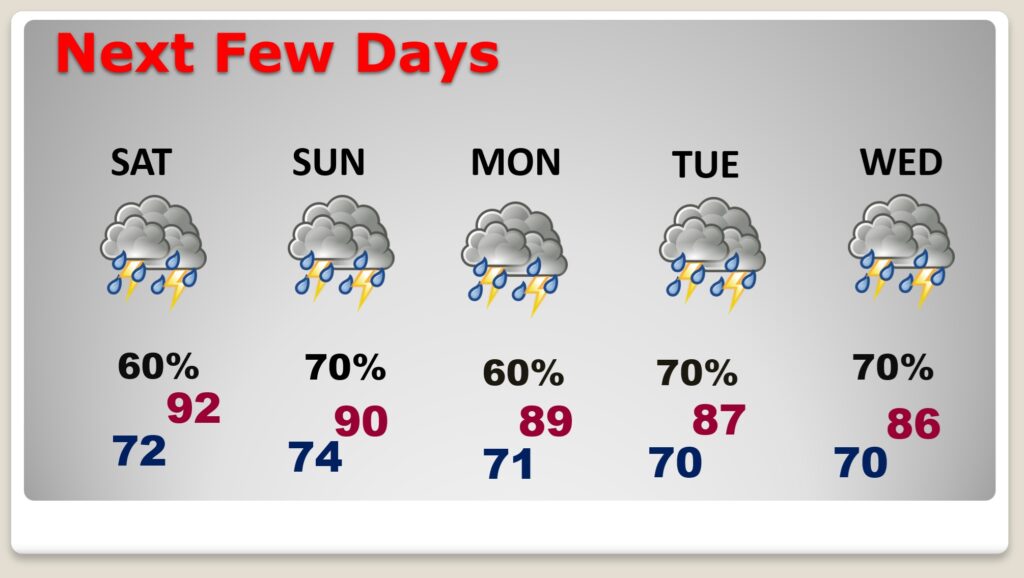
TODAY: Partial sunshine. High 90-92. Light SE wind. Random scattered mostly PM Showers and storms. Some could be strong to severe. Very humid Low tonight near 70. (Normal hi/lo 90/67)
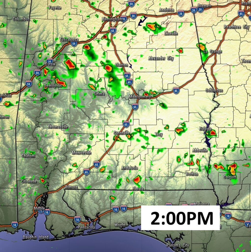
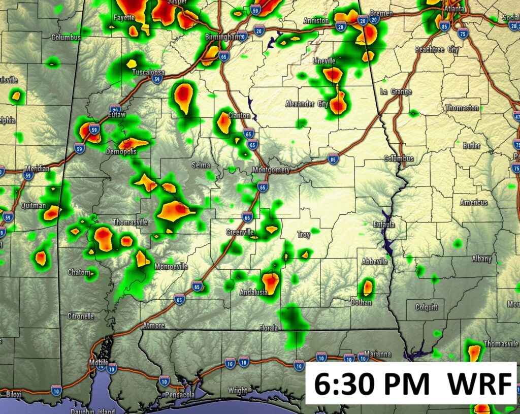
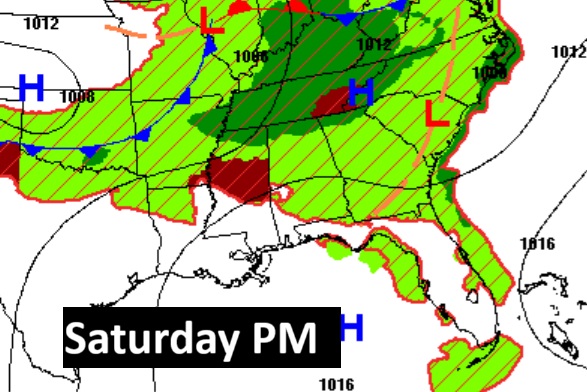
FUTURE RADAR looks fairly routine today. Scattered Random strong storms, some severe. But, I want to point out that Saturday afternoon snapshot showing a strong complex of storms (MCS) moving SE. These storm complexes are extremely difficult to forecast movement and timing.
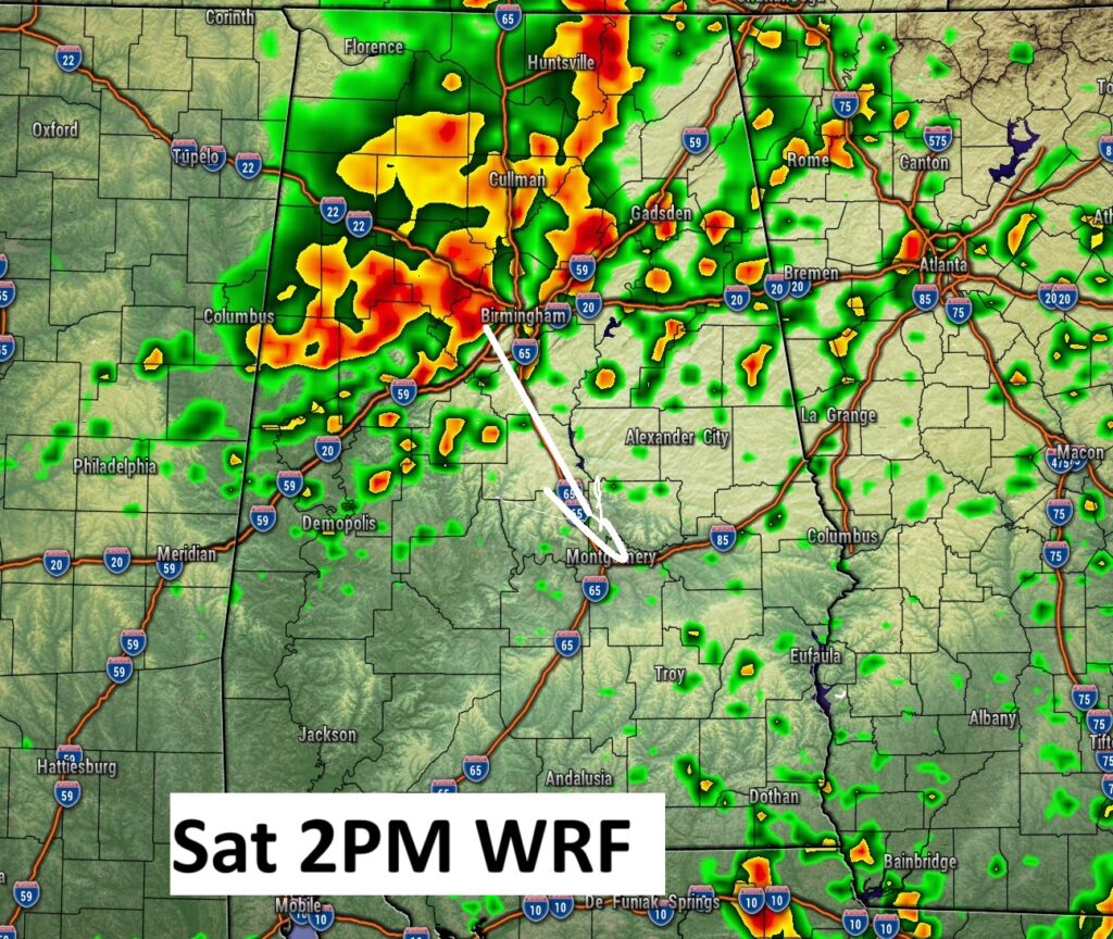
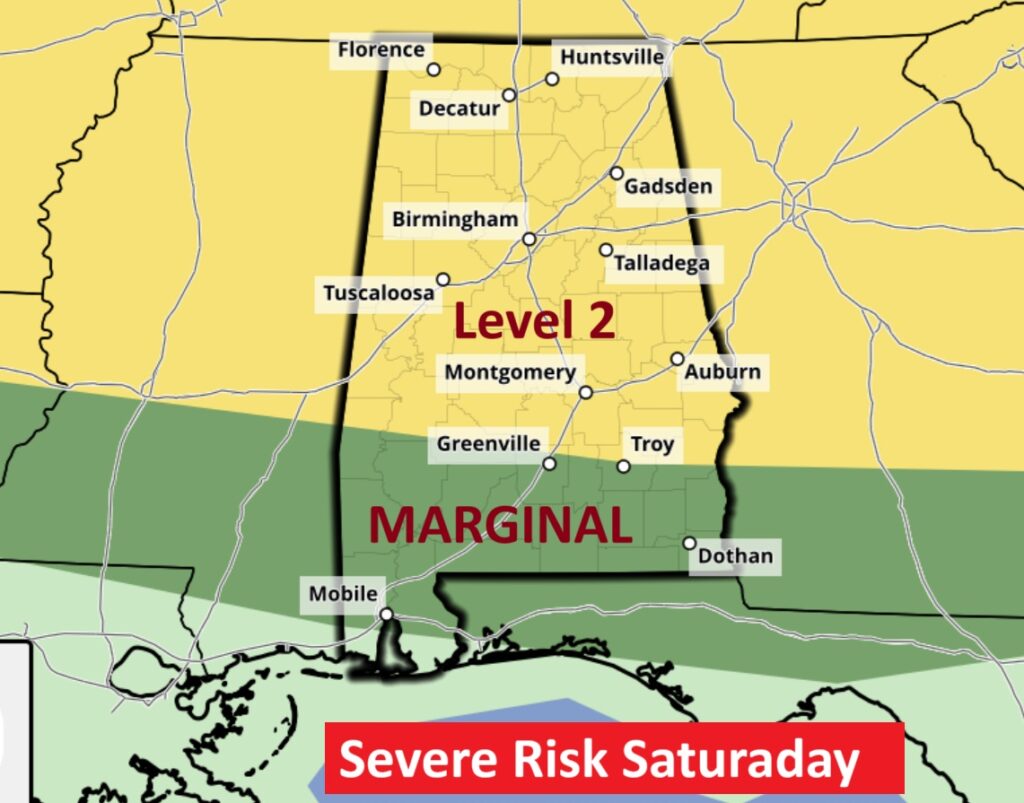
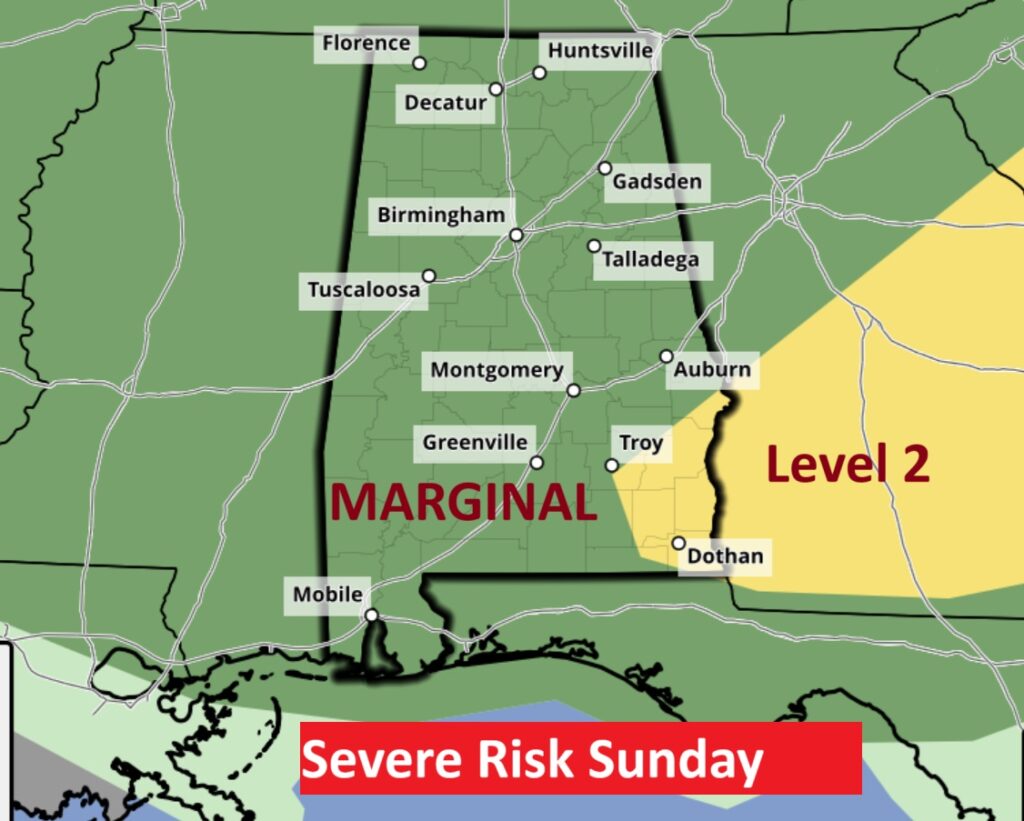
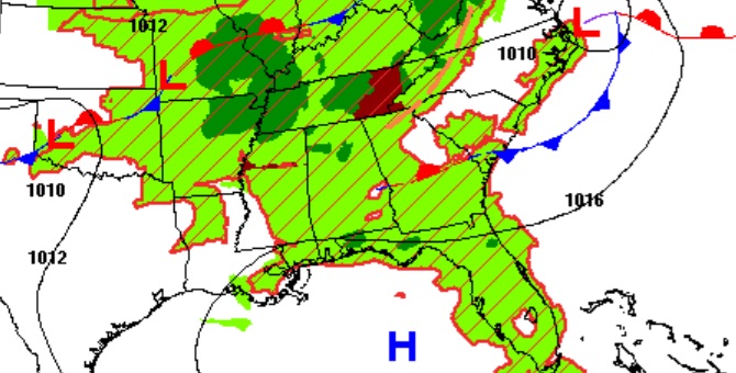
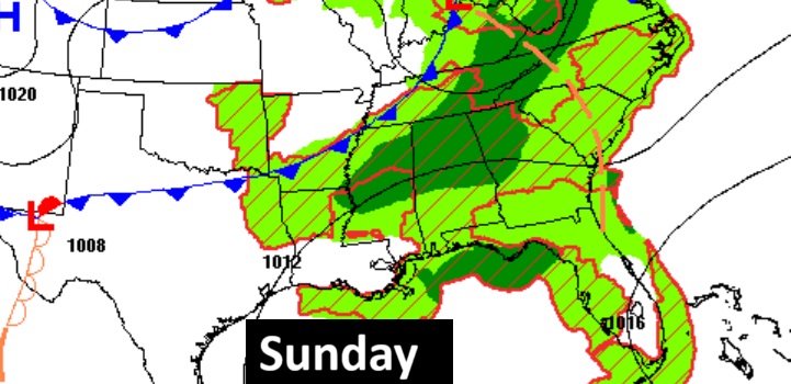
SPC has most of us in a Level 1 Marginal Risk today and Sunday. (and probably Monday) BUT, Saturday, a large extended area of Level 2 Risk (2 out of 5) covers much oif the state as far south as Troy/Greenville. SPC has also hinted on an upgrade to Level 3 for part of the state. Damaging straight-line wind gusts is the main risk. Our Weather App will keep you on top of the action.
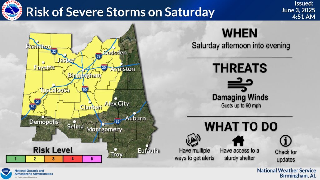
Good stuff from NWS Birmingham about the next 3 days. Saturday could be the biggest day. We’re heading into another active pattern with several rounds of systems coming through the region. With that, there’s at least a low to medium chance for severe storms each afternoon/evening for the next 3 days. For today – thunderstorms may initially be scattered, similar to a summertime pop-up thunderstorm coverage, so that’s why there’s no specific timing graphic associated with it. We could essentially see thunderstorm initiation around the same time for most of the area. For Saturday – we see more of a system move through so the timing could be broken down a bit better, but there’s still some uncertainty depending on when the storms develop upstream and where they eventually track. For Sunday – The areas may change depending on how Saturday’s system pans out and where the lingering boundary from Saturday’s round sets up for Sunday. #alwx
NEXT FEW DAYS: Not much day to day change. Random Showers and storms will be most numerous in the afternoon and evening hours. Some of the storms could be strong to severe especially on Saturday with a Level 2 Severe Risk. But even today and Monday there’s a Marginal Severe Risk. Damaging straight-line wind gusts is the main threat.
Get ready for a very turbulent weekend, with scattered strong storms and tropical downpours.
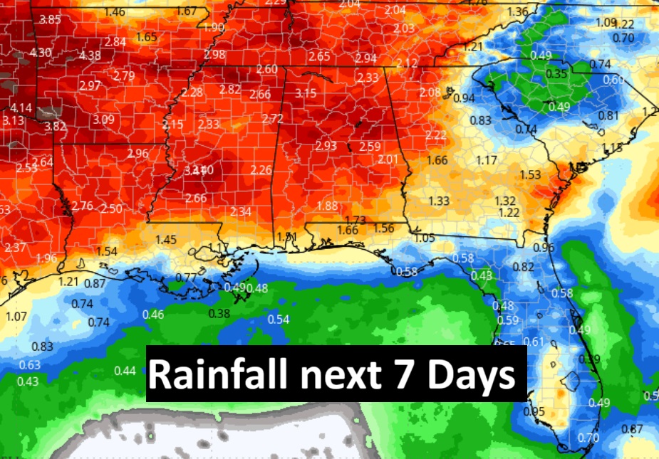
Locally heavy rainfall amounts are possible in spots over the next few days.
TROPICAL UPDATE: NHC says the Atlantic Basin is quiet for the next 7 days.
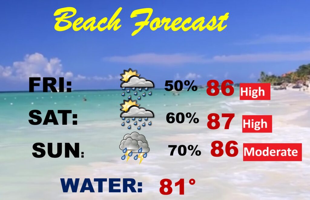
BEACH OUTLOOK: Be flexible with your plans. Numerous showers and storms will be roaming around each day, most numerous in the afternoon and evening. Gulf water temperature 81.
Thanks for reading the blog. Today everything is normal including LIVE on the Radio of NewsTalk 93.1 WACV. There will be another video forecast discussion and Blog Update in the 4 o’clock hours tomorrow morning. You can always find my forecast updates hourly on the 8 station Bluewater family of stations every day of the year.
–Rich