
Good morning! Welcome to June. A nice weather pattern continues through mid-week. Warmer today. Hotter Tuesday and Wednesday. Lower 90’s by then. Widely scattered showers returning Thursday. Scattered showers and thunderstorms Friday and Saturday. Here’s my brief forecast discussion.
TODAY: Sunshine. Low humidity. High upper 80’s. Light wind. Clear, comfortable tonight. Low 65.
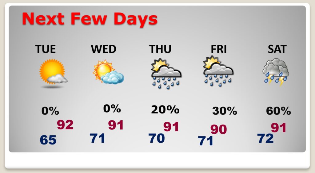
NEXT FEW DAYS: Still dry Tuesday and Wednesday. Starting to heat up. High 90-92. Widely scattered showers returning Thursday. Scattered showers and thunderstorms Friday and Saturday.
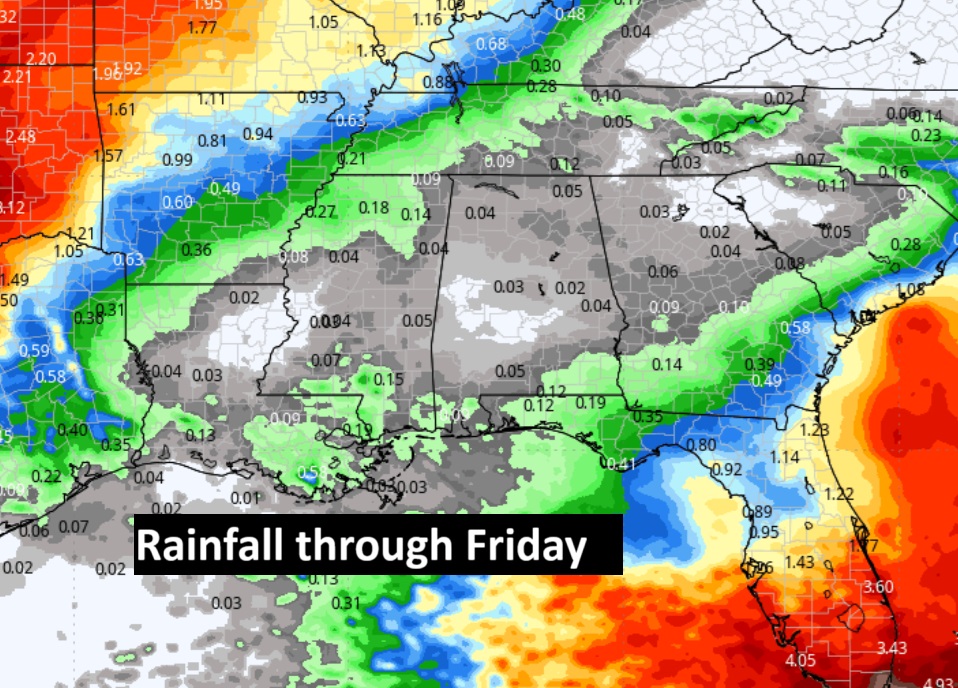
Here’s the expected rainfall in the next 7 days. Nothing heavy.
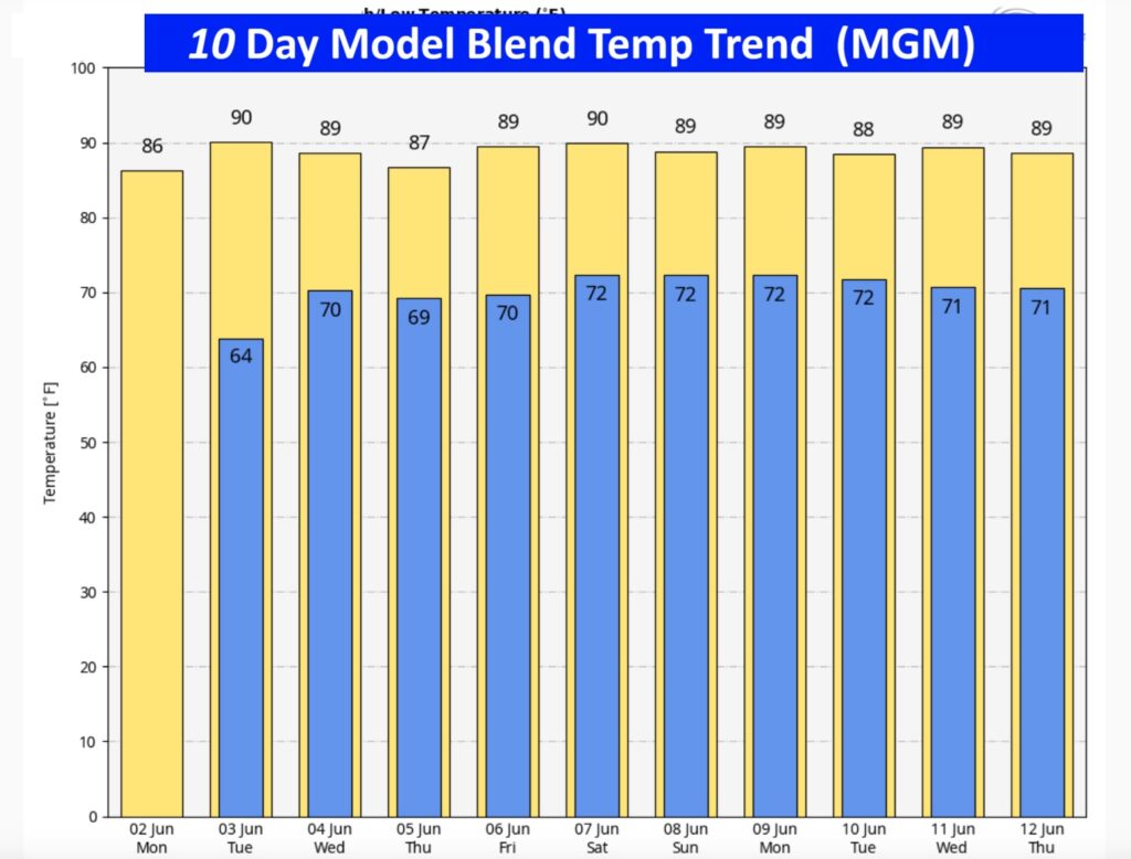
The 10 Day Model blend temperature trend confirms summer is here.
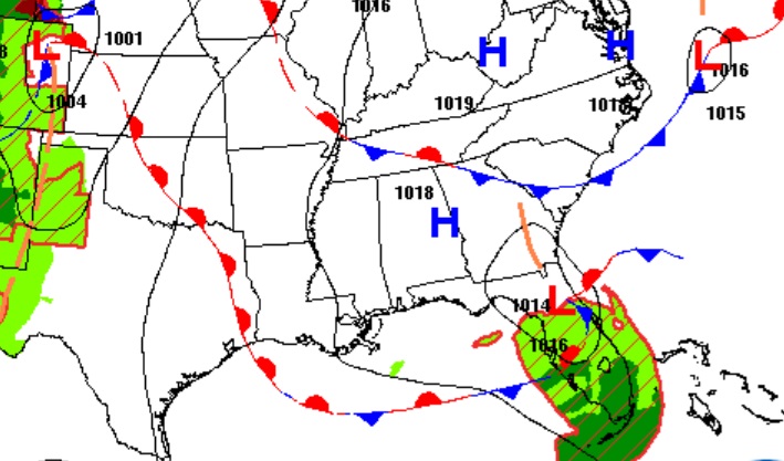
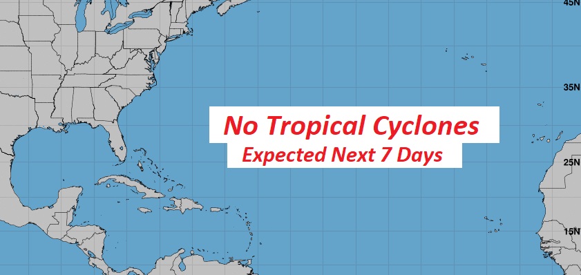
TROPICAL UPDATE: On this second day of the Hurricane Season…all is quiet for now in the Atlantic, Caribbean and in the Gulf.
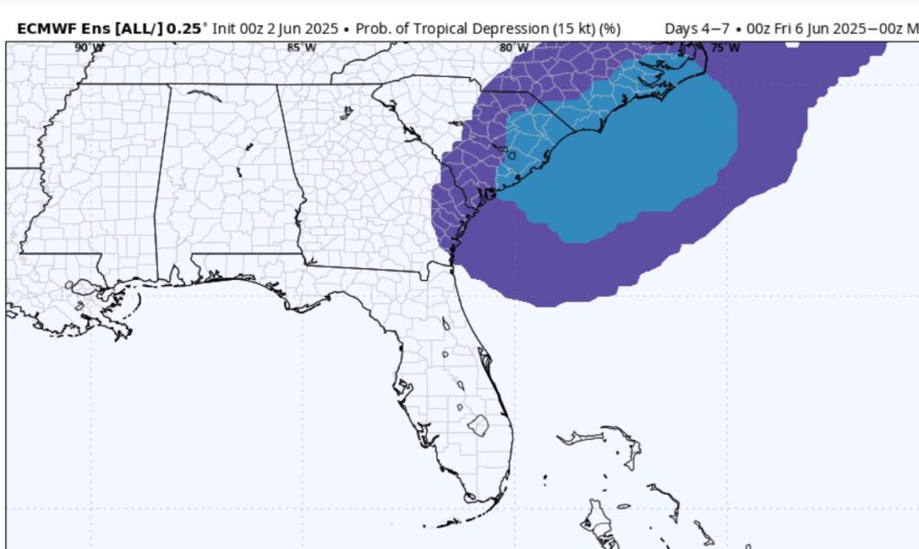
The EURO model is suggesting at least the possibility of TD development in the next week or so.
Thanks for reading the blog. Today everything is normal including LIVE on the Radio of NewsTalk 93.1 WACV. There will be another video forecast discussion and Blog Update in the 4 o’clock hours tomorrow morning. You can always find my forecast updates hourly on the 8 station Bluewater family of stations every day of the year.
–Rich