
12:30 PM
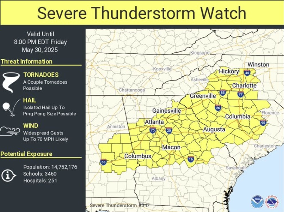
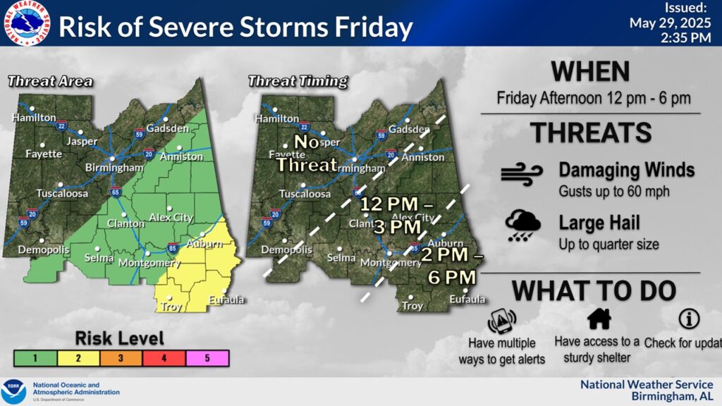
A Severe Thunderstorm Watch covers eastern Alabama, from Montgomery county eastward into Georgia until 7pm, but honestly, several counties will be cleared way before that.
Scattered wind gusts to 60 mph are likely. Hail up to quarter size is possible. A couple of tornadoes can’t be ruled out.
Please make sure to allow notifications on our Weather App. If you do not have our weather app, you can download it in the app store. Search: Rich Thomas Weather. And, make sure your Weather Radio is plugged up and in the alert mode.
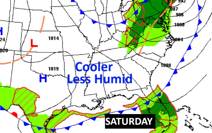
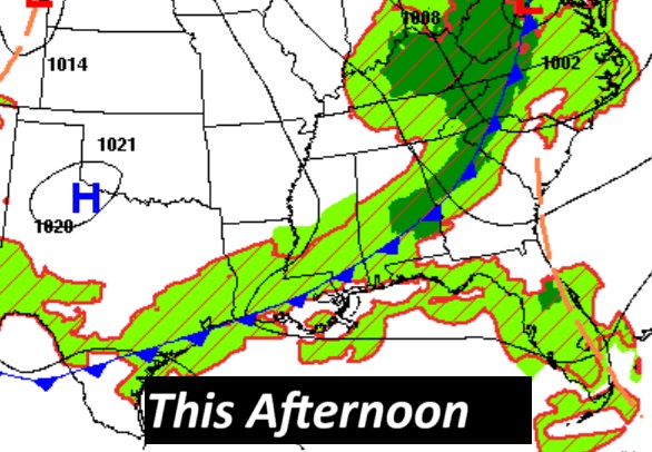
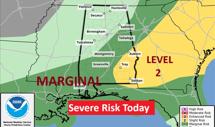
Good morning! A big weather change is on the way. A cool Front will sweep across the state today. More showers and storms are likely today ahead of then front. Another Marginal Severe Risk from SPC. Behind the front, we are in for a nice treat. The weekend looks very nice indeed with lower humidity, comfortable days and cooler nights. Here’s my brief video forecast discussion.
UH OH . There is a YOU TUBE problem this morning. It let me UPLOAD your movie for this morning, but it will not let me publish. I’ll keep trying. There’s an issue with their web-site today.
TODAY: DENSE FOG ADVISORY early. Showers and thunderstorms, mainly before 3pm. High near 84. Southwest wind 10 to 15 mph. Mostly cloudy, this evening with gradual clearing tonight. Much cooler Low tonight 59.
There is a Marginal Severe Risk from the Storm Prediction Center for many of us in central Alabama and a level 2 risk in Southeast Alabama. Damaging wind gusts is the main risk.
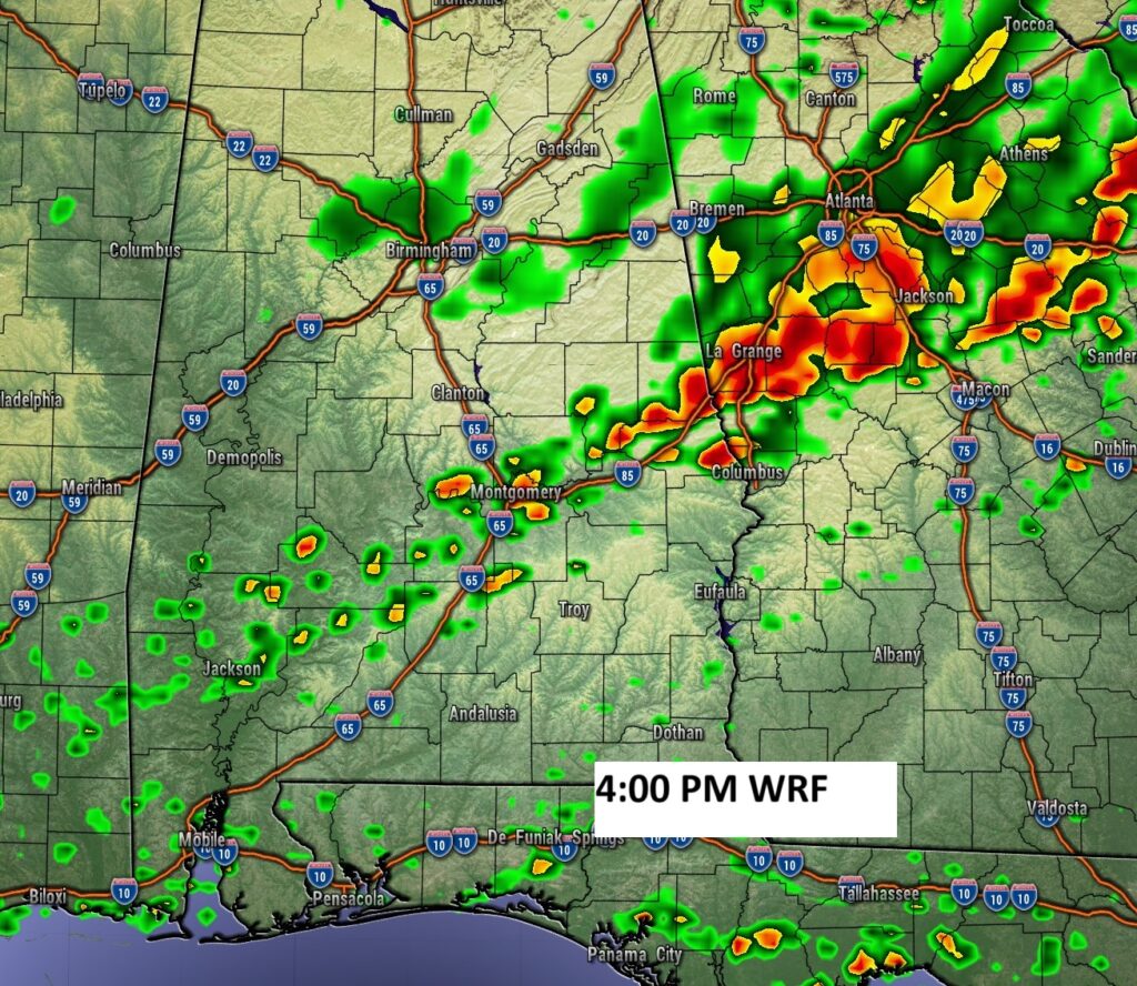
FUTURE RADAR: Shows a broken line of Rain and thunderstorms ahead of the frontal passage today.
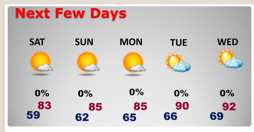
NEXT FEW DAYS: A Cold Front will sweep through the state by today. That will set the stage for nice, nearly perfect weather the weekend. Comfortable.
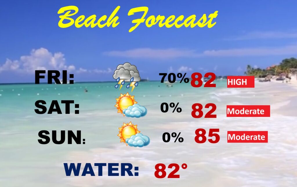
BEACH FORECAST: Potentially Wet and stormy today. Very nice weekend ahead. Gulf water 82.
Thanks for reading the blog. Today everything is normal including LIVE on the Radio of NewsTalk 93.1 WACV. There will be another video forecast discussion and Blog Update in the 4 o’clock hours tomorrow morning. You can always find my forecast updates hourly on the 8 station Bluewater family of stations every day of the year.
–Rich