
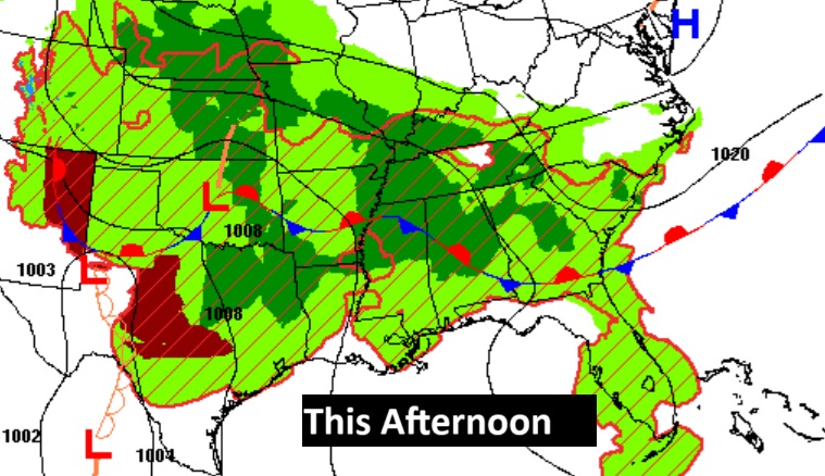
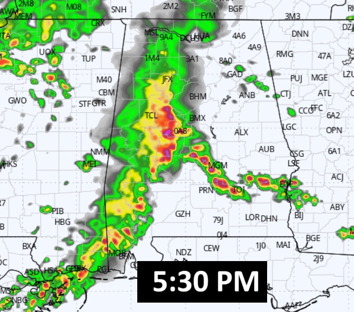
Good morning! Welcome to Memorial Day. It was very wet and stormy overnight in our state, with dozens of warnings and a Severe Thunderstorm Watch. That watch has now ended, and there will be several hours of dry weather before the next round develops in the afternoon heating. We’ll be radar watching well into the evening hours tonight. Unfortunately, the Storm Prediction Center has issued a Severe Risk each day – today through Wednesday. The risk level varies between Level 1 and Level 2. It’s a huge outdoor holiday, so stay in touch where the storms are located with our weather app. Search the app store for Rich Thomas weather. Have a good holiday, but stay weather aware.
TODAY: Mixed sun and clouds. Hot and humid. High 91. There will be many dry hours. Light SW wind. Scattered storms, mostly afternoon and evening. Marginal Severe Risk. Low tonight near 70.
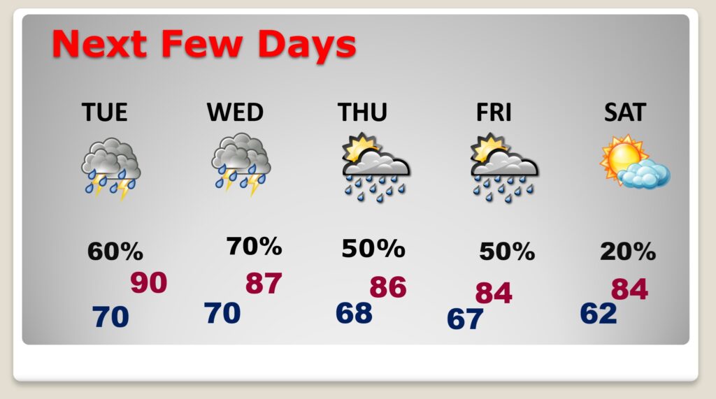
NEXT FEW DAYS: Random Scattered showers and thunderstorms will populate the radar every single day today through Thursday. Most numerous in the afternoon and evening hours. Hot and humid. Highs mostly near 90.. Low at night near 70. The first dry day I have on the graph is Saturday.
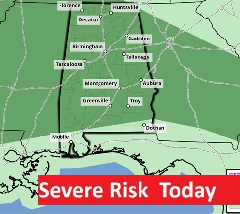
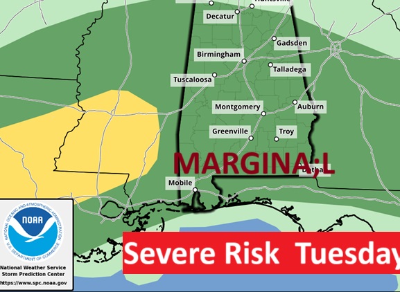
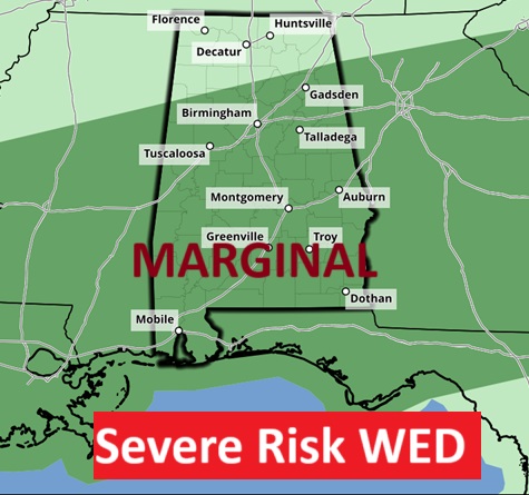
I can’t remember a time when SPC has had us in a Severe Weather Risk every single day. It started Saturday and continues through at least Wednesday. Level 1 Marginal Severe risk for most. Damaging wind gusts are the main threat.
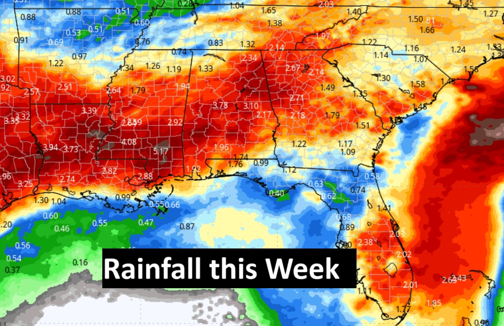
Here’s the rainfall potential map for the week ahead. Looks like locally rainfall amounts could be quite impressive in spots.
Honoring Our Heroes This Memorial Day
On this Memorial Day, we pause to remember the brave souls who served with unwavering courage and sacrificed for the freedoms we hold dear. Their dedication and strength have shaped the fabric of our nation, ensuring that liberty endures for generations to come.
To those who have served and given the ultimate sacrifice—we honor you, we remember you, and we are forever grateful for your service. Your legacy lives on in the hearts of a grateful nation.
May we never take for granted the cost of freedom, and may we always strive to uphold the values for which they fought.
🇺🇸 Thank you for your service. We will never forget

Thanks for reading the blog. The next scheduled full blog update and video forecast discussion will be Tuesday morning. Have a nice weekend!
–Rich