
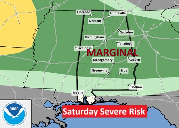
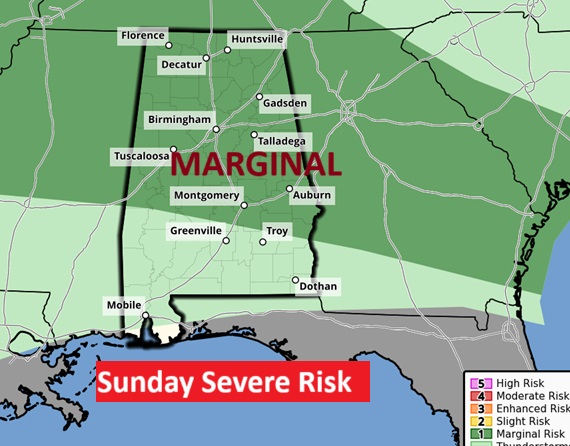
Good morning! Yesterday was the hottest day of 2025 so far with 92. Today clouds may keep us a few degrees lower. The record high of 93 is probably safe. Overnight, several north Alabama counties were under Severe Thunderstorms warnings. Today and Sunday, much of the state is in a Level 1 Marginal Severe Risk, as far south as, roughly a Troy/Greenville line. Sunday’s Risk map is almost identical. Damaging wind gusts possible.Not every town will get wet, but a line of storms will move through the area starting this morning. Monday looks dry. More scattered storms late Tuesday and Wednesday as a cool front approaches. Cooler late next week.
CLIMATE: Friday was the hottest day of the year so far with 92. (Record 95/1962) Morning low 72. (Thursday was the first 90 degree day of the year. Average first 90 degree day: June 10) Normal hi/lo 86/61) Today’s expected high 89 to 93, depending on the amount of sun. Today’s record is 93 from 1899 and 1951. Today’s record is probably safe.
TODAY: Sun/clouds mix. More clouds than sun. High 89 to 93. The record high of 93 is probably safe. SW wind 5 to 10 mph. The risk of a few thunderstorms begins this morning, as a line of storms moves southward. Some storms could be strong. Marginal Severe Risk. Damaging wind gusts possible.Mostly Cloudy tonight. Low 70.
A trough of low pressure will be the focus for a line of storms by mid-day.
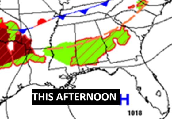
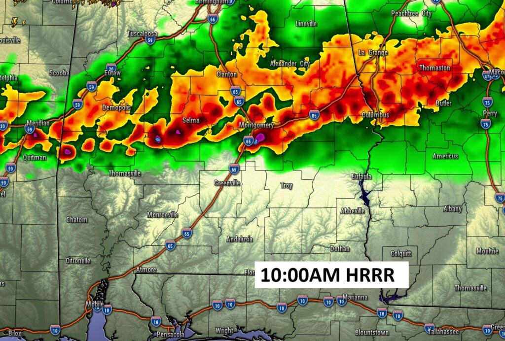
FUTURE RADAR: The line of storms which has been assaulting north Alabama overnight will move southward to the I-85/US 80 corridor later this morning. Some storms could be strong possibly severe.
WEEKEND SEVERE RISK: Both today and tomorrow, the Severe Weather Risk map from SPC looks very similar. Level 1 Marginal Severe Risk covering much of the state as far south as about a Troy/Greenville line. Not much change in the risk area Sunday. Damaging wind gusts is the main risk.
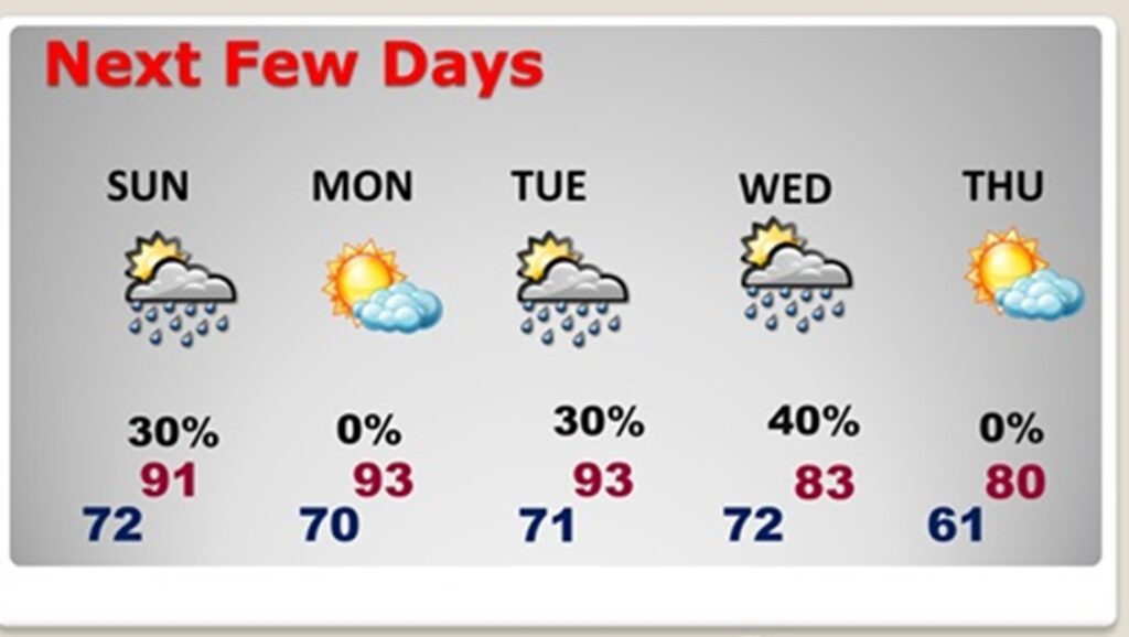
NEXT FEW DAYS: Hot and humid through the weekend. We’ll be 90+ through Tuesday.
The risk of some scattered showers and storms continues on Sunday. Mainly 30% range for central Alabama. A stronger threat in north Alabama closer to the front in the Tennessee Valley. The heat continues next week with more scattered storms Tuesday and Wednesday. Summer-like.
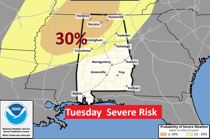
Parts of north Alabama could see an EHANCED Severe Risk by late Tuesday. We’re watching this situation.
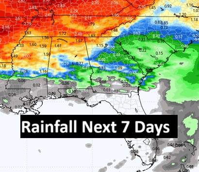
Here’s the rainfall potential map for the next 7 days shows the greatest potential in the northern half of Alabama.
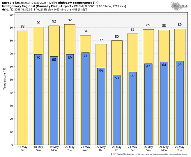
10 Day model blend temperature trend. Late next week will be cooler.
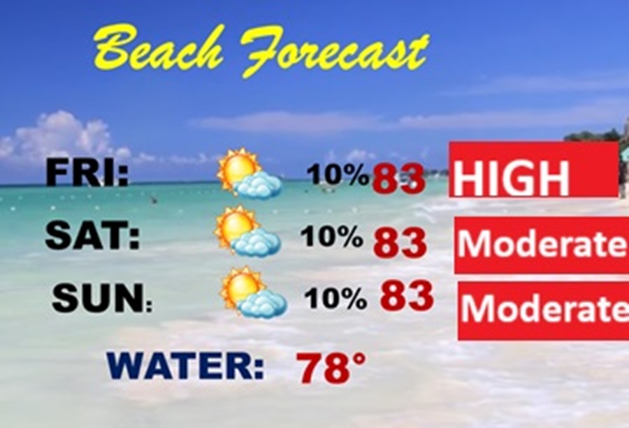
BEACH OUTLOOK: It’s a good forecast. Dry. Highs in the low 80’s. High rip current risk today, especially from Destin eastward. . Gulf water 79.
Thanks for reading the blog. The next scheduled full blog will be Monday morning, Have a nice weekend!
–Rich