
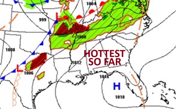
Good morning! We are still getting hotter and hotter. Yesterday was the first 90 of the year. Today will be the hottest day of 2025 so far. Theres a good chance we’ll be in the low 90’s today near 90 Saturday and Sunday. Meanwhile, the critical dewpoints are creeping upward. We will likely see dewpoints near 70 over the weekend. Hot & humid.
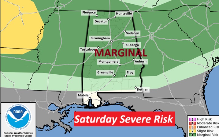
It’s another dry forecast today. Spotty random storms are possible this weekend. The storms will be few and far between and many towns will stay dry. Some storms could reach severe limits. There is a Level 1 Marginal Severe Risk both days. Here’s my brief video forecast discussion.
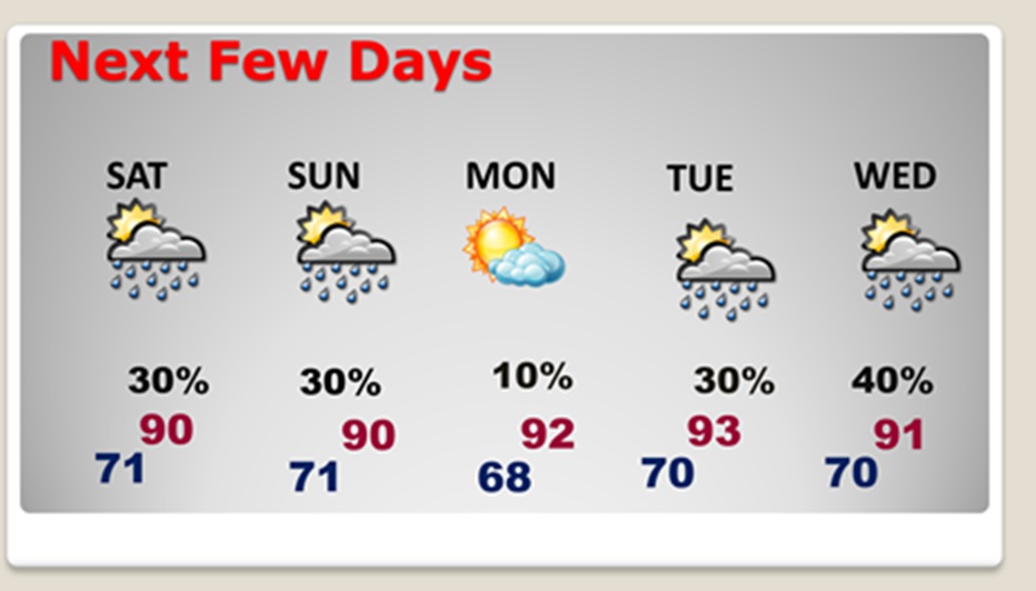
TODAY: Hottest Day of 2025 so far. Good bit of sunshine. High 92. SW wind 5 to 10 mph.
Partly cloudy tonight. Low 69. (Normal 86/61)
NEXT FEW DAYS: Hot through the weekend. We’ll be 90+ through Monday.
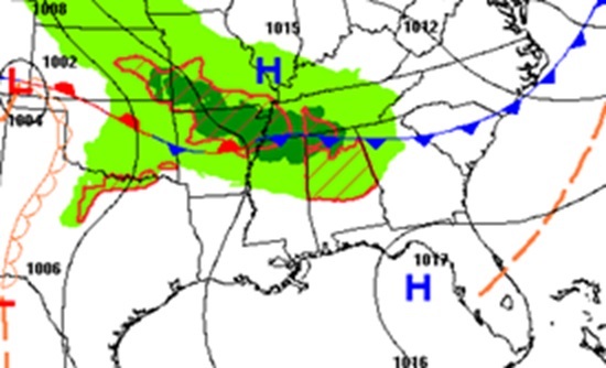
The risk of some scattered showers and storms returns this weekend. Mainly 30% range Saturday and Sunday for central Alabama. A stronger threat in north Alabama closer to the front in the Tennessee Valley. The heat continues next week with more scattered storms Tuesday and Wednesday. Summer-like.
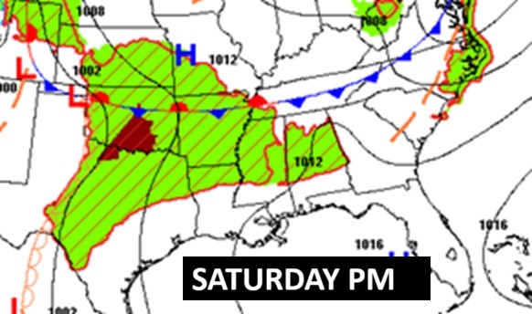
WEEKEND MARGINAL SEVERE RISK:
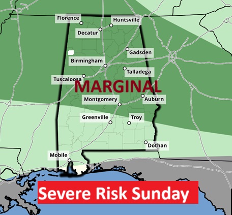
There is a Level 1 Marginal Severe Risk Saturday, roughly from Troy/Greenville northward. The Sunday Day 3 SPC outlook is similar. Damaging wind gusts are possible in some of the storms.
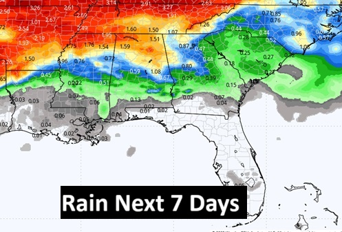
Here’s the rainfall potential map for the next 7 days shows the greatest potential in extreme north Alabama.
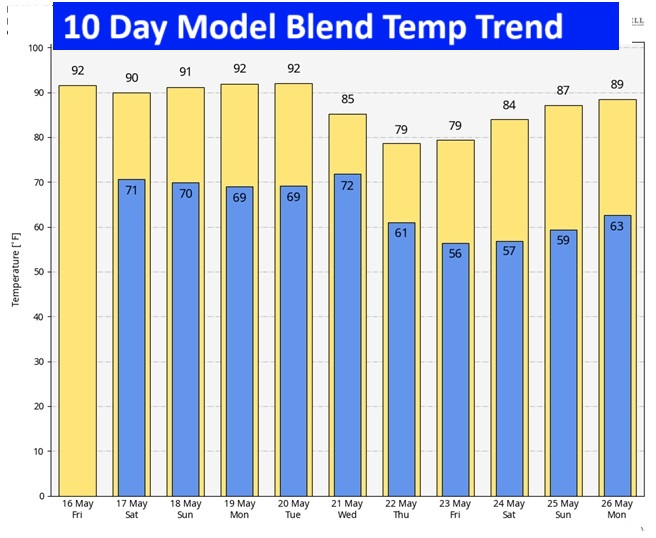
10 Day model blend temperature trend. Late next week will be cooler.
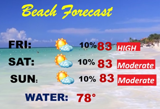
BEACH OUTLOOK: It’s a good forecast. Dry. Highs in the low 80’s. High rip current risk over the weekend, especially from Destin eastward. . Gulf water 78.

Thanks for reading the blog. There will be another Blog Update in the 4 o’clock hours tomorrow morning. You can always find my forecast updates hourly on the 8 station Bluewater family of stations every day of the year.
–Rich