
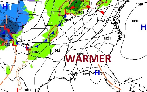
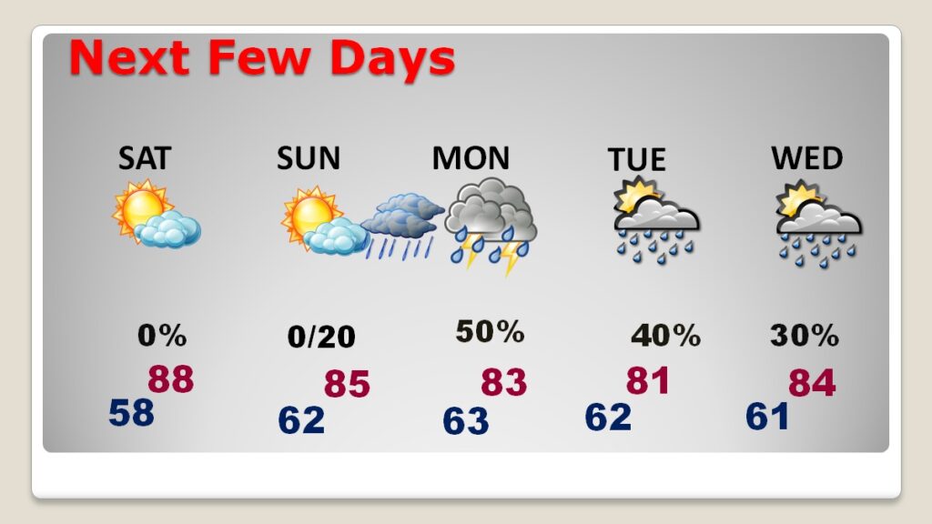
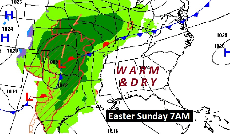
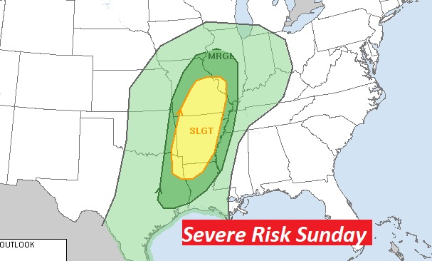
Good Morning! We are still on cruise control as our warm, dry, storm-free pattern continue for a couple more days. Today we’ll be in the mid to upper 80’s and very likely the upper 80’s on Saturday. Right now I think the next storm system will stay west of us through the daytime on Easter. Widely scattered storms will move in the overnight hours Sunday night, and scattered storms are more likely on Monday and Tuesday. Expect a very active/stormy pattern from Monday through the end of the month, with a parade of storm systems. Here’s my brief video forecast discussion.
CLIMATE: Yesterday’s lo/hi 45/81. Normal 51/79. No Rain.
TODAY: Sunshine & warmer. Nice day. High 87. East wind 5 to 10 mph. Clear, not as cool tonight. Low 58. (Today’s record hi 91 in 2006)
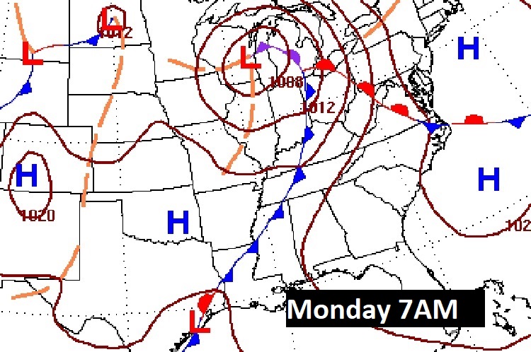
NEXT FEW DAYS: The warming trend continues. . Upper 80’s are a good bet with a sun/cloud mix on Saturday. Easter Sunday looks cloudy and warm. Widely scattered storms will move in the overnight hours Sunday night, and scattered storms are more likely on Monday, Tuesday and maybe Wednesday.
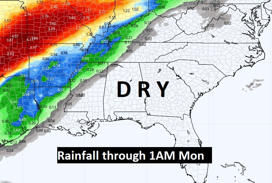
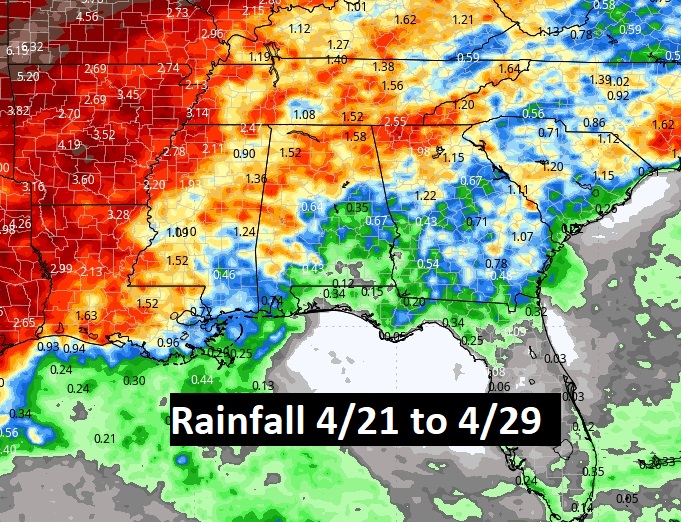
Here’s the expected rainfall starting Monday and through April 29th. Wet weather is returning.
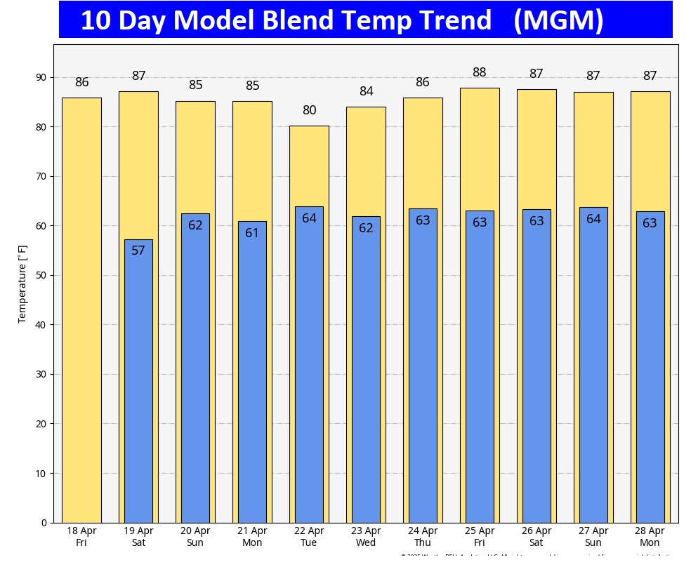
Here’s the 10 day model blend temperature trend. It’s a warm pattern.
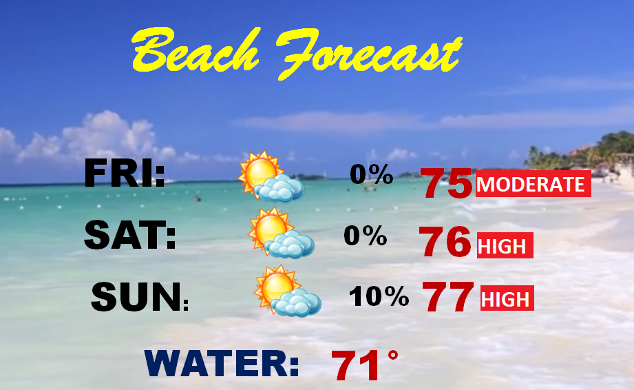
BEACH FORECAST: Easter weekend is a big deal at the Beach. This weekend, the beach forecast is pretty nice!
Thanks for reading the blog. Today everything is normal including LIVE on the Radio of NewsTalk 93.1 WACV. There will be another video forecast discussion and Blog Update in the 4 o’clock hours tomorrow morning. You can always find my forecast updates hourly on the 8 station Bluewater family of stations every day of the year.
–Rich