
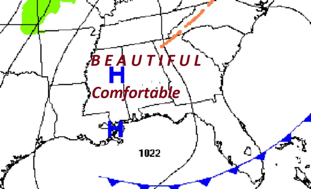
Good Morning! We are living the dream. This can be a very turbulent time of the year. It usually is. But, we have been enjoying an extended string of dry, comfortable, Storm-free days. And, this pattern continues for at least a few more days. Today will be very nice and quite comfortable with a perfect high in the mid 70’s. Tomorrow we’ll be warmer as the mercury makes it into the lower 80’s. On Good Friday, with plentiful sunshine, middle 80’s are likely. Upper 80’s are a good bet with a sun/cloud mix on Saturday. Easter Sunday looks cloudy and warm. I still think showers and storms hold off probably till next Monday. We will be getting into a very active/stormy pattern from Monday 4/21 through the end of the month, with a parade of storm systems. Here’s my brief forecast discussion.
TODAY: SUNSHINE. Nice day. Comfortable. High 75. North wind 5 to 10 mph. Clear, , cool tonight. Low 49.
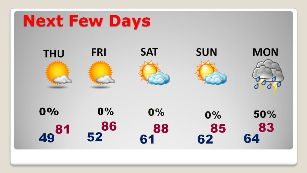
NEXT FEW DAYS: A warming trend begins Thursday. I think we’ll probably be in the lower 80’s. On Good Friday, with plentiful sunshine, middle 80’s are likely. Upper 80’s are a good bet with a sun/cloud mix on Saturday. Easter Sunday looks cloudy and warm. I still think showers and storms hold off probably till next Monday.
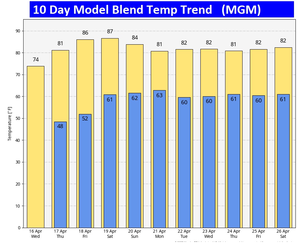
Here’s the 10 day model blend temperature trend.
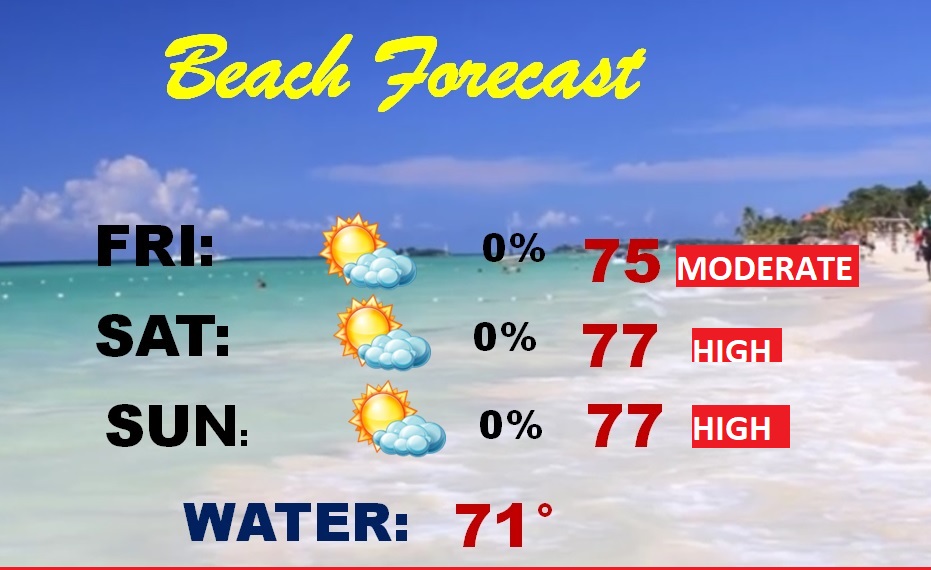
BEACH FORECAST: Lots of folks will be heading southward to our beautiful Gulf Coast Beaches. I wish I was. It’s looks beautiful.
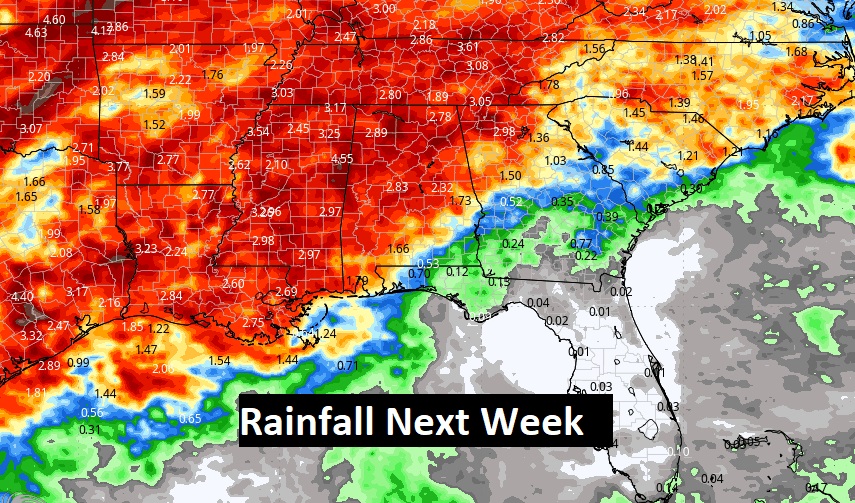
ACTIVE STORMY PATTERN NEXT WEEK: Next Monday through the end of the month looks, rather active. Busy, with a series of storm system.
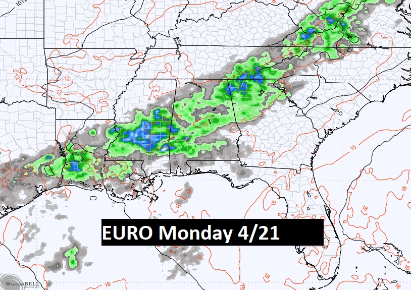
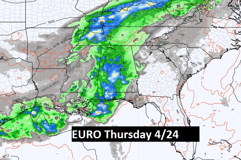
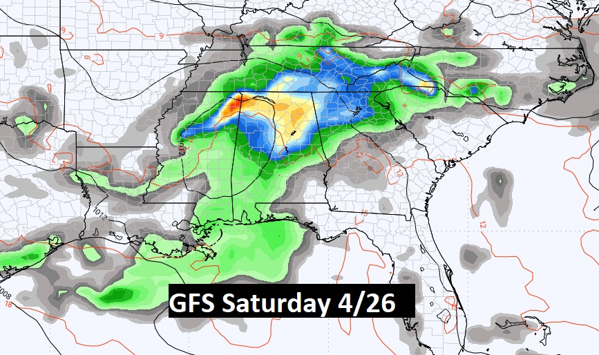
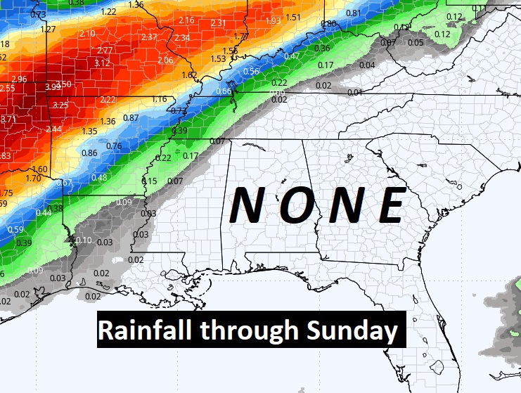
Just WOW. Look at the expected rainfall 4/21 through 4/27.
Thanks for reading the blog. Today everything is normal including LIVE on the Radio of NewsTalk 93.1 WACV. There will be another video forecast discussion and Blog Update in the 4 o’clock hours tomorrow morning. You can always find my forecast updates hourly on the 8 station Bluewater family of stations every day of the year.
–Rich