
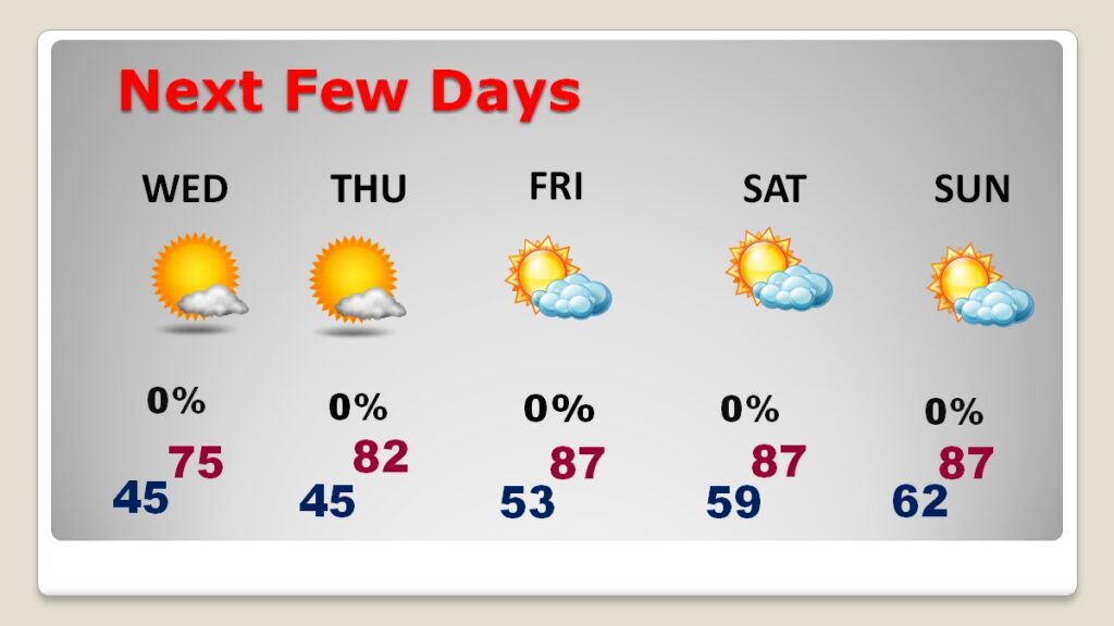
Good Morning! A dry cold front swept through the state overnight. Much cooler air is funneling in, behind the front. Today will be 10+ degrees cooler than Monday. Clouds dominate the first part of today before sunshine take over later. Wednesday is still below normal temperature-wise. But, expect major late week warming. Temperatures will warm to the low 80’s Thursday and mid to upper 80’s Good Friday through Sunday. We’re storm-free and dry through Easter. Here’s my brief forecast discussion.
TODAY: Cloudy this morning. Gradually, it will become mostly sunny later. Much cooler. High 73. West wind becoming north 6 to 12 gusting to 20 mph. Mainly clear tonight. Cool. Low 45.
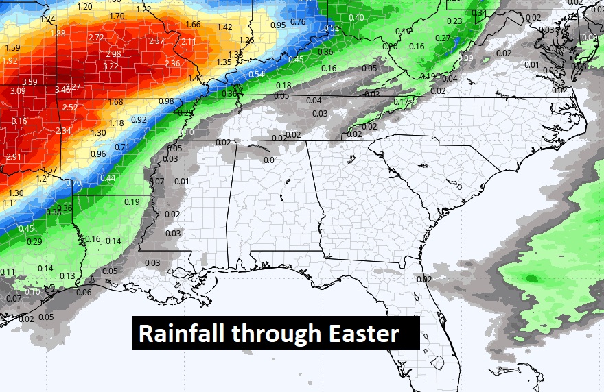
NEXT FEW DAYS: Wednesday is still below normal temperature-wise. But, expect major late week warming. Sunshine in abundance Wednesday through Saturday. Temperatures will warm to the low 80’s Thursday and mid to upper 80’s Good Friday through Sunday. We’re dry through Easter. Next week will be much more active, with a series of storm systems.
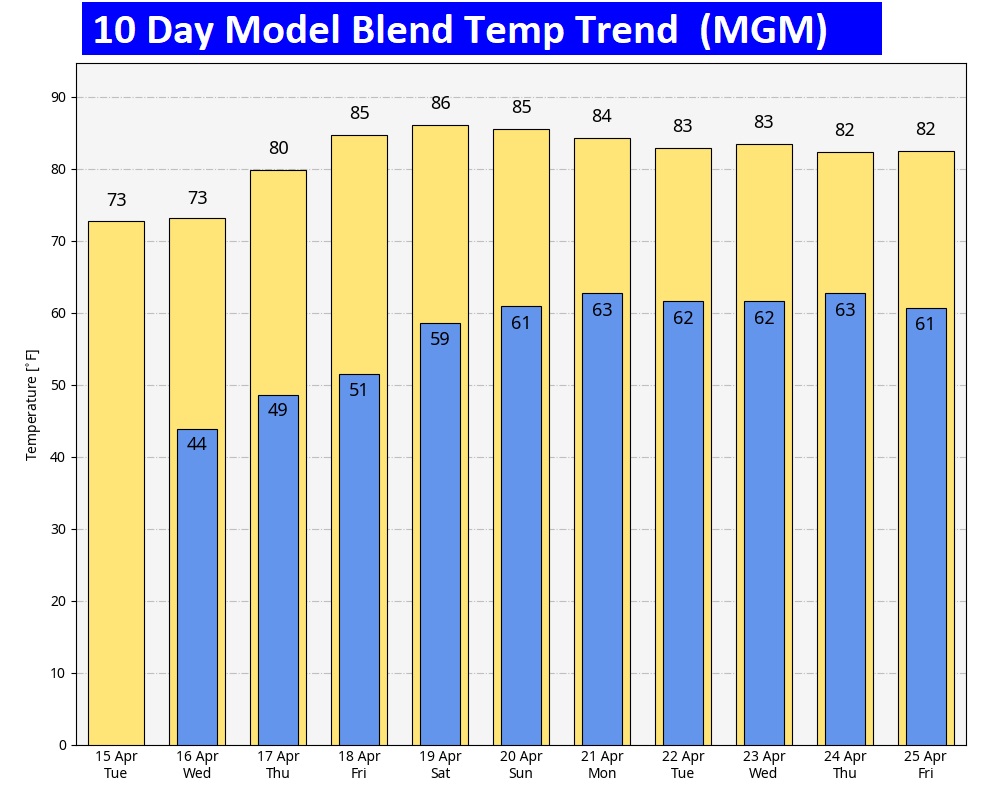
Here’s the 10 day model blend temperature trend. Major late week warming, through the Easter weekend and beyond.
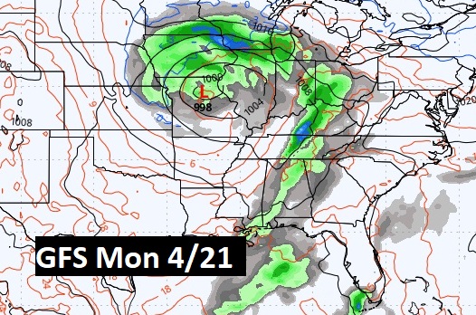
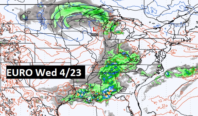
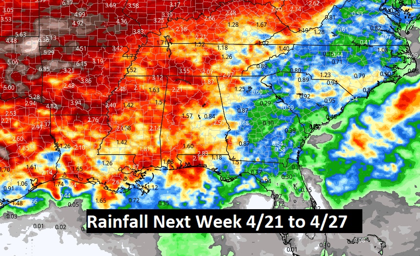
ACTIVE STORMY PATTERN NEXT WEEK: Next Monday through the end of the month looks, rather active. Busy, with a series of storm system.
Thanks for reading the blog. Today everything is normal including LIVE on the Radio of NewsTalk 93.1 WACV. There will be another video forecast discussion and Blog Update in the 4 o’clock hours tomorrow morning. You can always find my forecast updates hourly on the 8 station Bluewater family of stations every day of the year.
–Rich