
Good Morning! The cold front that brought last night’s storms has left the state. Cooler air is funneling in. It will be noticeably cooler today and Saturday. Nights will be chilly. A secondary front could bring some isolated showers late today and this evening. Otherwise, we’re expecting a storm-free, pretty nice weekend. The coldest night will be Saturday night. By Sunday morning, some towns will be close to 40. But, expect a nice warm-up by Sunday afternoon. Here’s my brief forecast discussion.
TODAY: Sun/Cloud mix. Cooler today. High near 70. Isolated showers possible late afternoon and evening. Breezy. West wind 5 to 15 gusting to 20 mph. Chilly tonight. Partly cloudy. Low 44.
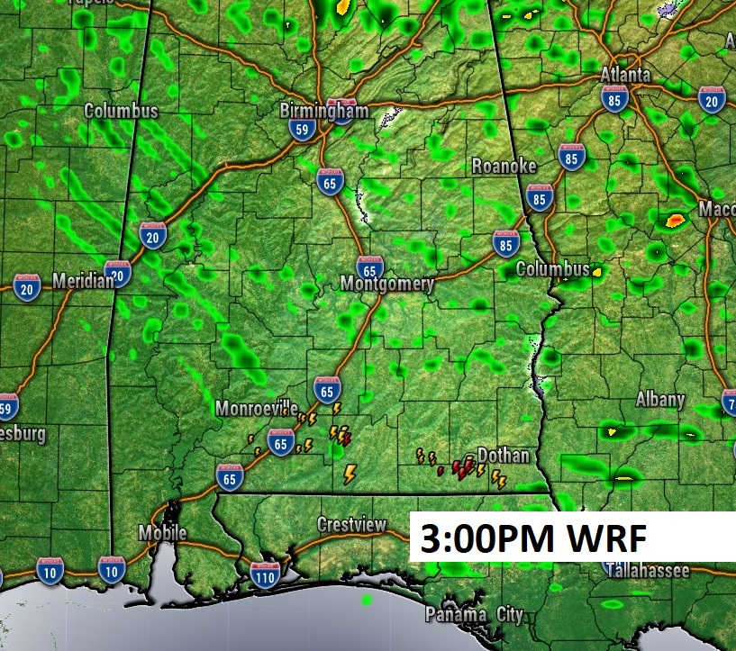
A couple of late afternoon, early evening showers?
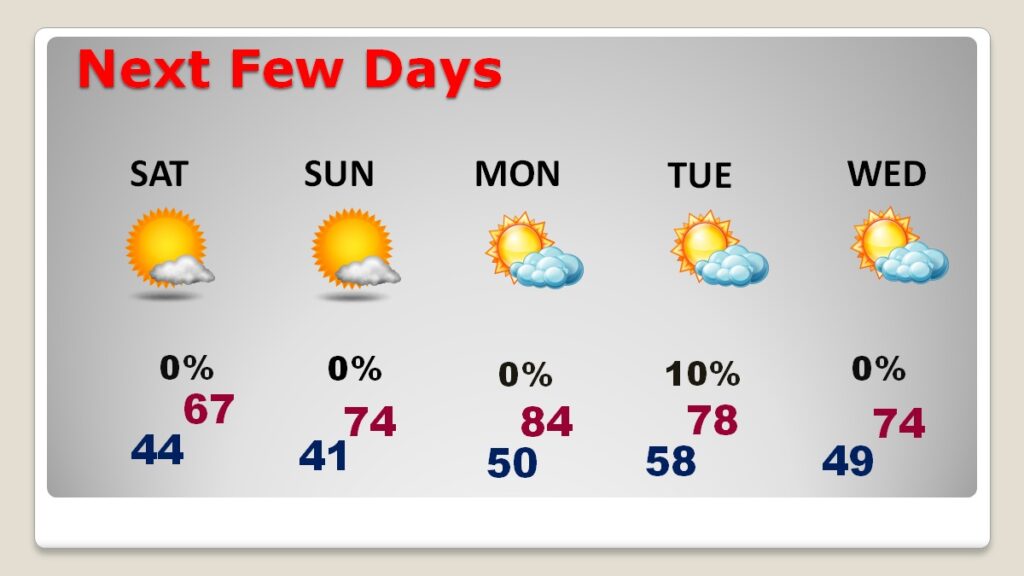
NEXT FEW DAYS: Saturday will be the coolest day with highs only in the 60’s. Nights will be quite chilly. Saturday night will be the coldest night. All and all it will be a pretty nice weekend, despite the night chill. (Normal 77/51) Storm-free. Lots of sunshine. Saturday’s high will only be in the 60’s. Sunday will be a little warmer with a high in the middle 70’s. Monday will be the warmest day. Perhaps mid 80’s. Storm-free Monday through Wednesday.
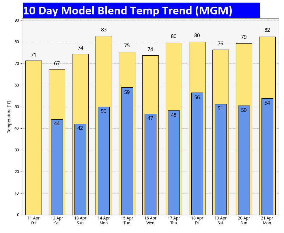
Here’s the 10 day model blend temperature trend. will be Saturday. The coldest morning will be Sunday. The warmest day will be Monday.
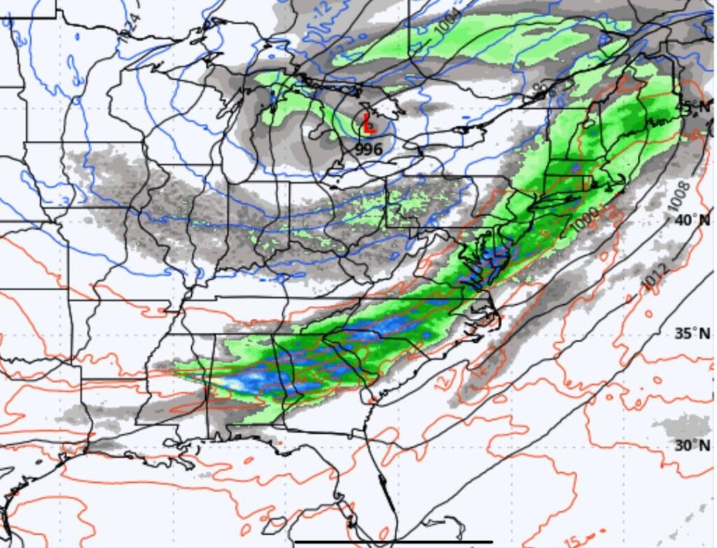
Next big deal storm system could be Easter Weekend. Here’s a snapshot of Saturday the 19th.
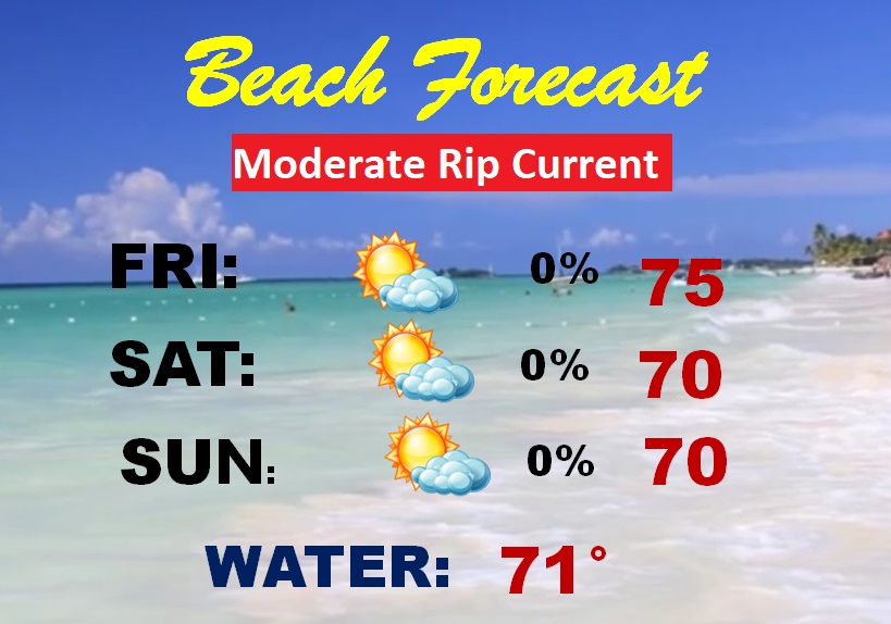
BEACH FORECAST: Moderate Rip Current risk continues. Should be a nice weekend with lots of sunshine. A little below normal on the temperature. Gulf water temperature is still a cool 71.
Thanks for reading this blog update. This morning everything is normal. We’ll be LIVE on NewsTalk 93.1. There will be another Blog Update and Forecast Video discussion in the 4’o’clock hour tomorrow morning. Have a good day.
Guess who’s home! Even with the Dreaded Cone of Doom, Chase is very happy to be home, and his Daddy is thrilled. He’s recovering well post-surgery. Welcome home. I love you.

–Rich