
Good Morning! Get ready for a nice day today. Today will be the warmest day of the week. A Cold Front is approaching the state. There is yet another risk of a few strong to severe storms beginning late this afternoon in the northern counties and this evening and tonight across the central counties. A Level 2 risk exists as far south to almost Montgomery, and there’s a Level 1 risk as far south as Greenville and Troy. Damaging wind gusts are the main threat. Otherwise, we’re expecting a storm-free, nice weekend. It will turn noticeably cooler again Friday and Saturday. Sunday will be sunny and warmer. All things considered, it’s a nice weekend forecast, except rather chilly nights. Here’s my brief forecast discussion.
TODAY: Lots of sunshine today. Warmer. High near 80. (Yesterday’s high 69) Light west wind 6 to 12 mph. Clouds increasing late. Risk of showers and thunderstorms tonight, especially late tonight. A few strong to severe storms are possible. Low tonight 53.
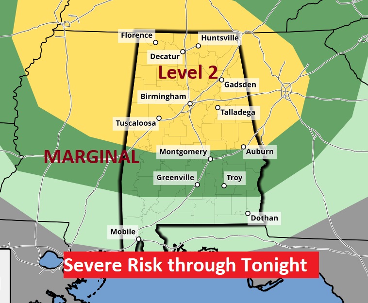
Here’s the Severe Risk map from SPC for this evening and tonight.
Where: Most of Central Alabama
When: 5pm Thursday (north) – 1 AM Friday (south
Threats: Damaging wind up to 60 mph, large hail up to quarter size
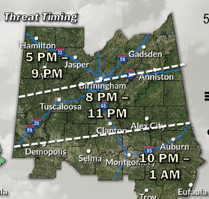
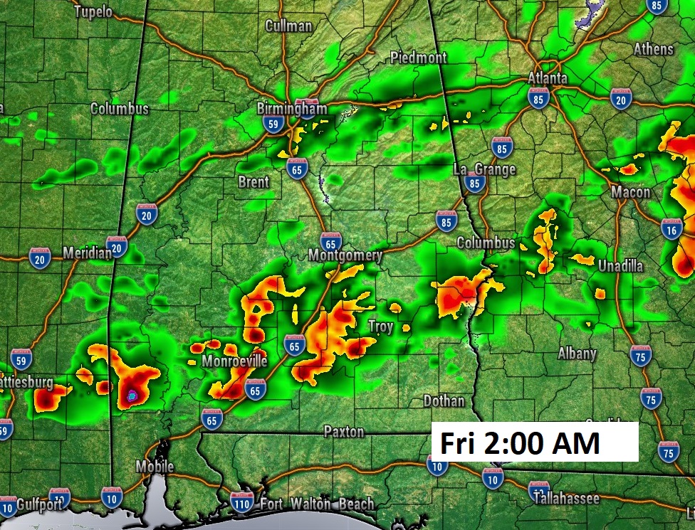
The updated timing map from NWS reflects a later timing on the storms arrival. For many of us, the window is 10pm to 1AM.
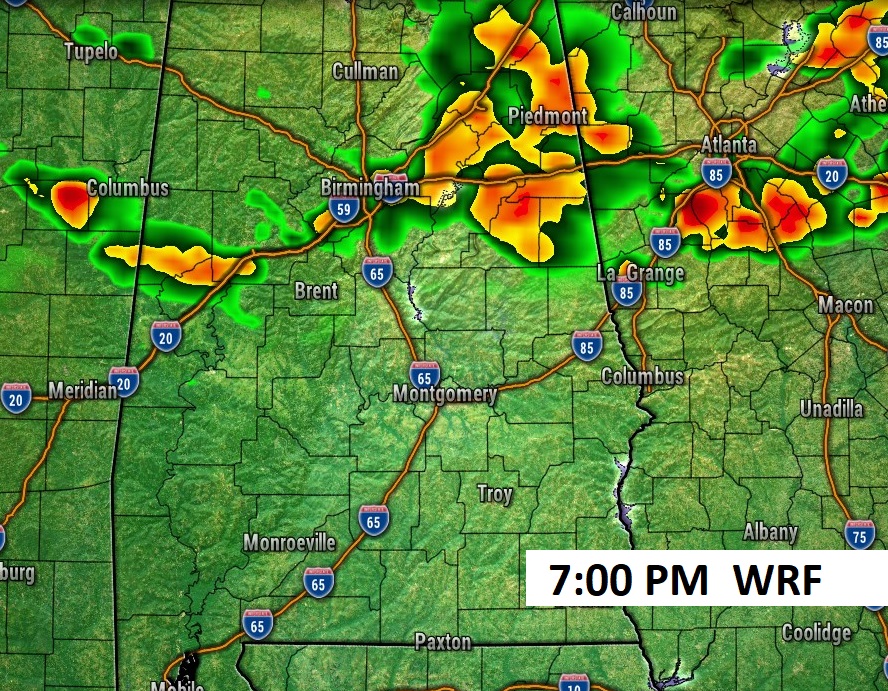
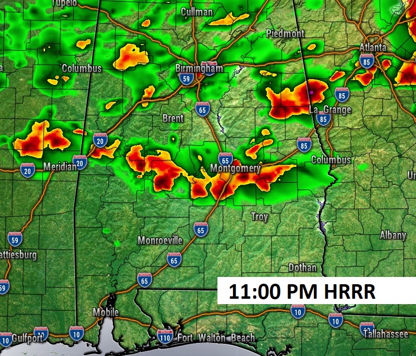
These hi-res model Future Radar snapshots reflect the later time table.
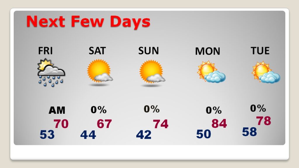
NEXT FEW DAYS: A couple of leftover showers are possible Friday AM. Friday and Saturday will be noticeably cooler again. Nights will be quite chilly. All and all it will be a pretty nice weekend, despite the night chill. (Normal 77/51) Storm-free. Lots of sunshine. Saturday’s high will barely reach the upper 60’s, but Sunday will be a little warmer with a high in the middle 70’s.
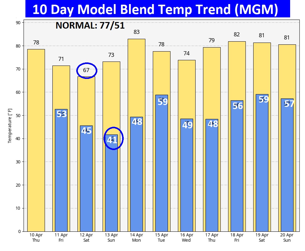
Here’s the 10 day model blend temperature trend. Expect a little temperature set-back, again on Friday and Saturday. The coolest day will be Saturday. The coldest morning will be Sunday. Next week looks warmer.
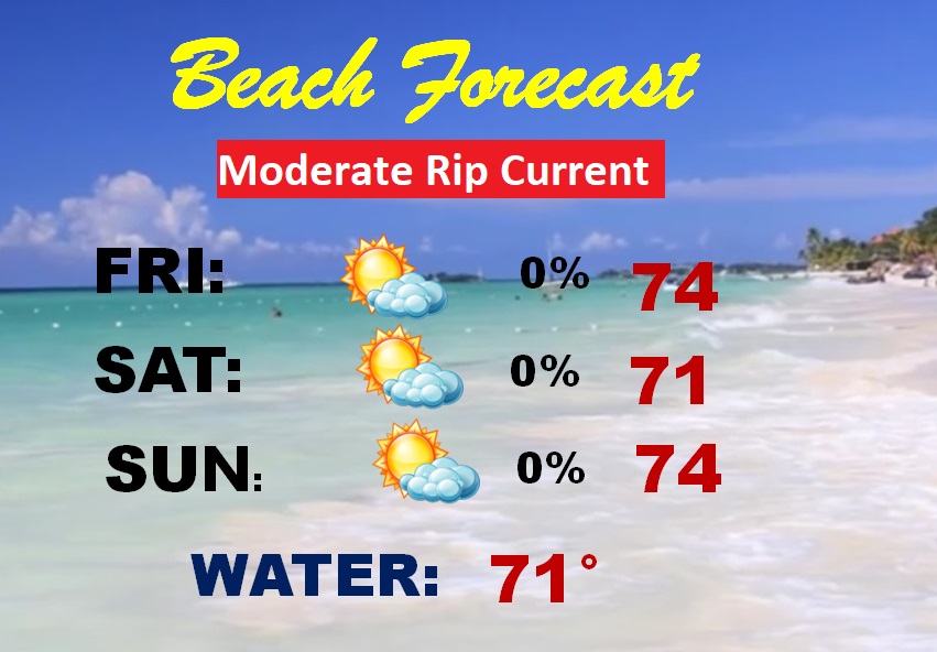
BEACH FORECAST: Moderate Rip Current risk continues. Should be a nice weekend with lots of sunshine. A little below normal on the temperature. Gulf water temperature is still a cool 71.
Thanks for reading this blog update. This morning everything is normal. We’ll be LIVE on NewsTalk 93.1. There will be another Blog Update and Forecast Video discussion in the 4’o’clock hour tomorrow morning. Have a good day.
–Rich