
Good Morning! It was not only a stormy Sunday – the rainfall has been relentless. Many towns have had 3 to 4” so far. Some towns have had over 5”. And, we’re not done yet. There is more rain and thunderstorms in our future today. Flood Watch continues. Locally heavy downpours through at least mid-day. Much cooler air is moving in. Expect much cooler days and some very chilly nights ahead. In fact, we’re headed for the lower 40’s tonight. The coldest will be Tuesday night. By dawn Wednesday, expect lows in the upper 30’s. The warmest day will be Thursday, before it turns cooler again Friday and Saturday. Here’s my brief forecast discussion.
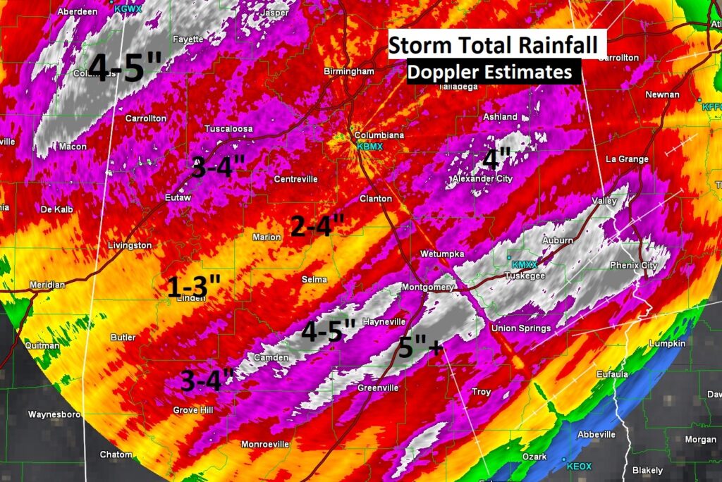
RAINFALL – PAST AND FUTURE: Daily rainfall records were set in many Alabama cities on Sunday. In Montgomery, total rain of 3.56” breaks the old daily record of 3.26″ in 1964. My rain gauge in East Montgomery had 4.85” Here’s Doppler radar estimates on Storm Total Rainfall so far. Some towns had more than 5”. This will give you an idea of what areas have had the most rain
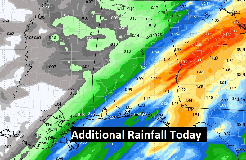
And, there’s more rain in our future today. Here’s the QPF.
TODAY: Showers and a few thunderstorms. Flood Watch continues. Locally heavy downpours. After 1PM the showers become more widely scattered. Much cooler. High 61. Cloudy early tonight, then gradual clearing later. Much colder. Low 42.
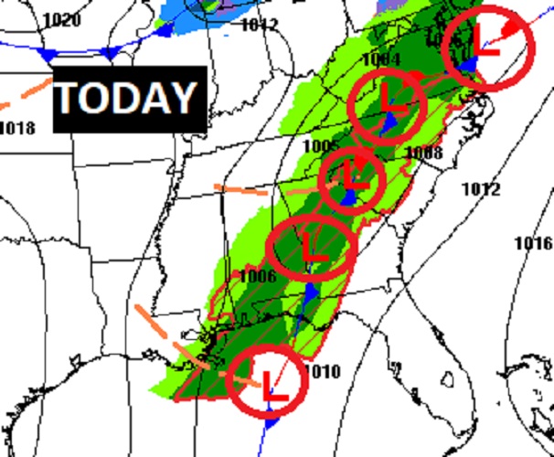
The front may be east of us, but a series of Low pressure waves moving along the front will keep us wet today.
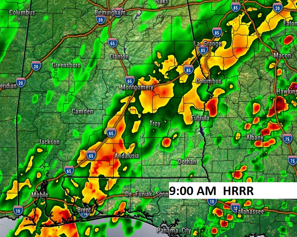
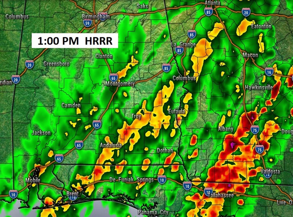
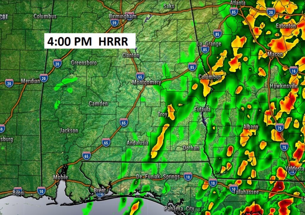
FUTURE RADAR: The relentless rain will continue today, especially morning and mid-day, tapering off later.
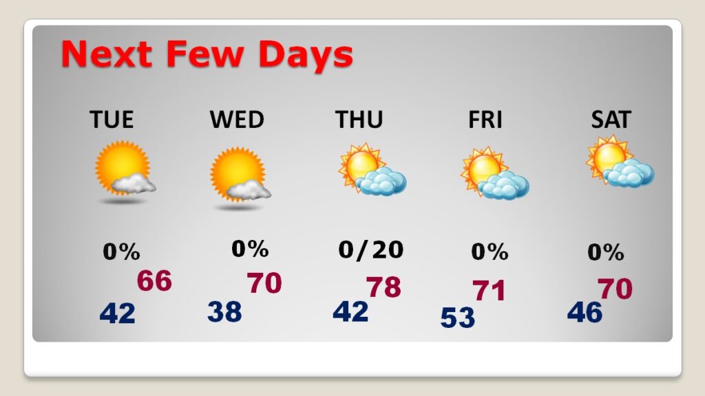
NEXT FEW DAYS: Much cooler days and cold nights. Tuesday’s high only mid 60’s. (Normal 77/50) The coldest will be Tuesday night. By dawn Wednesday, expect lows in the upper 30’s. Thursday will be the warmest day of the week. We’ll warm to the upper 70’s. It will turn cooler again Friday and Saturday. How would you like a Full Week with no severe weather? I have us storm-free all next week. There could be a few widely scattered showers Thursday night.
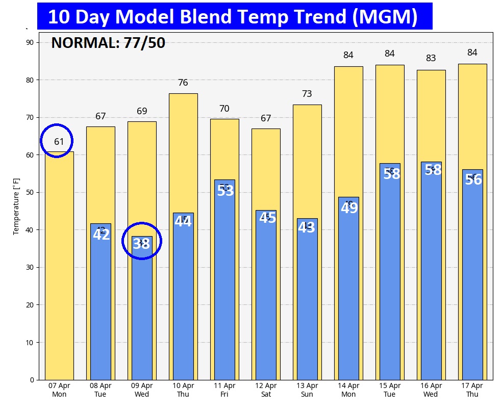
Here’s the 10 day model blend temperature trend.
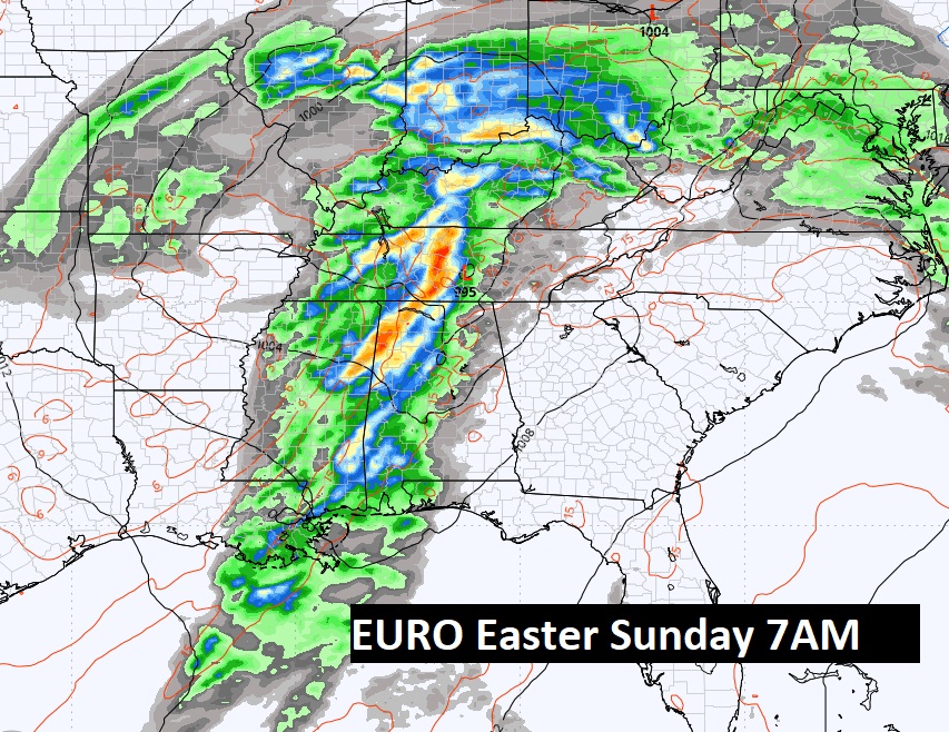
Next big deal storm system could be about two weeks out. Maybe on or close to Easter Sunday. We’ll see.
Thanks for reading this blog update. This morning everything is normal. We’ll be LIVE on NewsTalk 93.1. There will be another Blog Update and Forecast Video discussion in the 4’o’clock hour tomorrow morning. Have a good day.
–Rich