
Early this morning a tornado watch covers much of central Alabama through 10AM. The watch may be extended further south and east later today. Damaging wind gusts are the main risk. A couple of tornadoes can’t be ruled out. Unfortunately, the band of heavy rain and thunderstorms will tend to stall over central and south Alabama for many hours today, tonight and into Monday. The potential for excessive rainfall totals is increasing. A flood Watch covers most the area today, tonight and through much of Monday. Amounts of 2-4 inches are likely with isolated amounts of 5”+ possible. The other thing is, get ready for a big chill. Monday’s high will barely surpass 60. Expect lower 40’s Monday night. The coldest will be Tuesday night. By dawn Wednesday, expect lows in the upper 30’s. Stay weather aware!
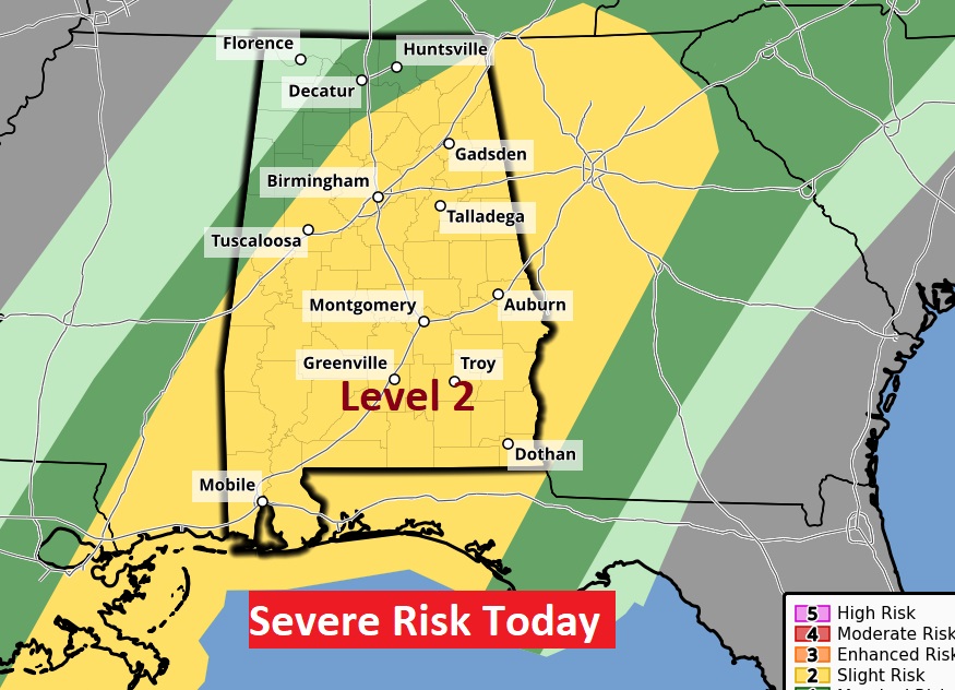
TODAY: Strong to severe storms are likely. We are in a Level 2 Severe risk from SPC. Damaging wind gusts is the main risk. A couple of tornadoes can’t be ruled out. Unfortunately, the band of heavy rain and thunderstorms will tend to stall over central and south Alabama for many hours today, tonight and into Monday. Total rainfall amounts of 2-4” are expected with isolated amounts of over 5”. Today’s high in the 70’s. Windy at times. Low tonight mid 50’s.
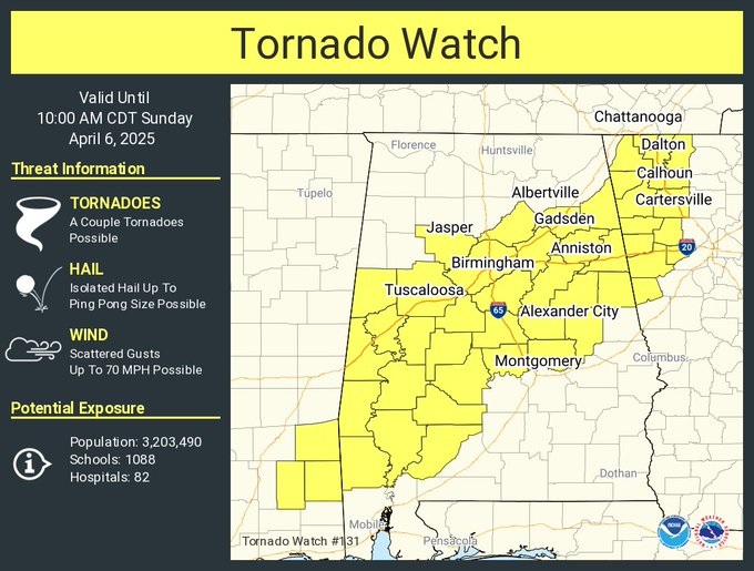
Early this morning, as I prepare this – here’s the current tornado watch from SPC until 10AM. The watch extends as far east as Autauga, Elmore and Tallapoosa counties. While the watch does not currently include Montgomery, additional watches are a good bet later today as a strong line of storms moves eastward.
Here’s today Level 2 outlook from the storm prediction center.
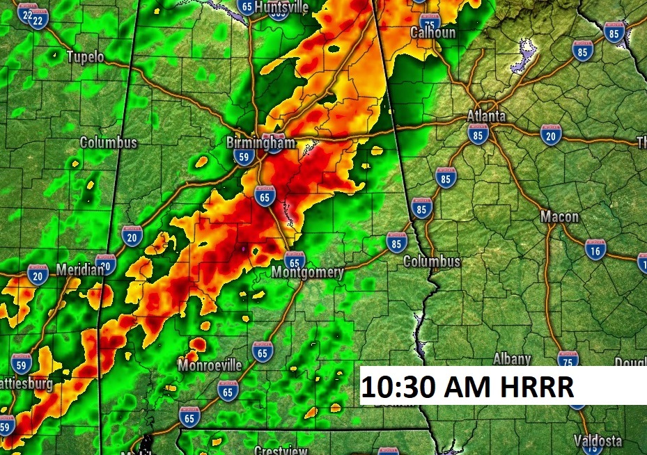
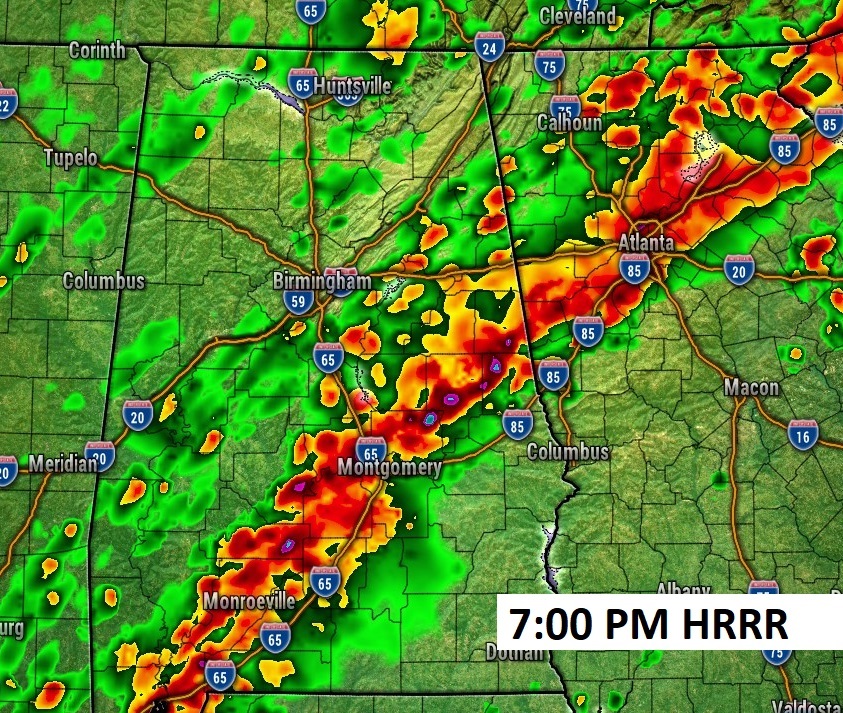
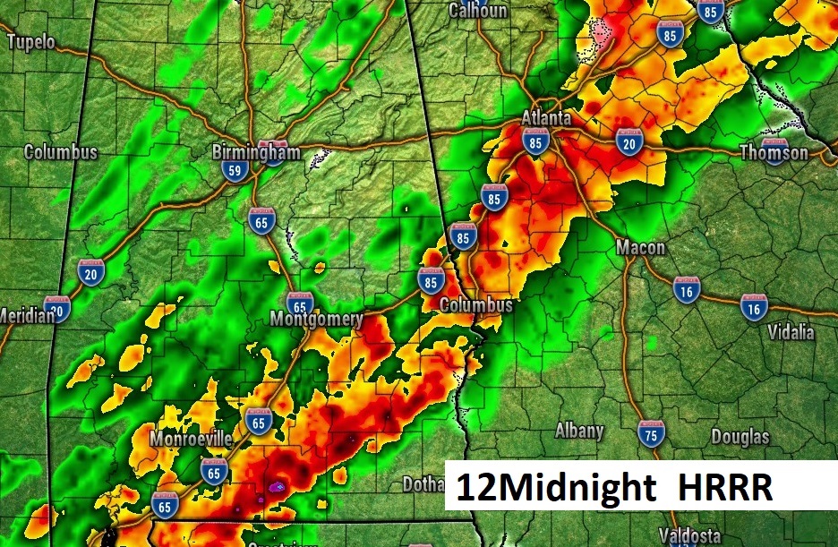
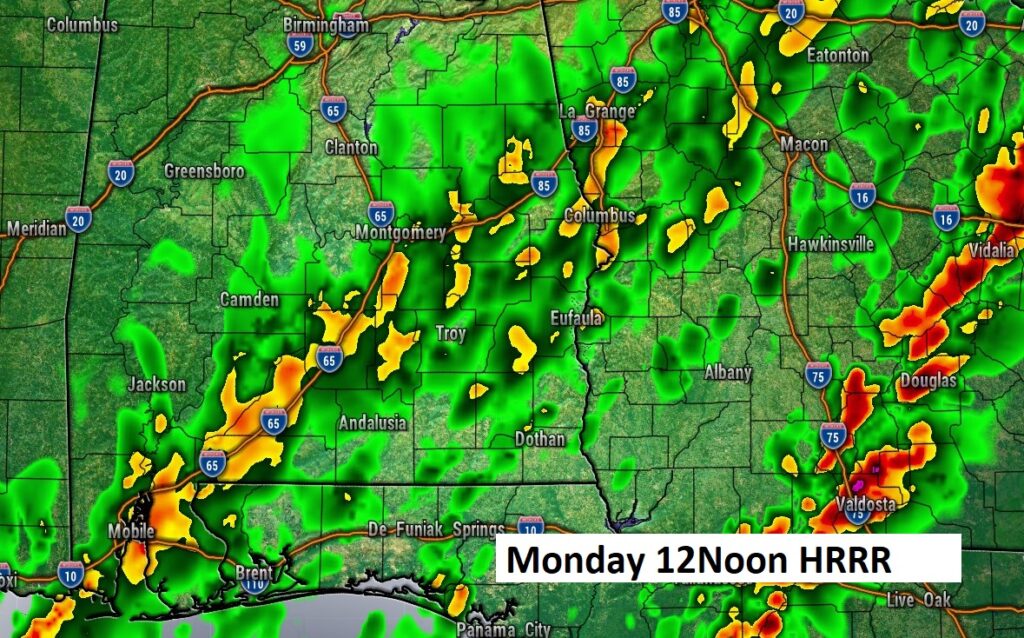
FUTURE RADAR: The disturbing part of this story, is that the band of heavy rain and storms is likely to stall over central Alabama with the threat of excessive rainfall over the same area for several hours. Here’s some snapshots from the HRRR model today and tonight.
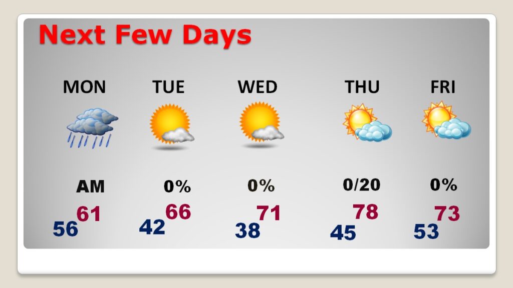
Look at tomorrow. It’s still raining through mid-day.

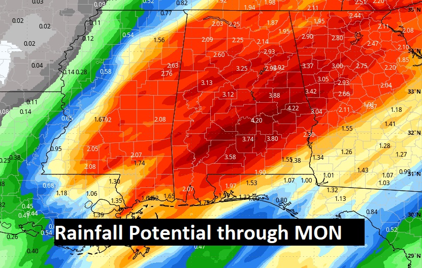
Total rainfall: 2 to 4”. 5”+ in spots is not out of the question.
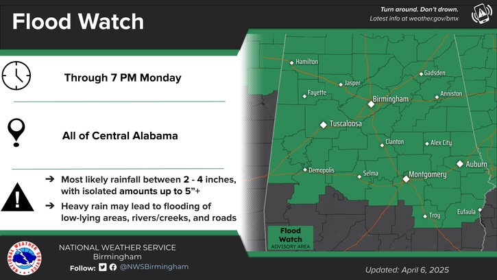
A flood watch continues in effect.
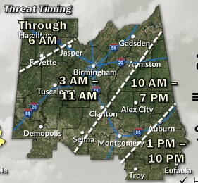
Here’s the updated Severe Weather threat timing map from NWS. Note the LONG duration of the threat because of the slow movement of the band of strong to severe storms.
NEXT FEW DAYS: It’ll still be raining through mid-day tomorrow. Monday’s high will barely surpass 60. Expect lower 40’s Monday night. The coldest will be Tuesday night. By dawn Wednesday, expect lows in the upper 30’s.We’ll warm to the upper 70’s Thursday. I have us storm-free all next week. There could be a few sidely scattered showders Thursday night.
Stay weather aware. I’ll do my best to keep you up to date. Please make sure to allow notifications on our Weather App. If you do not have our app yet, go to the app store and download Rich Thomas Weather. Make sure your Weather Radio is plugged up and in the alert mode. Do not depend on Weather Sirens. –Rich