
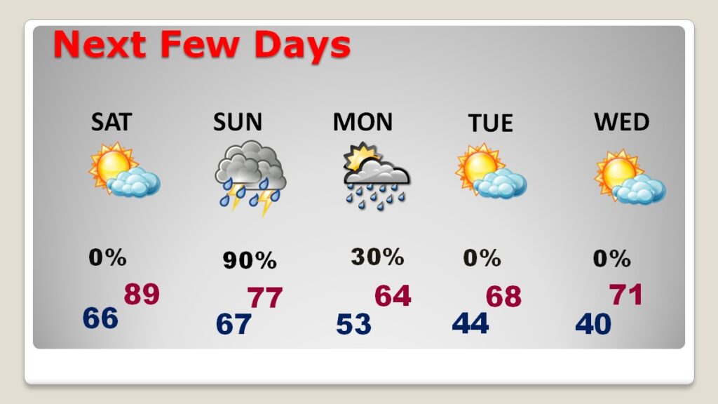
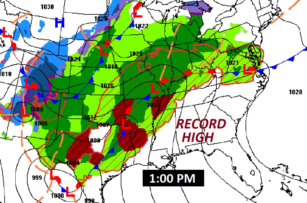
Good Morning! The calendar says April, but it feels more like June. Yesterday’s high of 87 tied the record from 2015. Today’s high of near 90 will break the 89 degree record from 2023. Even Saturday we’ll be close to a record. It’s still storm-free and dry for us today and through the daytime Saturday, and well through the overnight hours Saturday night. By the early pre-dawn hours of Sunday AM, the severe threat eases in west Alabama. For most of us the greatest threat of Severe storms and possible tornadoes is on Sunday, starting very early. Much cooler air will follow the storm system. Monday’s high may only reach 64. Expect low 40’s by dawn on Tuesday. Here’s my brief video forecast discussion.
TODAY: Limited sunshine. Mostly cloudy and very warm. High near 90. (Normal 76/50) (Record high 89 from 2023) South wind at 10 to 15 gusting to 20+ mph. Partly cloudy, mild tonight. Low 68.
NEXT FEW DAYS: It’s still storm-free and dry for us today and through the daytime Saturday, and well, into Saturday night. By the early hours of Sunday AM, starting around Dawn, a line of severe storms eases in west Alabama. For most of us, the greatest threat of Severe storms and possible tornadoes is on Sunday, especially morning and through mid day. Much cooler air will follow. Monday’s high may only reach 64. Expect low 40’s by dawn on Tuesday, and near 40 on Wednesday. What a shock to the system after record warmth.
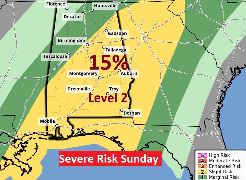
WEEKEND SEVERE RISK: First, we note that a multi-state area north and west of Alabama have been barraged by a barrage of severe weather including tornadoes which have killed at least 9. Over two dozen have occurred over the last two days alone. More severe weather is in the cards today, including a dangerous Level 4 Moderate Risk from the Ark/La/Tex area to Missouri.
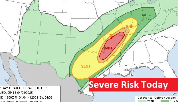
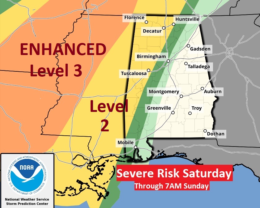
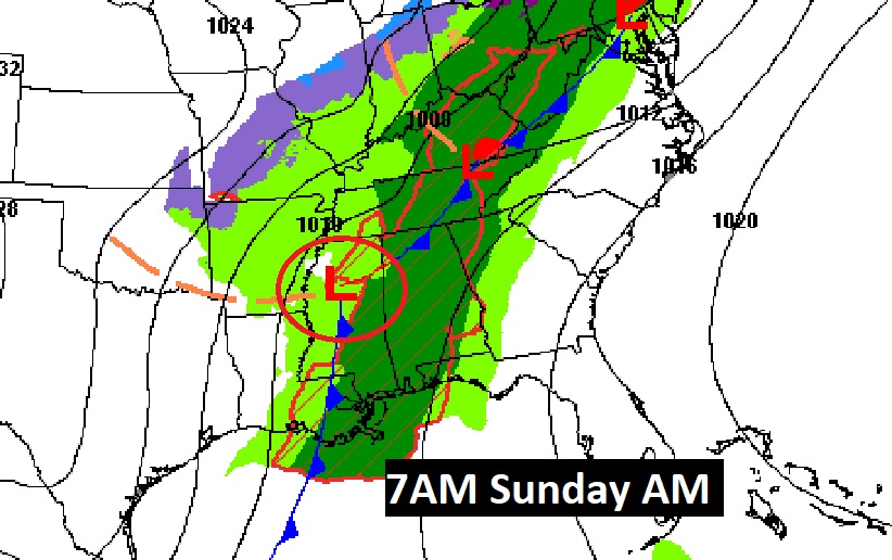
On Saturday, the greatest threat for severe weather will stay west of us. Here’s the SPC Day 2 outlook through 7AM Sunday.
The Day 3 Sunday outlook begins at 7AM . An ongoing line of severe storms will bring the threat of damaging winds and a Tornado threat, too. Here we go again.
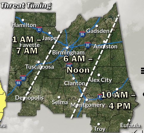
Here’s the updated timing map from NWS. For most of us the greatest threat is morning and mid-day.
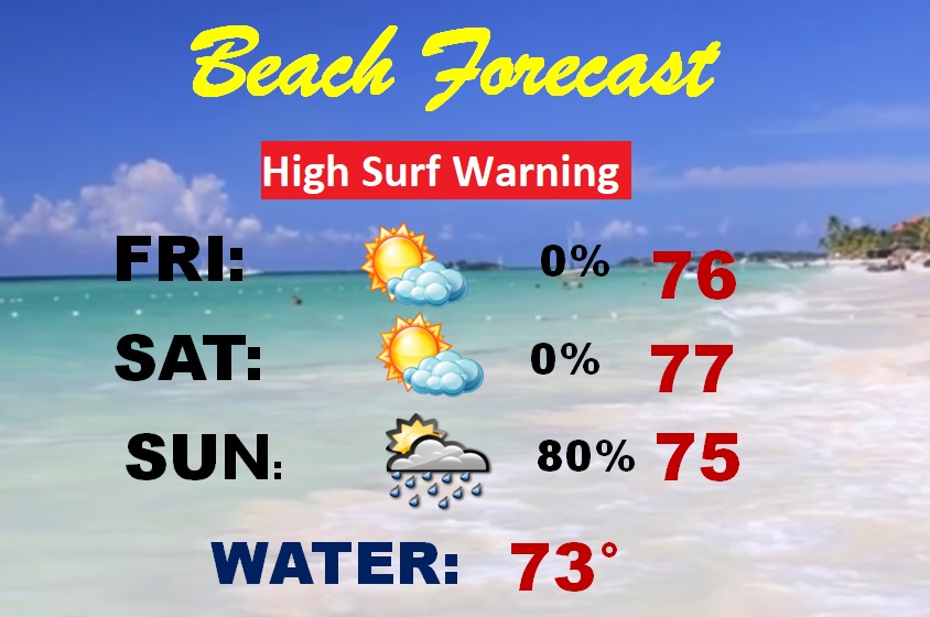
BEACH: Today and Saturday are dry and comfortable. Showers and locally severe storms are likely Sunday. Be careful. A High surf warning continues in effect. Expect highs in the 70’s. Gulf water temperature is now 73.
Thanks for reading this brief blog update.
I’m still at the National Tropical Weather Conference, South Padre Island, Texas. Tomorrow morning’s Blog Update will be from Montgomery. Have a nice Weekend. Stay weather aware, especially Sunday.
–Rich