
Good Morning! Get ready for some very active weather. Radar will be active at times today with showers and storms. There could be even a few stronger storms. But, the main event is tomorrow, likely starting very early. The greatest severe weather threat will be shifting into Southeast Alabama by mid-day Monday. The Storm Prediction Center has most of us a Level 3 out of 5 Enhanced Severe Risk. All modes of severe weather are on the table, including tornadoes, along a fast moving line of severe storms. Damaging wind gusts are the main threat with embedded tornadoes. Hail is also possible.
TODAY: The main risk of showers and storms (70% chance) will be by mid-day, into this afternoon and early evening. Can’t rule out a couple of stronger storms, near severe limits. Marginal hail risk in some of the storms, too. High near 80. Low tonight 65.
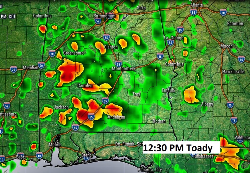
Here’s one hi-res model snapshot at mid-day today.
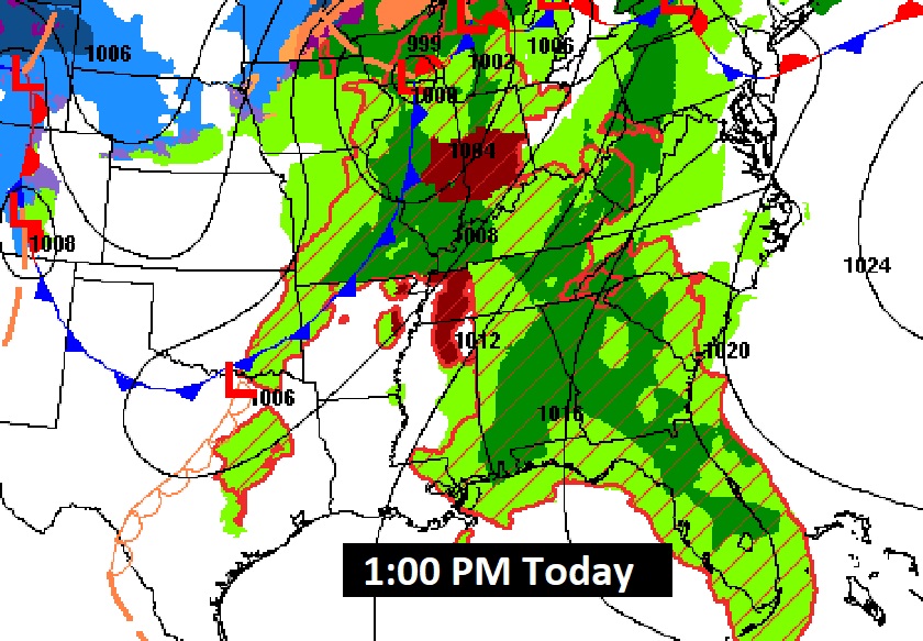
The main storm system is still well northwest of us today, battering the mid-section of the country with a sizeable severe risk from the Great Lakes to the ArkLaTex..
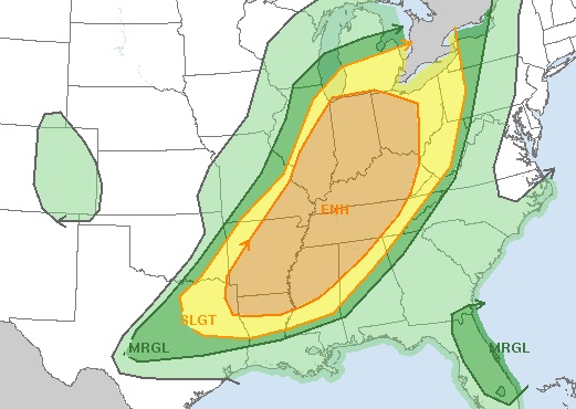
MONDAY SEVERE WEATHER THREAT: First, here isthe Day 1 SPC outlook outlines a Level 1 through 3 risk across the NW half of Alabama through 7AM Monday. Strong to Severe Storms could start affecting northwest Alabama after Midnight tonight.
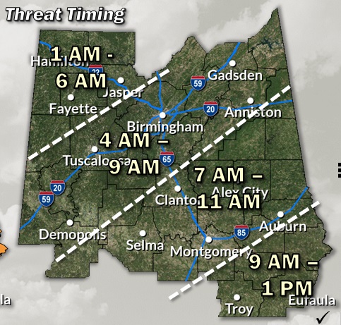
But, we’re going to focus on Day 2, Monday. The main event will be Monday morning, perhaps quite early, in through perhaps mid-day Monday. For many of us, roughly speaking, 7am to 11AM will be primetime. SPC is still highlighting a Level 3 out of 5. Expect all modes of severe weather including damaging winds, tornadoes and possible large hail. Right now it looks like the greatest severe threat wilk be along the strong, fast moving line of storms (QLCS). It’s not out of the question that there could be some cellular activity ahead f the main line, but right now that appears to be a very small chance.
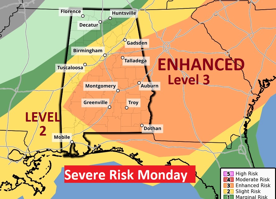
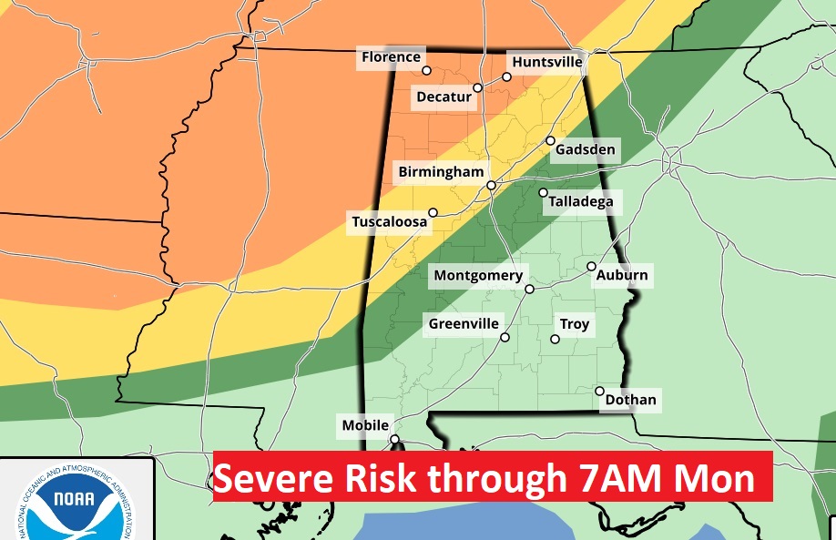
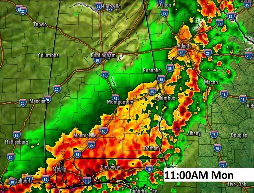
This map will help with your planning purposes for Monday. For many of us in the middle, 7AM to 11AM may indeed be the primetime hours, shifting into Southeast Alabama early in the afternoon.
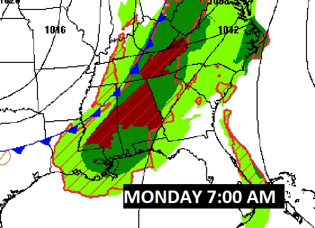
Here is the set-up Monday morning as the frontal system approaches. At 7AM, the frontal system will be in northwest Alabama.
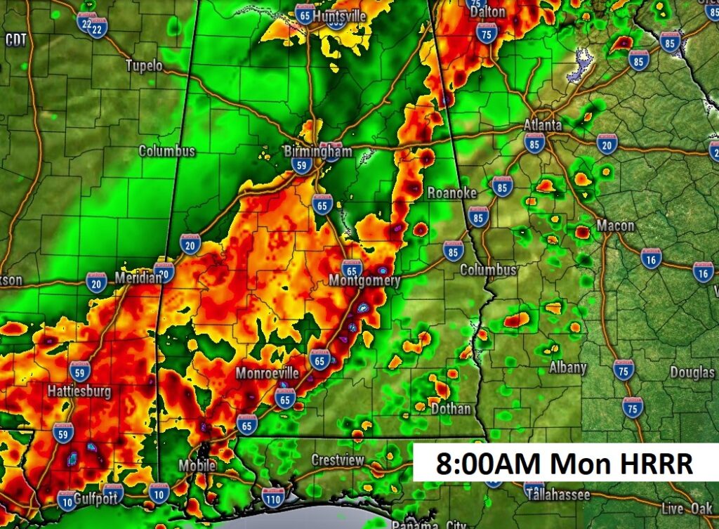
Future Radar shows the robust Squall Line (QLCS) sweeping rather quickly through the area starting in the early hours of Monday in through mid-day.
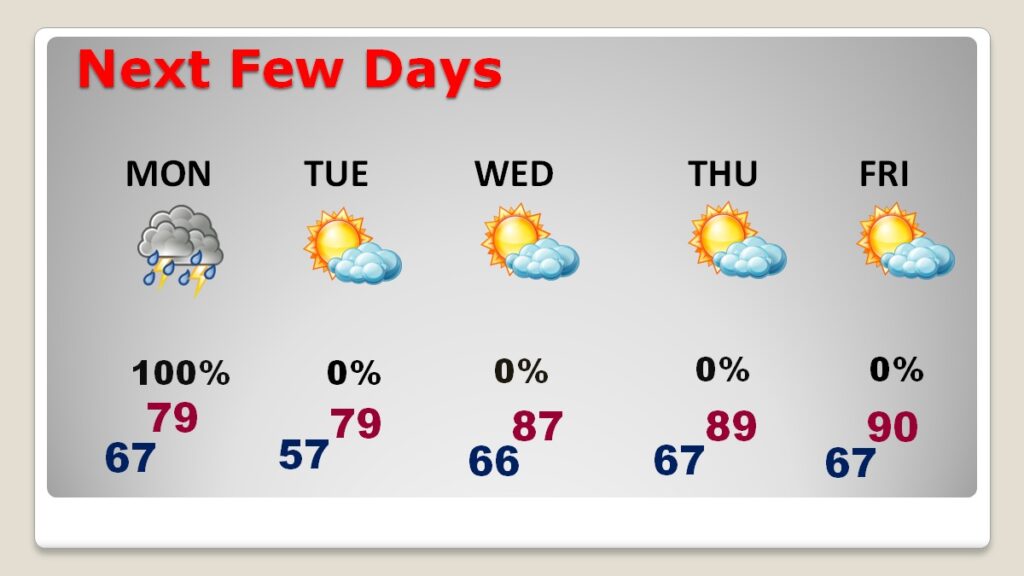
NEXT FEW DAYS: Look at the heat later this week. Warmest of 2025 so far.
Thanks for reading this blog update.
Here’s my plan today. I will be on a webinar with the national Weather Service at 10 AM. Then I will do a Facebook live around 10:30 AM with the latest information on Monday’s severe weather threat and any new information that I learned from the Weather Service. And I’ll try to answer some questions as well. FACEBOOK LIVE 10:30 am.
There will be another update, of course, in the morning, including a video forecast discussion. Stay weather aware this weekend.
–Rich