
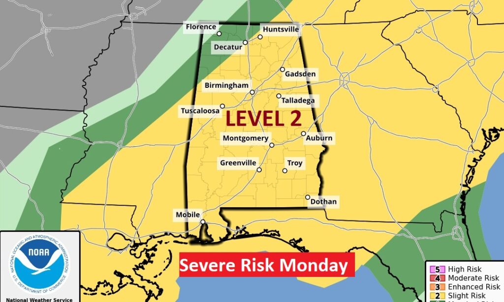
Good Morning! Our extended Storm-free pattern has ended. We are in for an unsettled few days and least through Monday. Periods of showers and storms begin today and tonight. More storms are likely Sunday and scattered storms Sunday night. The weekend storms are not likely to be severe. The main event is on Monday, perhaps very early, perhaps in the pre-dawn hours, and through the morning and mid-day hours, into early afternoon. The Storm Prediction Center is still highlighting a Level 2 (15%) Severe Risk. All modes of severe weather are on the table, including tornadoes.
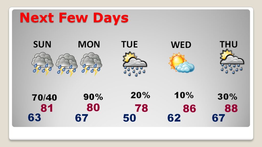
TODAY: Not quite as warm as yesterday. High 78-80. Risk of showers and storms will increase this afternoon and through the evening hours. (Probabilities about 50% in any given town.) Becoming breeze with SE wind 5 to 15 gusting to 20 mph. Very mild tonight. Low 65
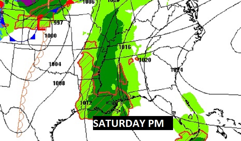
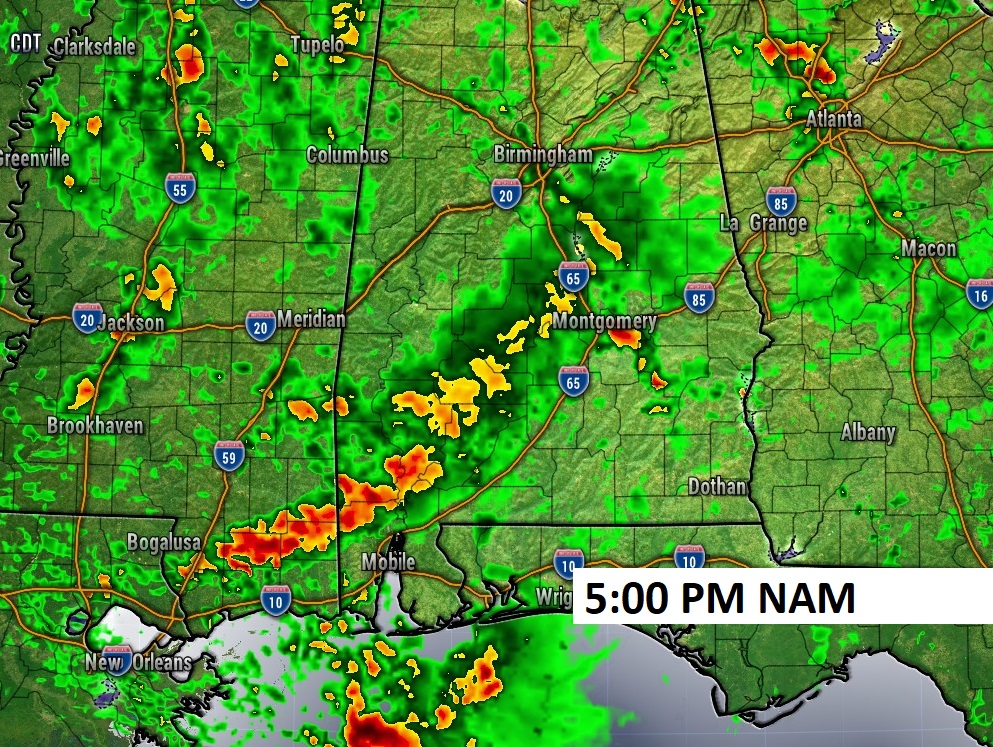
SUNDAY: The main risk of showers and storms (70% chance) will be in the afternoon and early evening. 40% chance Sunday night. High near 80. Low Sunday night 65.
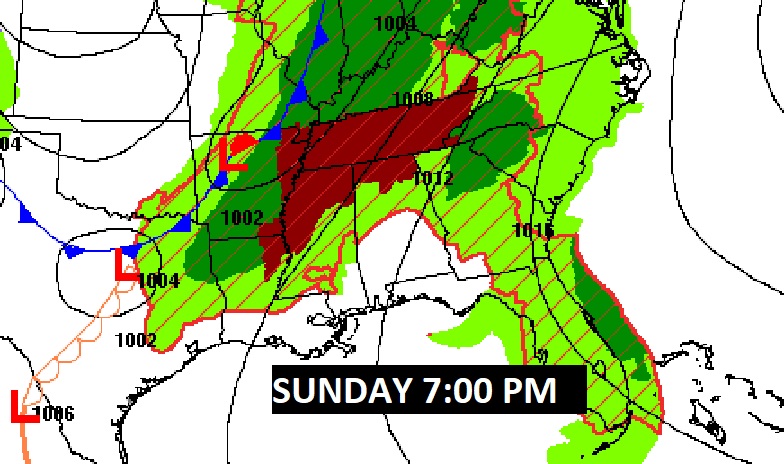
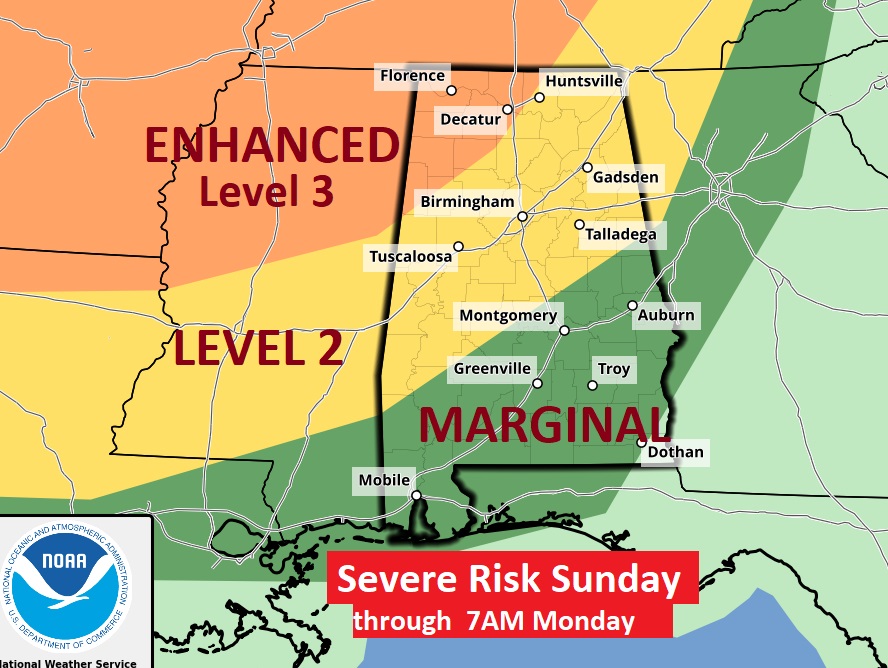
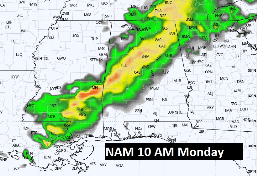
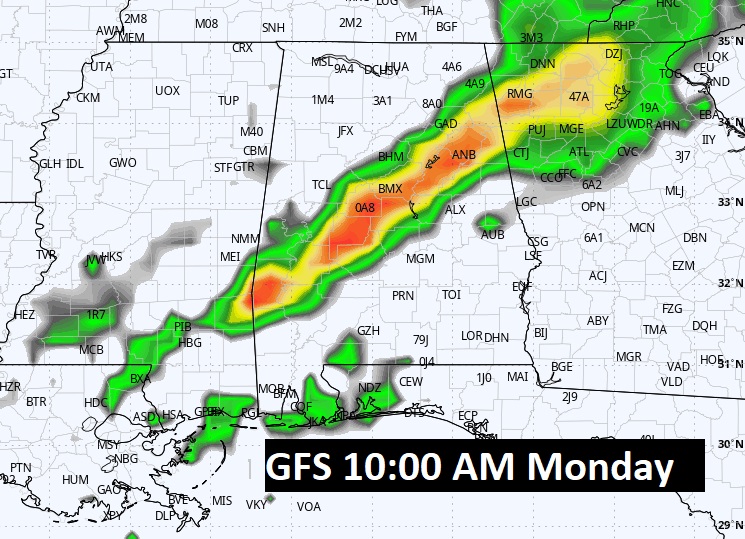
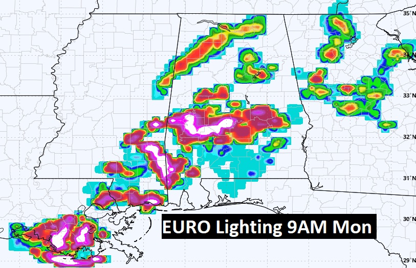
MONDAY SEVERE WEATHER THREAT: There is a Marginal Severe Risk for many of us Sunday, through 7AM Monday.It still looks like the main event begins Monday morning, perhaps even in the pre-dawn hours, in through perhaps mid-day Monday. SPC is still highlighting a Level 2 (15%) Severe Risk on the Day 3 outlook through 7AM Monday, and the Day 4 Monday outlook. Expect all modes of severe weather including damaging winds, tornadoes and possible large hail. The exact details of the “mode” of severe weather is still not known. Hi-res models will help decipher the magnitude and the character of the threat as we get closer. Here’s the Day 2 outlook through 7AM Monday, and the Day 3 outlook for the day Monday.
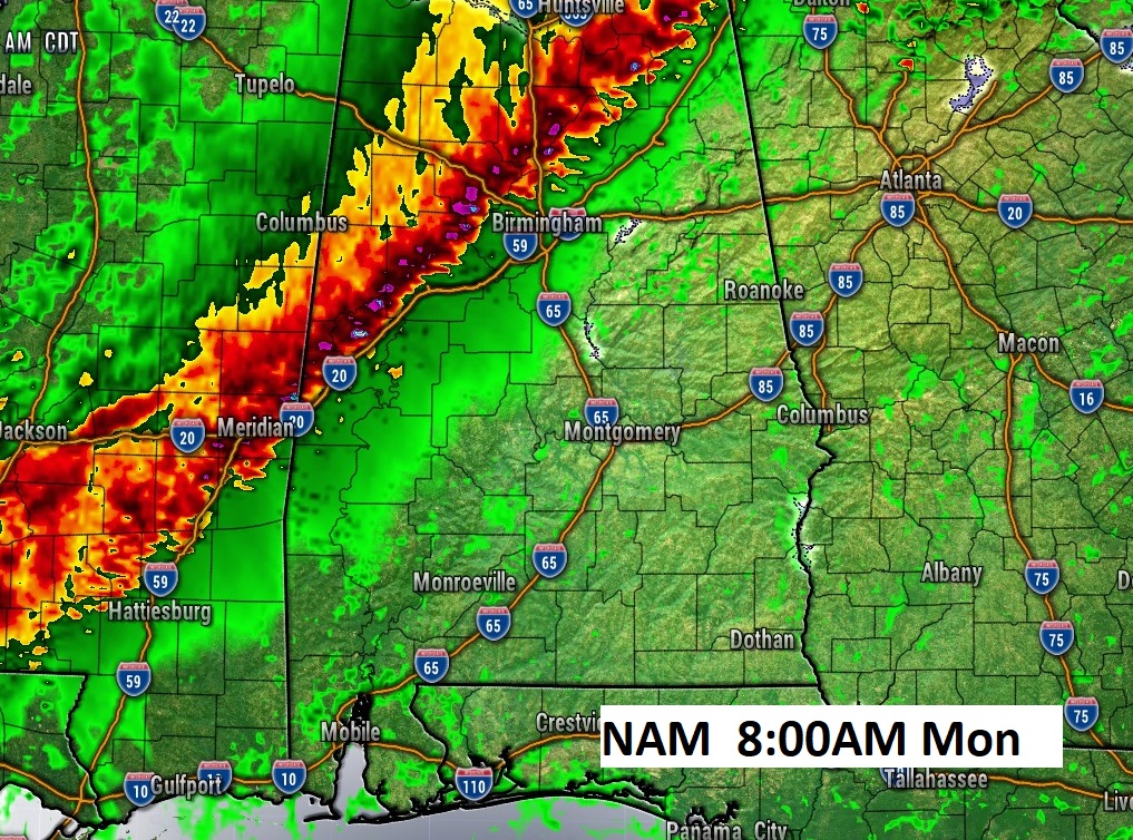
The main severe weather threat here in central Alabama will begin very early on Monday, perhaps even as early as pre-dawn for some of us. The threat will shift into Southeast Alabama by early afternoon. But, some details are still not known. Will this be a mainly linear (QLCS) event with damaging wind gusts and embedded tornadoes? Or, will there be cellular (discrete supercell) mode ahead of the main line? As we get closer to this event, we are coming into the range of more and more hi-res models which will help spell out the mesoscale nature of this severe weather threat. Stay tuned.
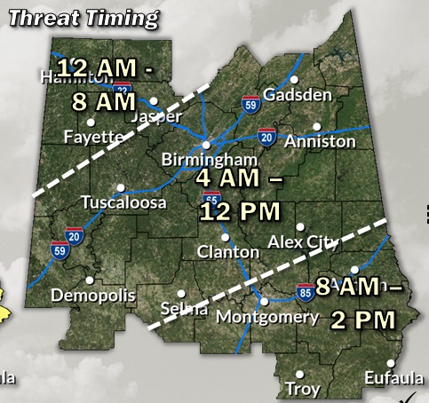
Here is the set-up Monday morning as the frontal system approaches. At 7AM, the frontal system will be in northwest Alabama.
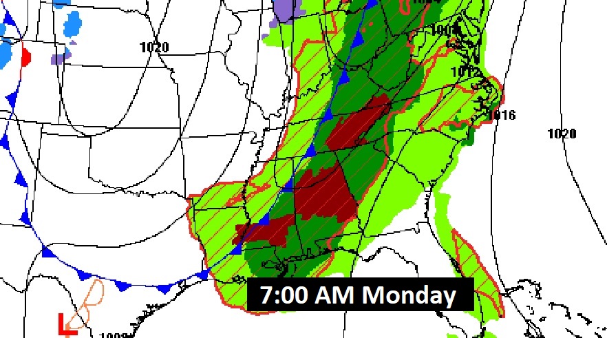
The models indicate that the Severe Threat will begin after Midnight Sunday night across northwest Alabama. That’s where SPC has a Level 3 out of 5 Enhanced risk.
NEXT FEW DAYS: An unsettled pattern will continue through the weekend and through Monday, as a series of storm systems approaches, Scattered showers and thunderstorms are likely Sunday. The Main Event, including severe weather, will begin early Monday, through mid-day and exit the state in the early afternoon. All modes of severe weather are possible. showers Tuesday. Wednesday looks dry and warm. I have a small chance of showers and storms in the Thursday forecast. This could change.
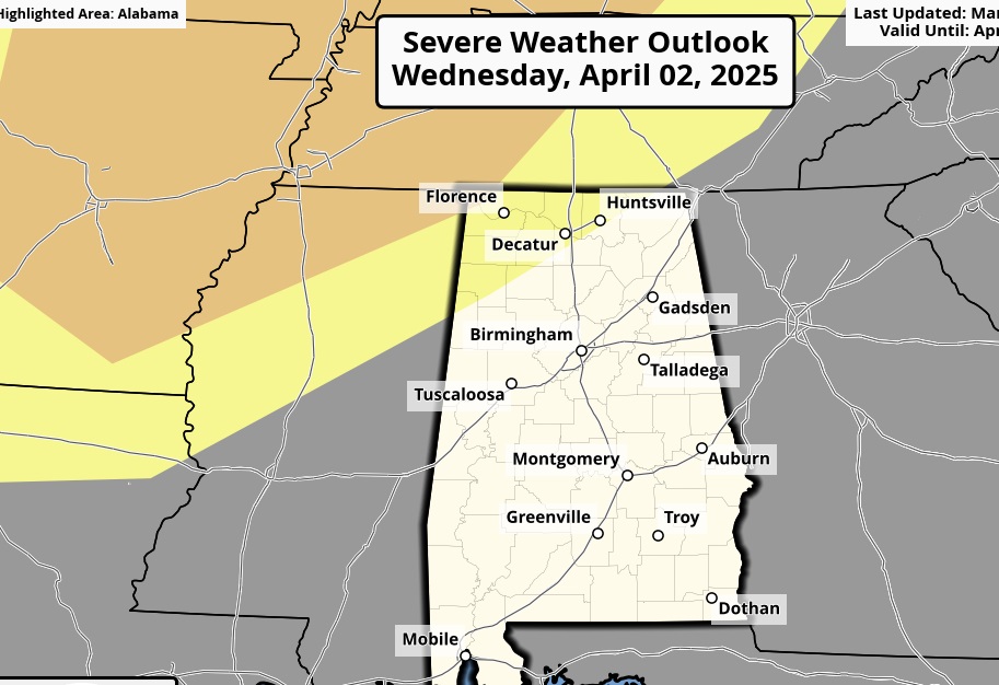
SPC has northwest Alabama in a severe risk again Wednesday night. Details of this next system are not clear yet.
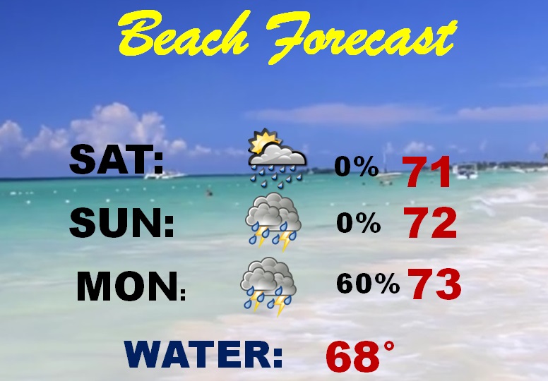
BEACH OUTLOOK: Not a wash out. But, Scattered showers and thunderstorms oat times today and tomorrow. Severe weather threat Monday. Highs in the 70’s. Gulf water is 67.
Thanks for reading this blog update. There will be another update, of course, in the morning. Stay weather aware this weekend.
–Rich