
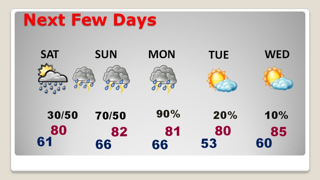
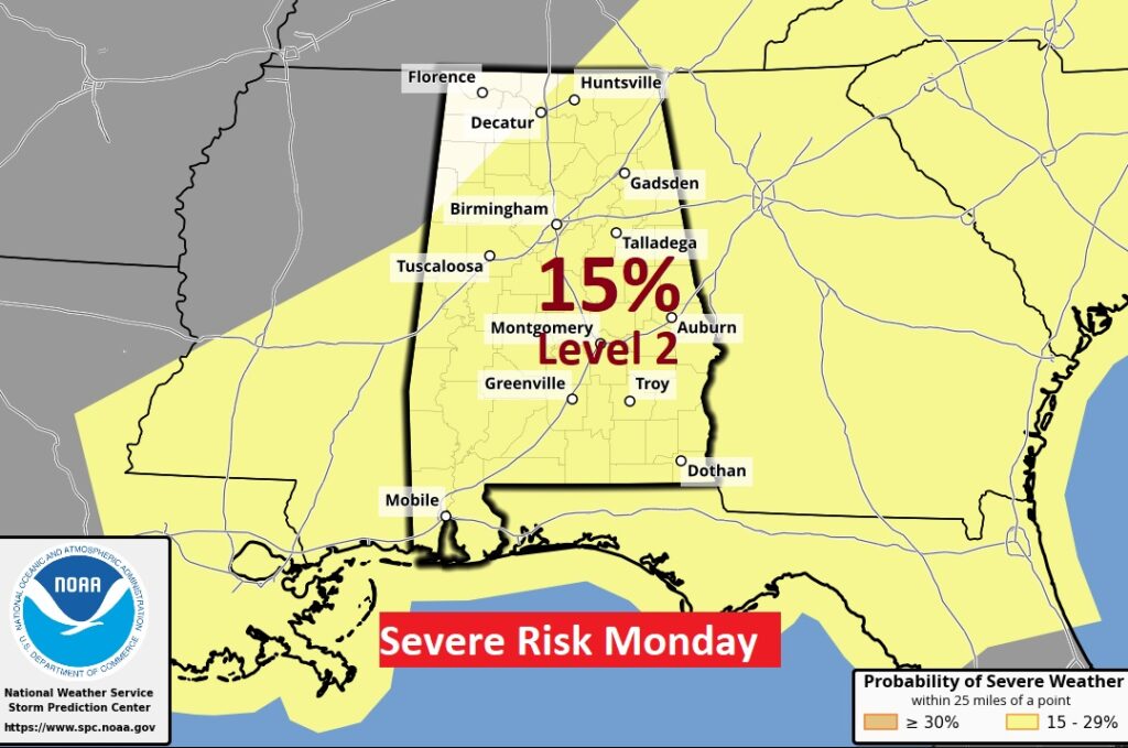
Good Morning! Our Storm-free pattern continues for one final day today. Expect a warm dry day with highs in the lower 80’s. Periods of showers and storms begin Saturday afternoon, Saturday night, Sunday and Sunday night. The main event is becoming more and more likely Monday, perhaps starting pre-dawn, and through the morning and mid-day hours, into early afternoon. The Storm Prediction Center is still highlighting a Level 2 (15%) Severe Risk. All modes of severe weather are on the table, including tornadoes. Here’s my brief video forecast discussion.
TODAY: Sun/cloud mix. Continued warm. Light SE wind 10 to 15 mph with higher gusts. High near 83. Mostly cloudy tonight. Mild. Low 61
NEXT FEW DAYS: An unsettled pattern will begin this weekend and at least through Monday, as a series of storm systems approaches, Scattered showers and thunderstorms, at times Saturday, Saturday night and Sunday. Expect and increasing risk of showers & storms Sunday night. The Main Event, including severe weather, will begin early Monday, through mid-day and into the early afternoon. All modes of severe weather are possible. More below. There could be some leftover showers Tuesday. Wednesday looks dry and warm.
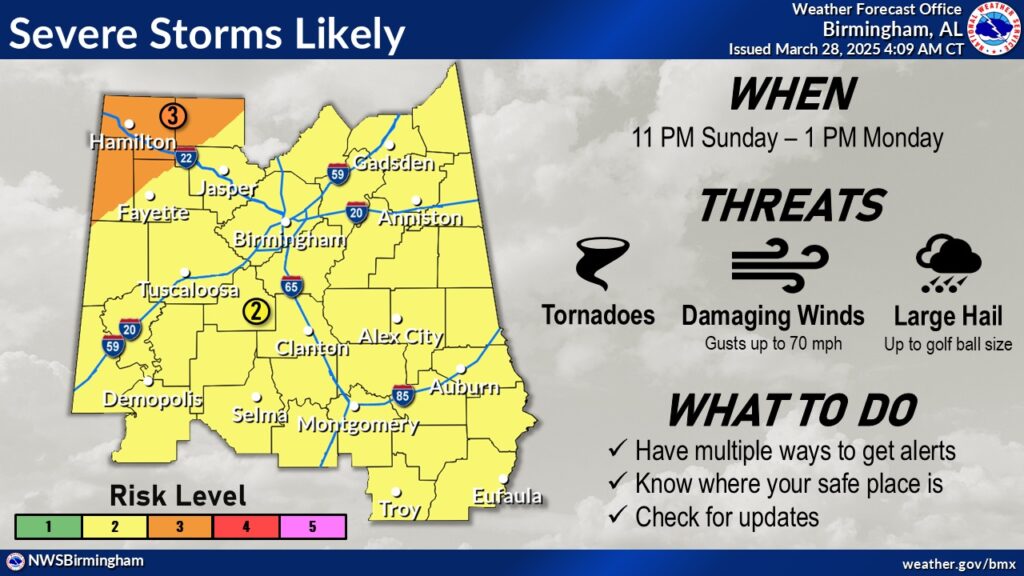
SEVERE WEATHER THREAT: There is a Marginal Severe Risk for many of us Sunday, through 7AM Monday.It looks like the main event begins Monday morning, perhaps even in the pre-dawn hours, in through perhaps early Monday afternoon. SPC is still highlighting a Level 2 (15%) Severe Risk on the Day 3 outlook through 7AM Monday, and the Day 4 Monday outlook. Expect all modes of severe weather including damaging winds, tornadoes and possible large hail.
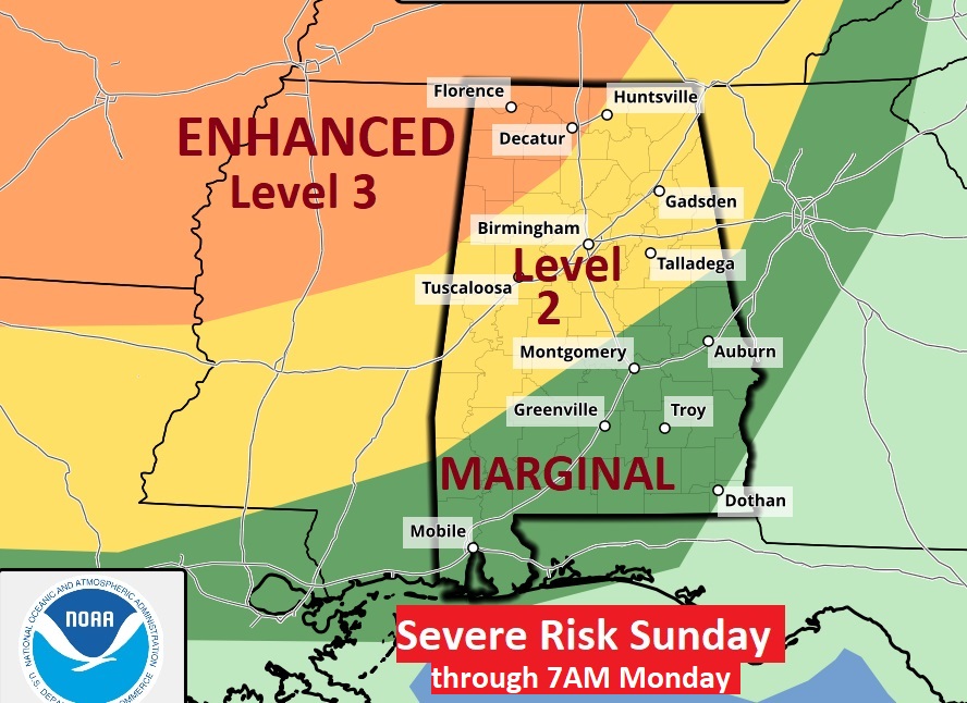
NWS says: Our threat for strong to severe thunderstorms increases late this weekend into early next week. There is now an Enhanced Risk (Level 3 out of 5) in place across our northwestern areas with a Slight Risk (Level 2 out of 5) across the remainder of the region. All forms of severe weather will be possible.
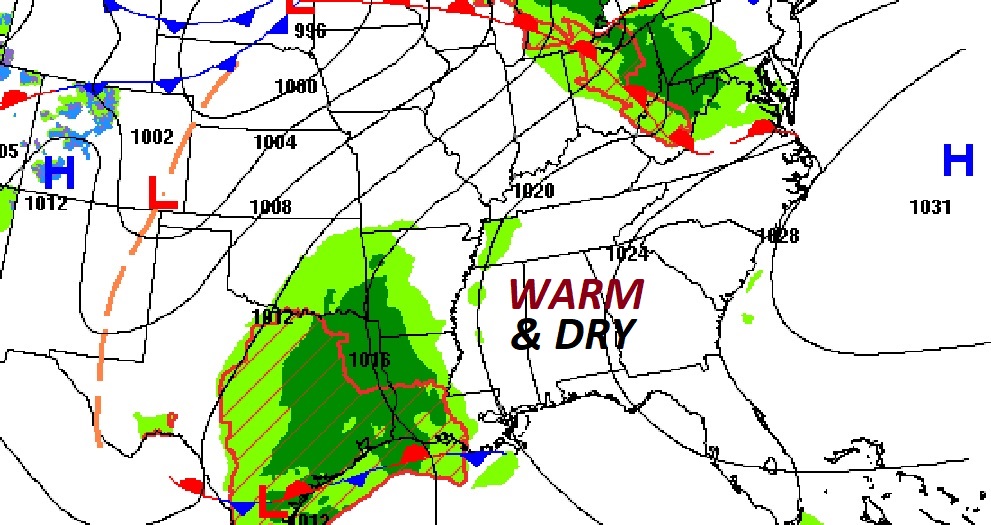
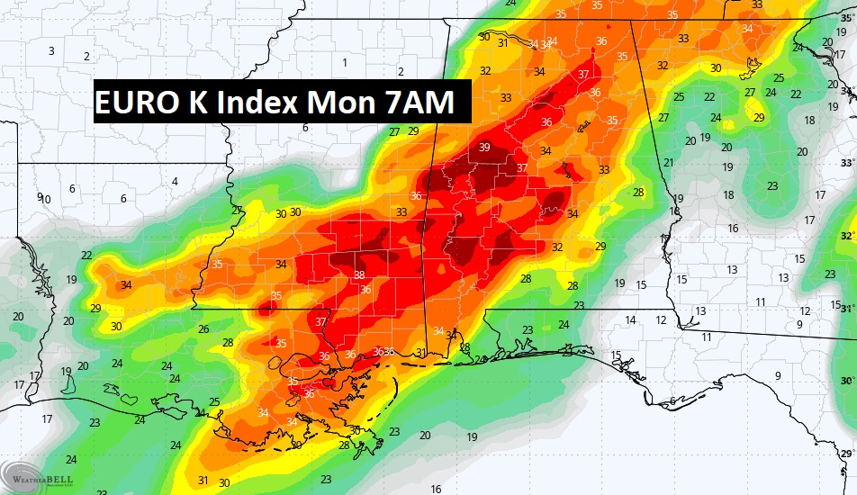
Here is the set-up Monday morning as the frontal system approaches.
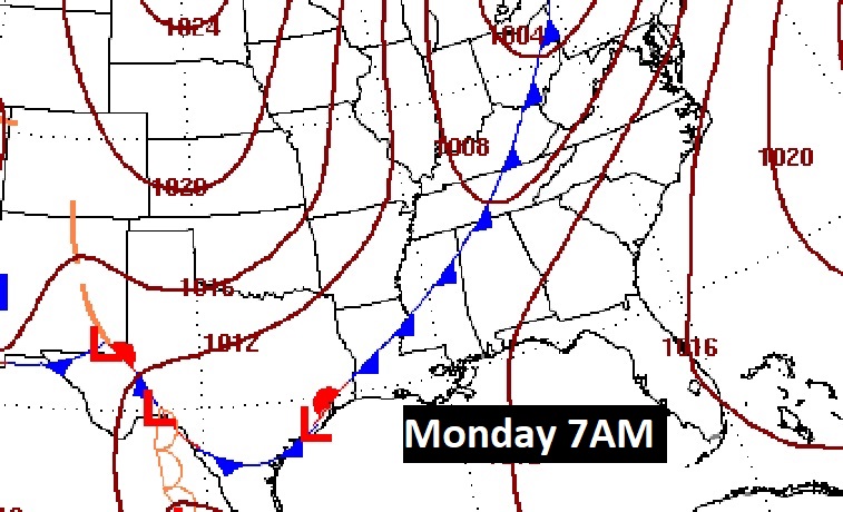
Models continue to ramp up on the ingredients for potential Severe Storms and tornadoes. The tornado threat appears to be increasing, starting in Alabama in the overnight hours Sunday night. Monday morning looks like prime time for most of us, perhaps beginning pre-dawn.
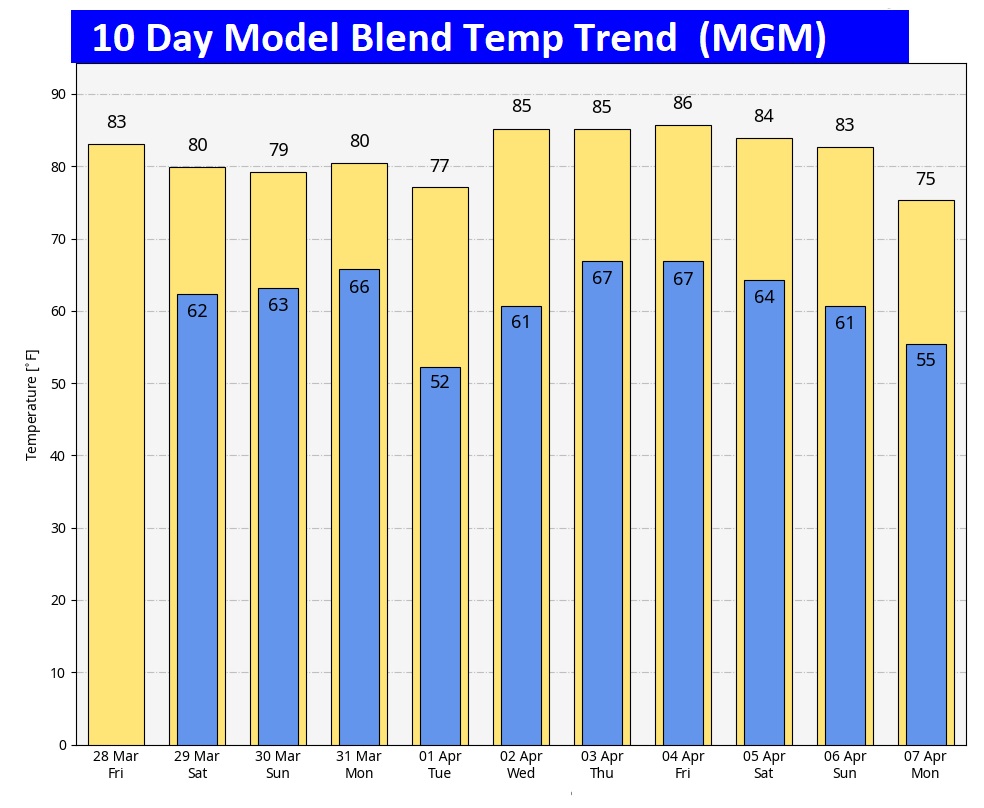
Here’s the 10 day model blend temperature trend. The warmth will continue.
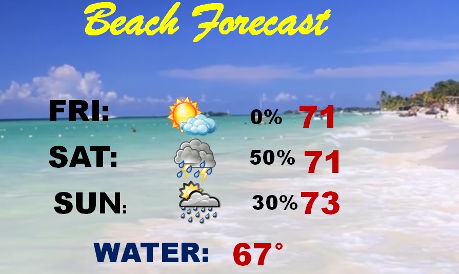
BEACH OUTLOOK: Dry today. Scattered showers and thunderstorms over the weekend. Highs in the 70’s. Gulf water is 67.
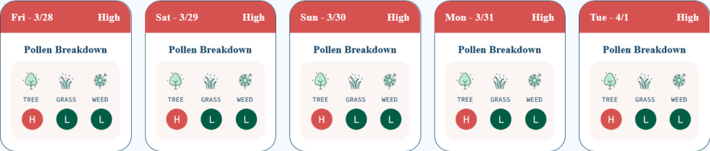
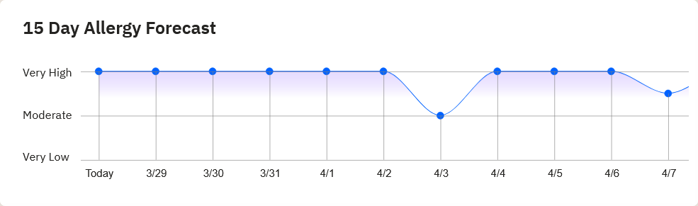
POLLEN: The news is not good. Looks like pollen will continue very high for several days.
Thanks for reading this blog update. This morning everything is normal. We’ll be LIVE on NewsTalk 93.1. There will be another Blog Update and Forecast Video discussion in the 4’o’clock hour tomorrow morning. Stay weather aware this weekend.
–Rich