
UPDATE:
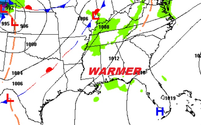
…DENSE FOG ADVISORY IN EFFECT UNTIL 9 AM CST THIS MORNING… * WHAT…Visibility one quarter mile or less in dense fog. * WHERE…Autauga, Dallas, Elmore, Lowndes, and Montgomery Counties. * WHEN…Until 9 AM CST this morning.
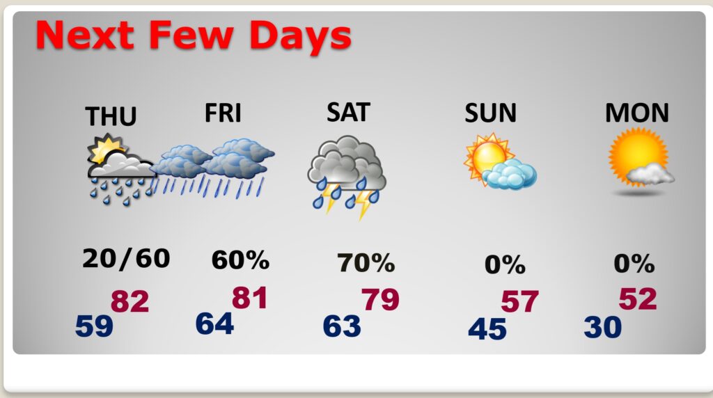
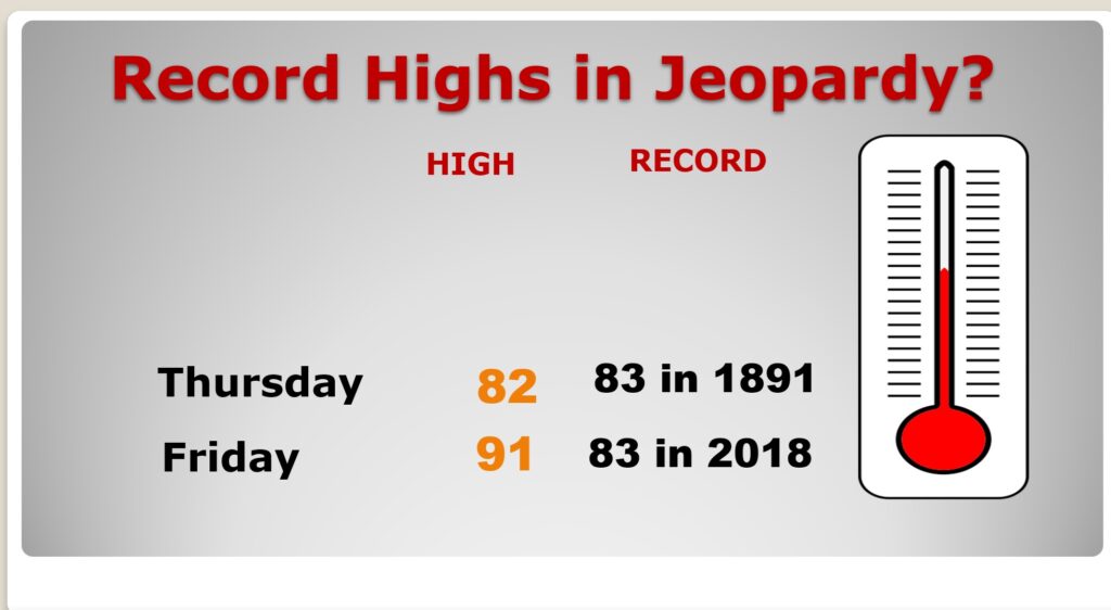
Good Morning! Our big-warm-up continues. Today we’re headed for at least the middle 70’s today. By Thursday and Friday – we may be 80 or above. The record for both of those days is 83. We’ll be in at least in the neighborhood. We’re dry today.
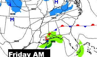
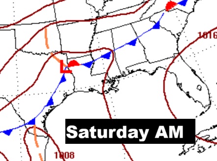
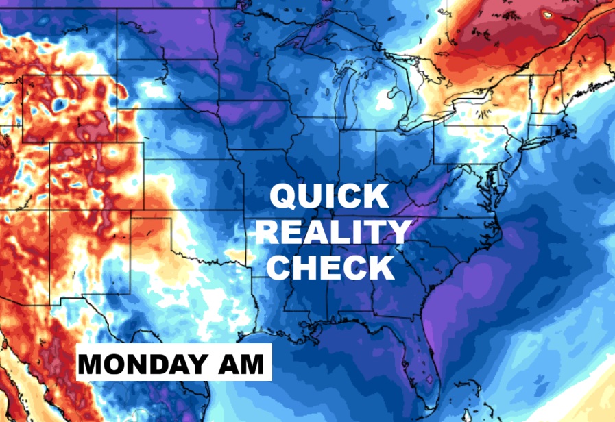
The risk for widely scattered showers begins overnight tonight and part of Thursday. Then more showers Thursday night into Friday. Showers and thunderstorms are expected Saturday ahead of a cool front that will substantially lower temperatures by Sunday and especially Monday. Another reality check is on the way. Here’s my video forecast discussion.
TODAY: DENSE FOG ADVISORY till 9. Mostly cloudy. High 76.
(Normal 65/41)
TONIGHT: Dry through the evening hours. Widely scattered showers possible after midnight. Low 59
NEXT FEW DAYS: Scattered showers possible early Thursday. A better chance of showers and possibly a thunderstorm or two Friday. We’ll be in record high territory Thursday and Friday. Showers and thunderstorms are expected Saturday ahead of a cool front that will substantially lower temperatures by Sunday and especially Monday.
Flirting with records….
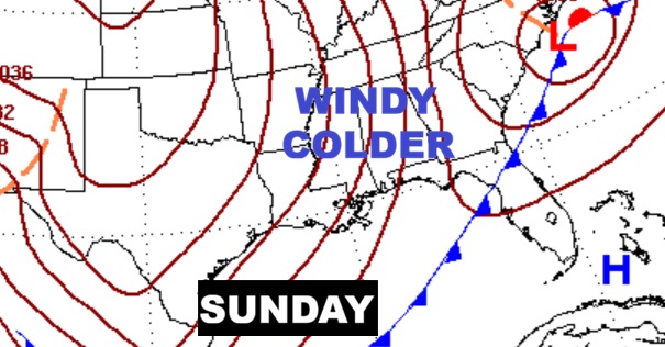
Big changes ahead. Much colder air begins to funnel In Sunday. An unpleasant change.
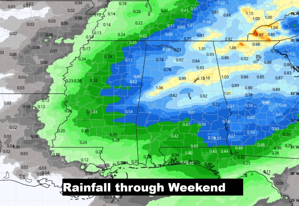
Here’s the expected rainfall through Sunday. Not a lot – unfortunately.,
The 10 Day model Blend Temperature Trend. Big-cool down by Sunday/Monday. Cold nights Monday and Tuesday night.
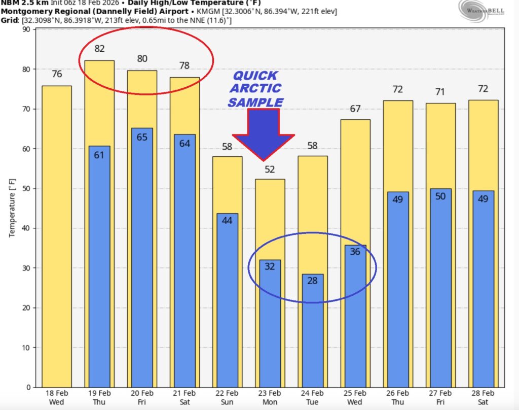
Here’s the EURO 16 day Ensemble temperature outlook. After next week’s set-back, look for a nice rebound starting around the 26th.
DAYS TILL SPRING: 30 days!
Thanks for reading this Blog this morning. This morning we are LIVE on the radio from 6 to 9 on NewsTalk 93.1. I’ll have another update for you in the 4 o’clock hour tomorrow morning. Have a nice day.
–Rich