
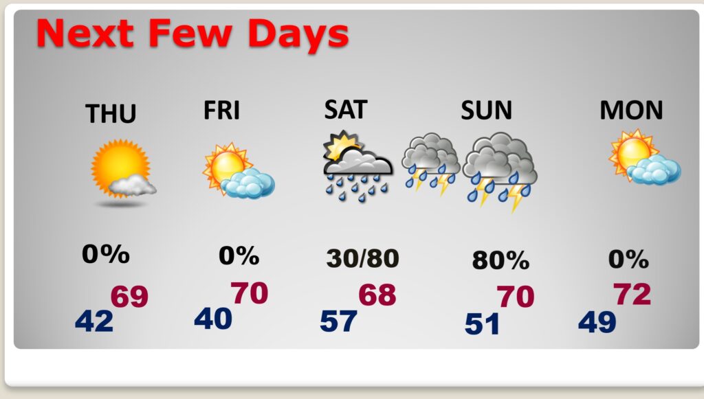
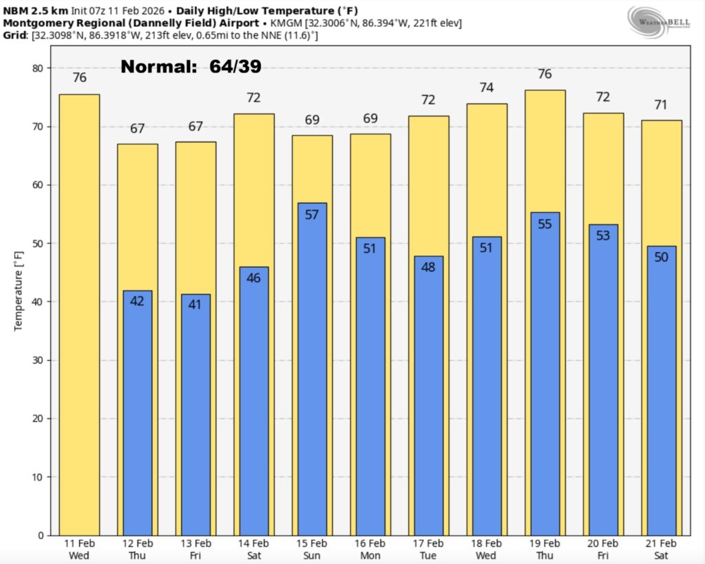
Good Morning! Spring-time in February continues. Tuesday’s high was 76. We’ll be in the middle 70’s again today. Scattered showers in the overnight hours will continue to pop up today, ahead of a week cool front. Temperatures will be just a few degrees cooler tonight and Thursday, but still above normal. A Valentine’s weekend storm system is starting to come into to better focus. Showers and storms are most likely starting in the overnight hours Saturday night and especially on Sunday. It’s becoming more and more likely that some storms could be strong to possibly severe. Rainfall amounts could be locally heavy. We’ll know more about this storm system as we get closer. Here’s my Video Forecast Discussion.
TODAY: Cloudy, then gradually becoming mostly sunny. Scattered spotty showers possible. High in the mid 70’s. Southwest wind 5 to 10 mph becoming north in the afternoon.
(Normal 64/39)
TONIGHT: Partly cloudy. Cooler. Low 42. Light wind.
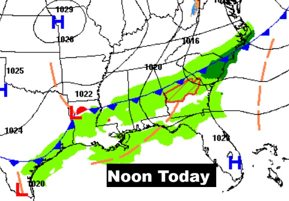
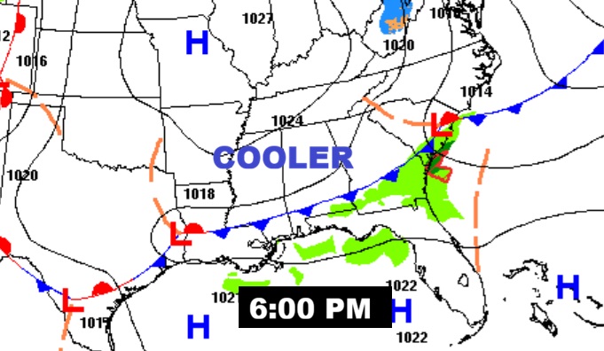
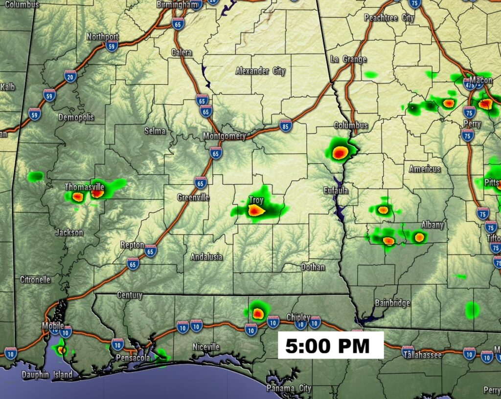
A southward moving cool front will be the focus for the scattered shower threat.
NEXT FEW DAYS: Our Nice February above normal pattern continues. Thursday and Friday will feature a lot of sunshine with highs in the upper 60’s to near 70. Nights will be in the 40’s.
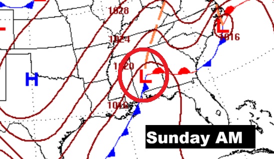
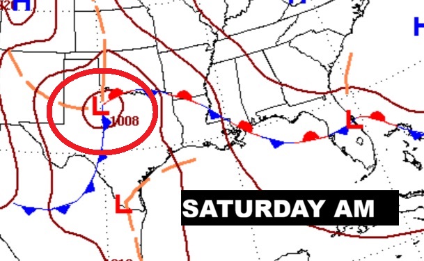
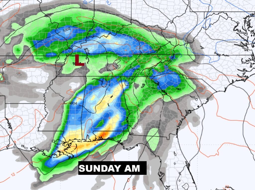
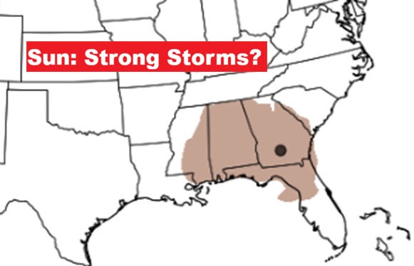
A Valentine’s weekend storm system is coming into better focus. Showers and storms are most likely starting in the overnight hours Saturday night and especially on Sunday. It’s becoming more and more likely that some storms could be strong to possibly severe. Rainfall amounts could be locally heavy. The models are now coming into better focus as far as the very important track of the low pressure storm system. This particular set-up looks more and more like a severe weather set-up, based on the expected position of that Low.
Rainfall over the next 7 days. Potentially significant rainfall.
The 10 Day model Blend Temperature Trend. Not bad for February – the Dead of Winter.
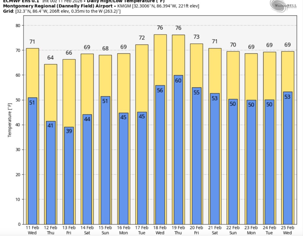
Here’s the EURO 16 day Ensemble temperature outlook. The Arctic Floodgates are closed for now.
.
DAYS TILL SPRING: 38 days!
Thanks for reading this Blog this morning. This morning we are LIVE on the radio from 6 to 9 on NewsTalk 93.1. I’ll have another update for you in the 4 o’clock hour tomorrow morning. Have a nice day.
–Rich