
Good Morning! Widespread Spring-like February warmth will continue. We made it into the lower 70’s on Monday. The well above normal temperatures will continue through this week. Today will be dry. There is a small risk of showers late tonight and Wednesday. More spotty showers could pop up Thursday night and Friday. But, it still looks like the “Main Event” will hold off until Valentine’s Night – Saturday night into Sunday. Showers and thunderstorms. Could we see some strong/severe storms? That depends on the exact track of the storm system. To be honest, there is major disagreement in the global models on the exact track and details. Stay tuned. Here’s my brief Video Forecast Discussion.
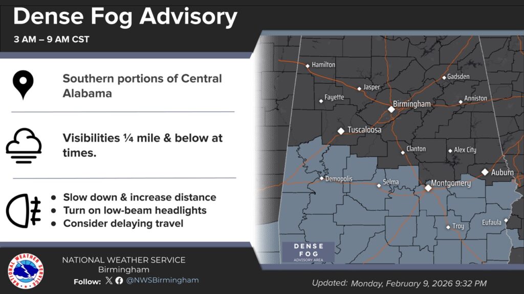
TODAY: Dense Fog Advisory this morning. Otherwise, cloudy, then gradually becoming mostly sunny. High 76. Southwest wind 5 to 10 mph.
(Normal 63/39)
Morning fog could limit visibility across the southern half of the state this morning. Dense fog Advisory.
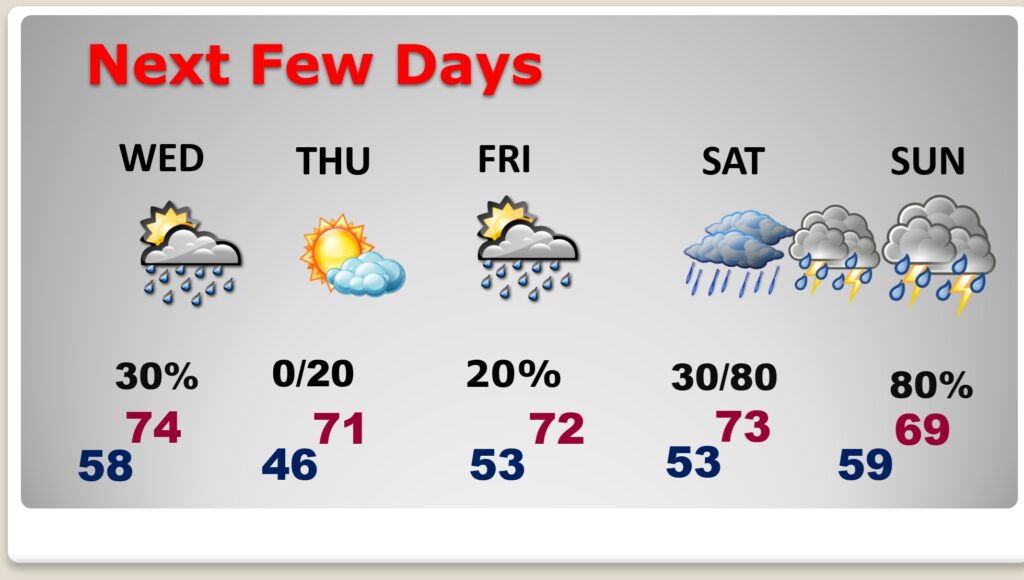
TONIGHT: A 30 percent chance of rain, mainly after midnight. Mostly cloudy, with a low around 58.
NEXT FEW DAYS: Our Nice February warming trend continues. Highs 70+ each day this week. Lows most nights in the 50’s. The trade-off is – scattered showers at times – late tonight through Saturday. (much of Thursday appears dry) The storm system on Saturday Night into Sunday looks significant, depending on the exact track. Showers and thunderstorms.
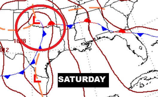
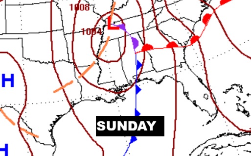
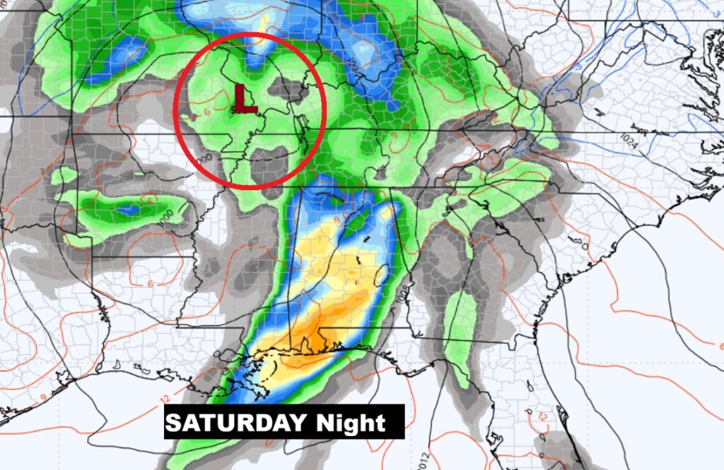
Global models still disagree on the storm system track. THIS is an average of the models. But, the exact details are still not known.
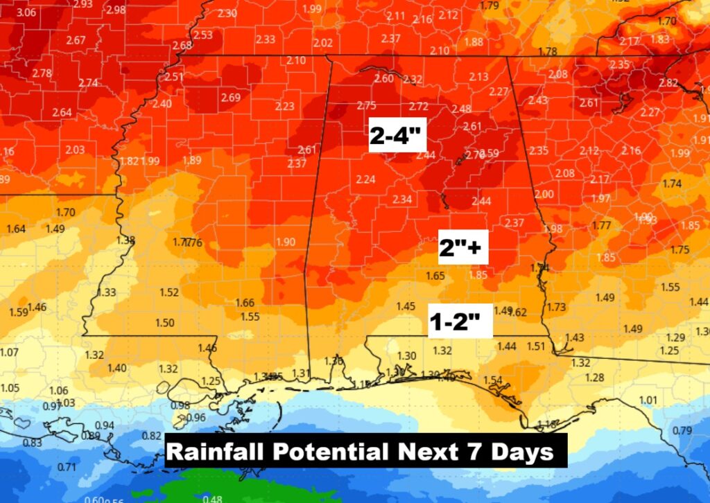
Rainfall over the next 7 days. Potentially significant rainfall totals from central Alabama northward.
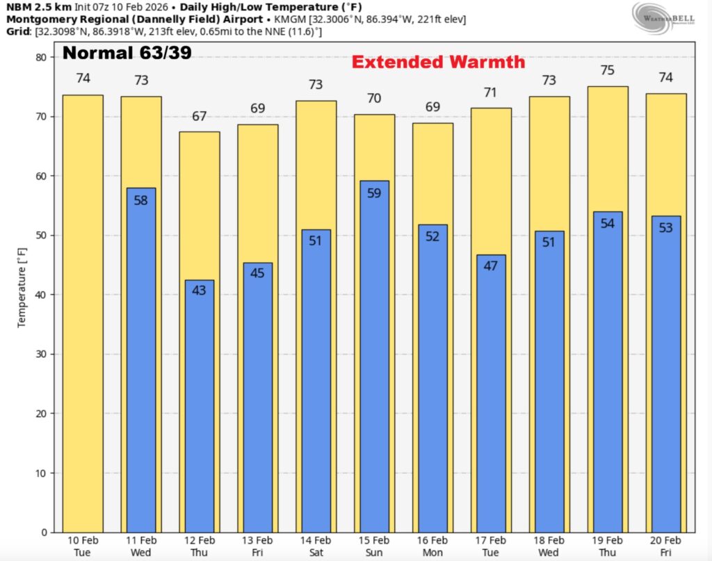
The 10 Day model Blend Temperature Trend. This nice periods of warmth continues.
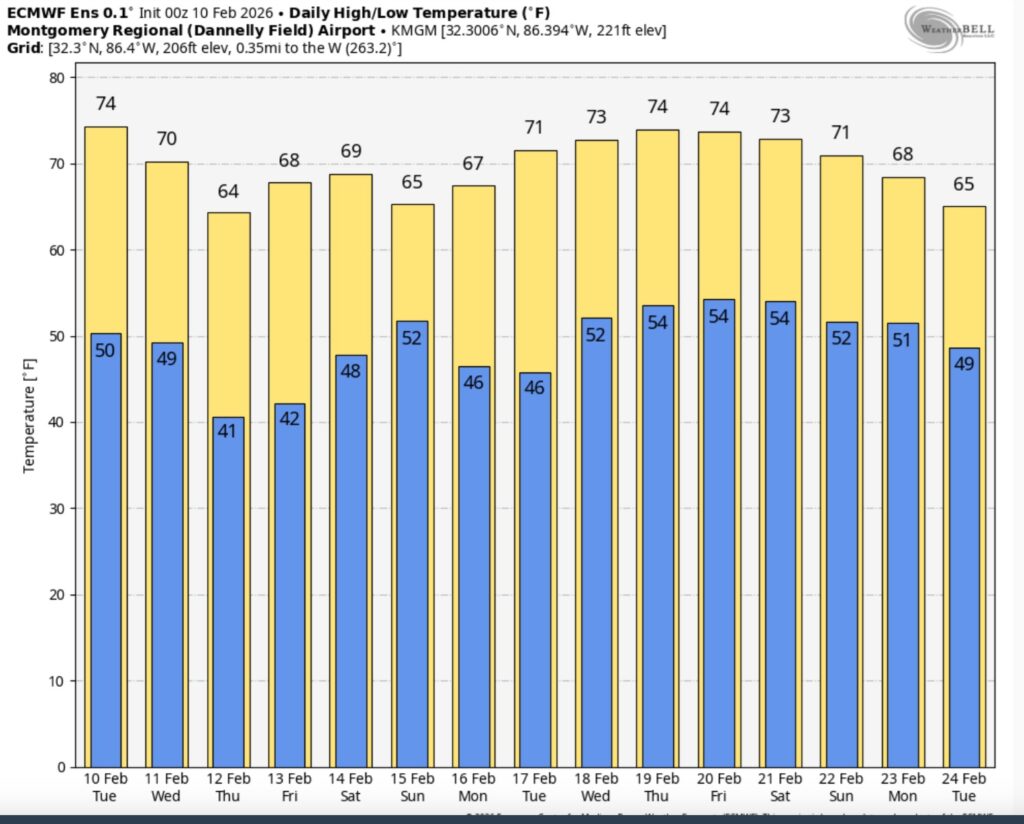
Here’s the EURO 16 day Ensemble temperature outlook. The Arctic Floodgates are closed for now. Thankfully.
.
DAYS TILL SPRING: 39 days!
Thanks for reading this Blog this morning. This morning we are LIVE on the radio from 6 to 9 on NewsTalk 93.1. I’ll have another update for you in the 4 o’clock hour tomorrow morning. Have a nice day.
–Rich