
Good Morning! Today will be sunny, but chilly – with highs only in the 40’s. Another freeze is likely tonight. This will be a rather brief temperature set-back. There is a very nice weekend in our future. And, a big temperature rebound is in the cards for next week. Highs will reach the lower 60’s Friday. The weekend will be sunny, and only a little below normal. It should be a great weekend. Next week, several days could be 70 or above. It appears that the Arctic Floodgates will close for several days. Here’s my brief video forecast discussion.
TODAY: Mostly sunny, with a high near 47. Northwest wind with gusts as high as 20 mph.
TONIGHT: Mostly clear and cold. Low 29. Light wind.
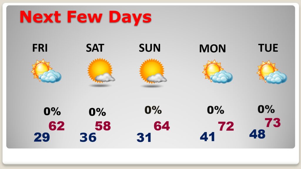
NEXT FEW DAYS: There is a major temperature re-bound in our future. Highs 60+ begins Friday. We’ll be well into the 60’s Saturday and Sunday. Perhaps 70+ by Monday. A February thaw is in our future.
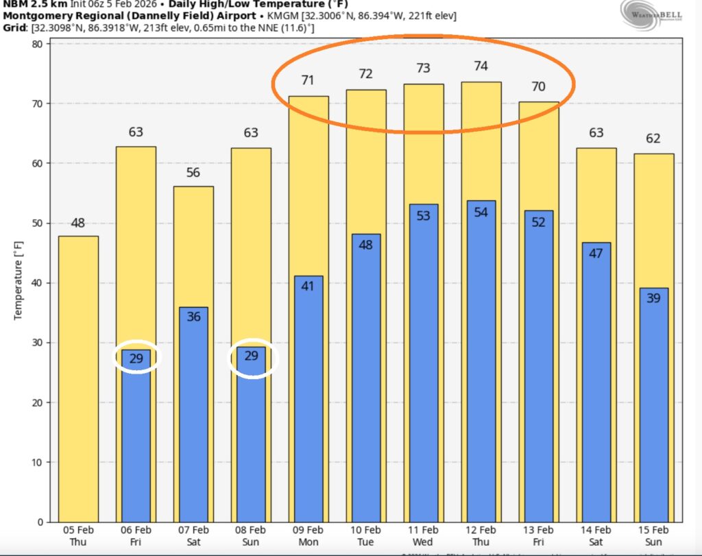
The 10 Day model Blend Temperature Trend. Temperatures next week look very nice. Spring-fever.
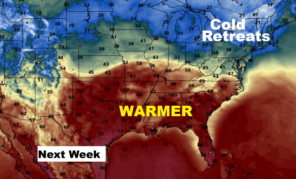
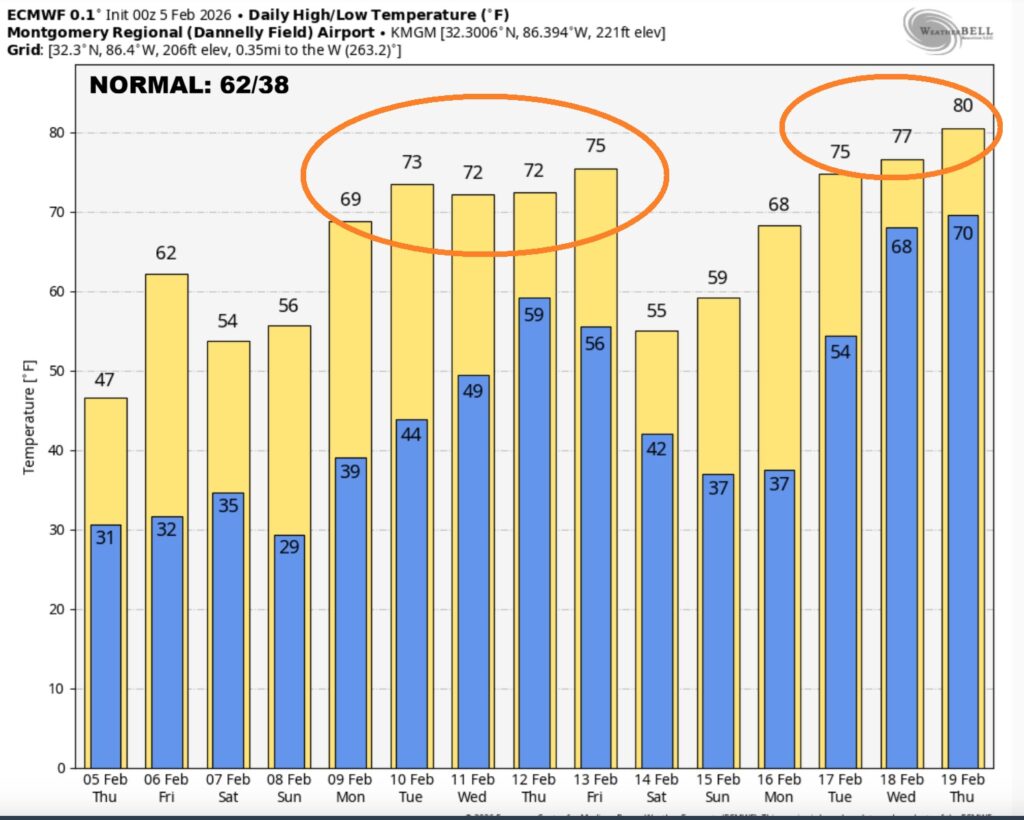
Here’s the EURO 16 day Ensemble temperature outlook. Warmer days are in our future.
.
DAYS TILL SPRING: 44 days!
Thanks for reading this Blog this morning. This morning we are LIVE on the radio from 6 to 9 on NewsTalk 93.1. I’ll have another update for you in the 4 o’clock hour tomorrow morning. Have a nice day.
–Rich