
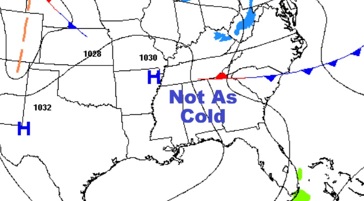
Good Morning! Temperatures are trying to moderate a little bit, but it’s still way below normal, and the moderation won’t last long. It’s a storm-free forecast for us.
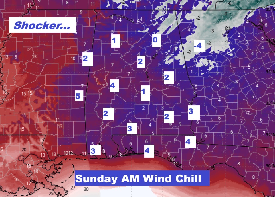
Yet Another Arctic surge will be arriving by Saturday. It will likely be the coldest yet. Saturday’s high may fail to reach the freeze mark. Middle teens Saturday night, if not lower. . I’ve got the projected wind chill Zero to 5 above Sunday AM. Probably the coldest in at least 9 years.. Temperatures will slowly start to moderate next week. But, still below normal. Here’s my brief video forecast discussion.
TODAY: COLD start. Partly sunny, then gradually becoming sunny, with a high near 49. West wind 5 to 10 mph.
TONIGHT: Mostly clear, with a low around 25.
NEXT FEW DAYS: Briefly, temperatures are trying to moderate a little bit. But, that won’t last.
It’s a storm-free forecast for us.
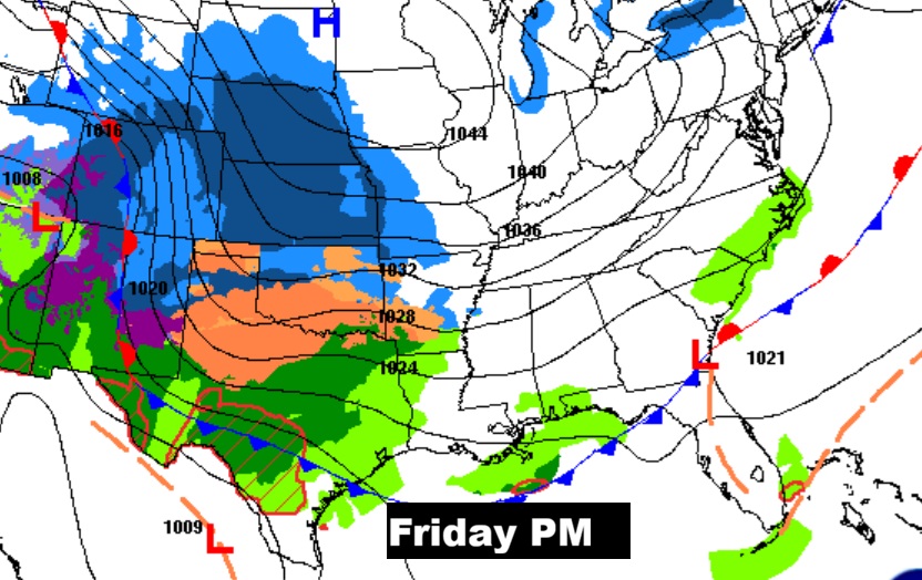
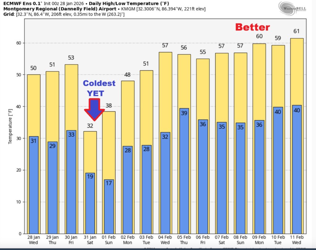
Yet Another Arctic surge arriving by Saturday will likely be the coldest yet. Saturday’s high may fail to reach the freeze mark. Middle teens Saturday night, if not lowerThis map is a shocker. -25 to 30 degrees below normal Saturday. The GFS model.
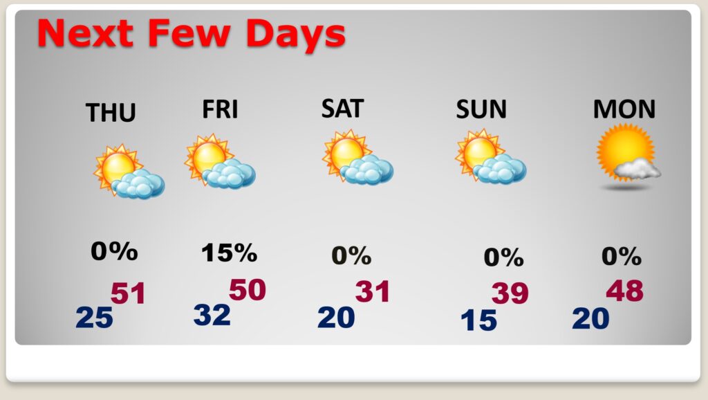
Low pressure along the Gulf coast may bring a few showers to South Alabama on Friday. I have our rain chance under 20%.
Crazy cold Saturday and Saturday night. Wind chill in the teens deep into central Florida.

WOW. I’ve got the projected wind chill Zero to 5 above. Probably the coldest in at least 9 years.
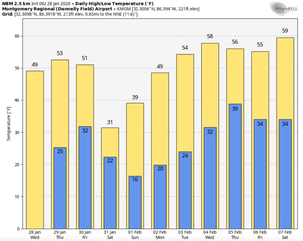
The 10 Day model Blend Temperature Trend. Look at that next Arctic Plunge Saturday. Temperatures will slowly start to moderate next week.
Here’s the EURO 16 day Ensemble temperature outlook. Normal hi/lo 61/37.
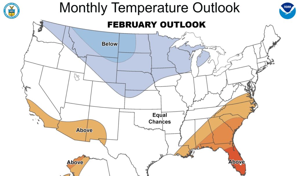
FEBRUARY OUTLOOK: The Climate Prediction Center says there’s some hope for more reasonable temperatures in the Southeast US. Fingers crossed.
.
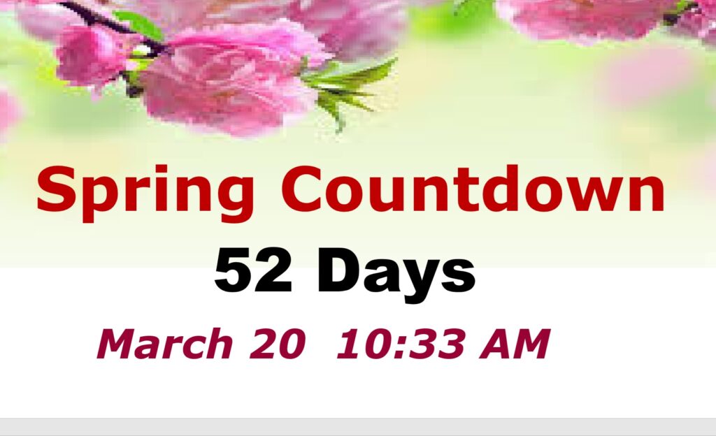
DAYS TILL SPRING: 52 days!
Thanks for reading this Blog this morning. This morning we are LIVE on the radio from 6 to 9 on NewsTalk 93.1. I’ll have another update for you in the 4 o’clock hour tomorrow morning. Have a nice day.
–Rich