
Good Morning! Early this morning, temperatures are dropping. Some towns will end up in the middle-teens at Dawn. Not as much wind this morning, but enough to lower the wind chill to perhaps the low teens. Sunshine today takes us to the lower 40’s, with low 20’s tonight. Upper 40’s on Wednesday is a little better, but way below normal. (Normal 61/37)
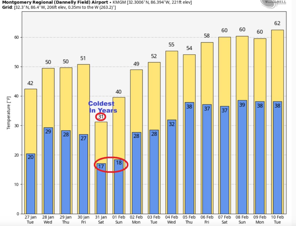
AND, I hate to say this. Another Arctic surge arriving by Saturday will likely be even colder. Saturday’s high may struggle to reach freezing. Maybe coldest in years. At least, I have us storm-free through the weekend. We are 53 days till Spring. Here’s my brief video forecast discussion.
TODAY: Sunny and cold. High 43. West wind 6 to 12 mph.
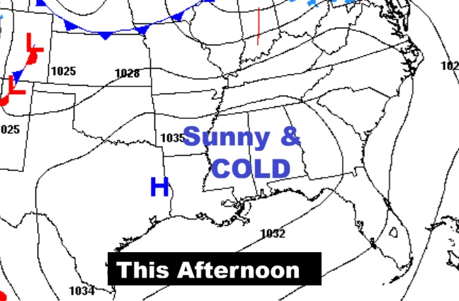
TONIGHT: Partly cloudy and very cold. Low 24.
WIND CHILL POTENTIAL: Dress in layers this morning.

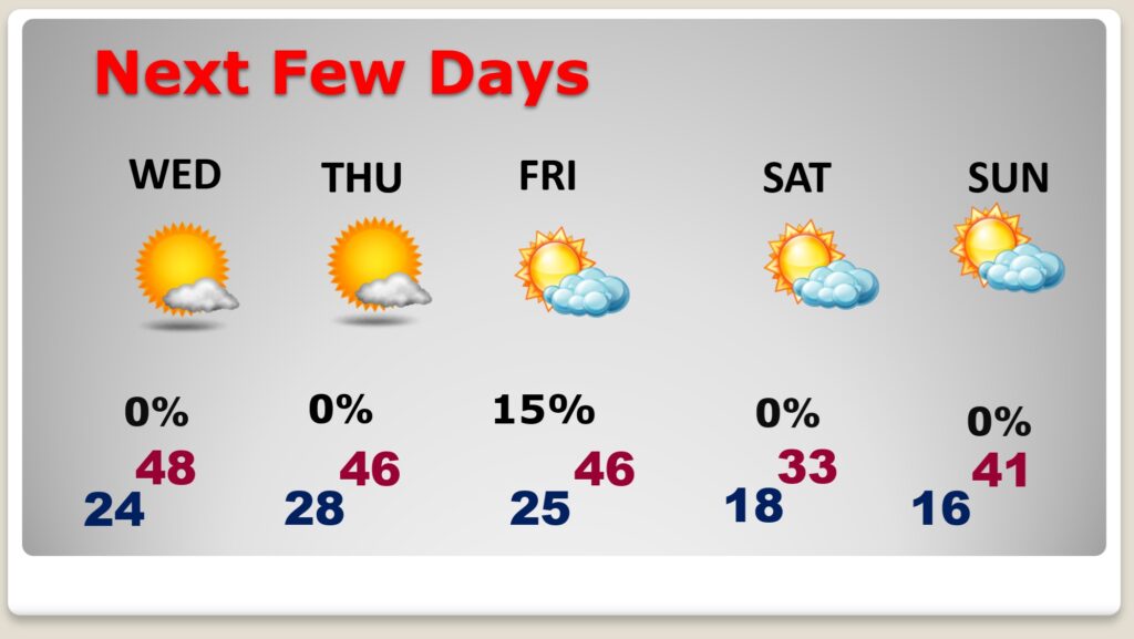
NEXT FEW DAYS: Sunshine with upper 40’s Wednesday is a little better, but well below normal. (Normal 61/37)
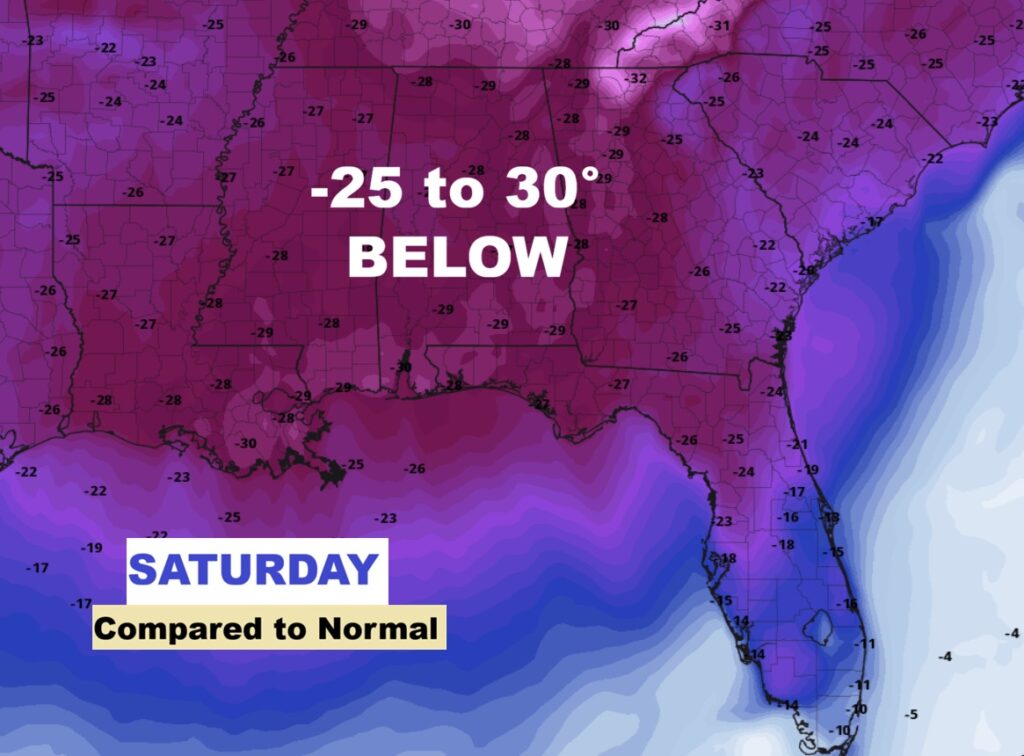
AND, listen to this. Another extreme Arctic surge arriving by Saturday will likely be even colder. Saturday’s high may struggle to reach freezing. Maybe coldest in years.
This map is a shocker. -25 to 30 degrees below normal Saturday. The GFS model.
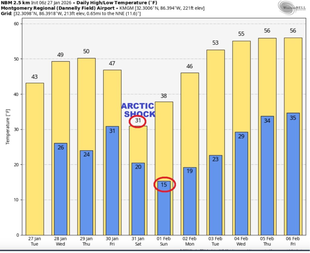
The 10 Day model Blend Temperature Trend. Even more Arctic Air Ahead.
Here’s the EURO 16 day Ensemble temperature outlook. Stupid Cold. (Normal 61/37).
.
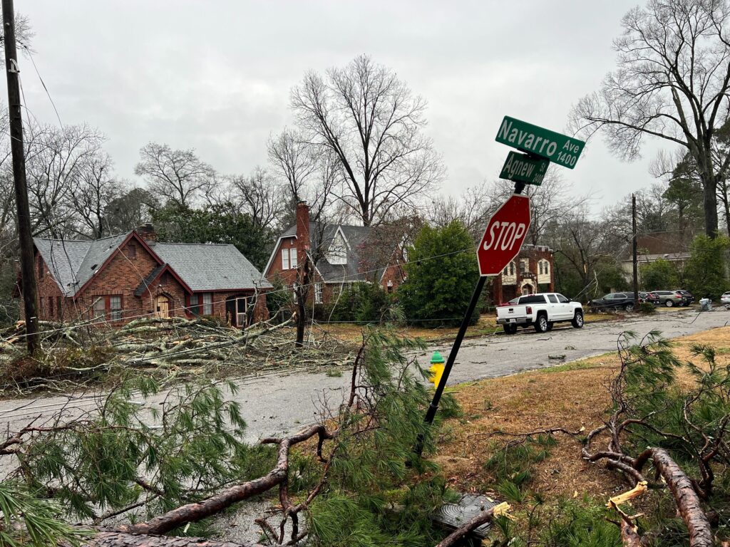
LOWNDES/MONTGOMERY Damage Storm Survey from Sunday Storm Includes EF-1
NWS Meteorologists survey of Damage in Lowndes Montgomery counties from the Sunday damage path indicated an EF-1 Tornado from eastern Lowndes County into part of western Montgomery county east to I-65. (Max wind 90 mph) Especially in the area of the Rolling Hills sub-division. The remainder of the extensive tree damage and other damage was due to extensive Straight Lines winds (60-70 mph). No injuries. Complete details:
https://forecast.weather.gov/product.php?site=NWS&issuedby=BMX&product=PNS&glossary=1

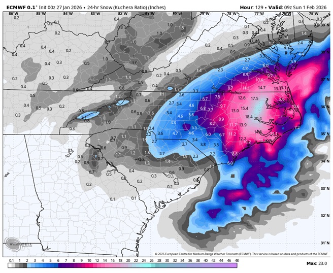
I’m not even going to talk to you about this potential weekend blizzard along the US East coast. Because it won’t effect us. Crazy possibilities. Just saying.
DAYS TILL SPRING: 53 days!

Cooking at my house now….
Thanks for reading this Blog this morning. This morning we are LIVE on the radio from 6 to 9 on NewsTalk 93.1. I’ll have another update for you in the 4 o’clock hour tomorrow morning. Have a nice day.
–Rich