
Good Morning! Here we go. Dress in layers this morning. AM lows which are likely to be in the low to mid 20’s by Dawn, will seem that much colder with Wind chills of 10 to 15. It won’t warm up much today. High near 37 – but wind chill will be a big factor all day, and even tonight. Tonight will be colder. The Tuesday morning low will be 15 to 17° with wind chill 10-14. Tuesday will not be quite as windy with a high in the lower 40’s perhaps. But, bitter cold nights in the low to mid 20’s are expected all week. AND, listen to this. Another Arctic surge arriving by Saturday will likely be even colder. Coldest air of the season so far. We are 53 days till Spring. Here’s my brief video forecast discussion.
TODAY: Mostly cloudy through mid-morning, then gradual clearing, with a high near 37. Northwest wind 10 to 15 mph, with gusts as high as 20 mph. Wind chill factor in the 20’s much of the day.
TONIGHT: Mostly clear, with a low around 15-17. Northwest wind 5 to 10 mph becoming light after midnight. Winds could gust as high as 20 mph. Wind chill as low as 10 by Dawn Tuesday.

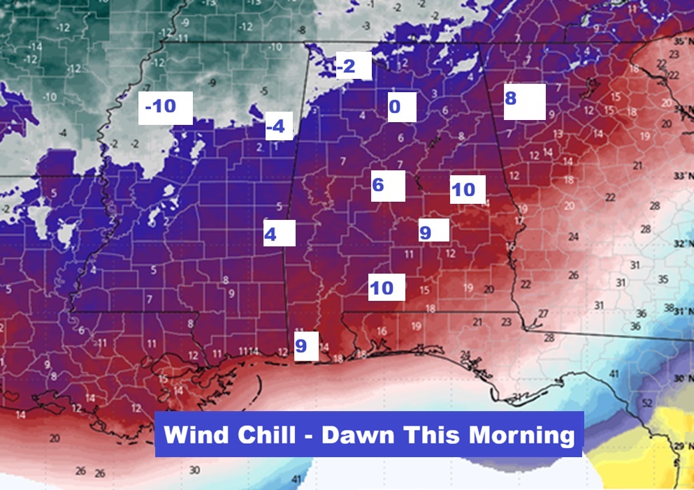
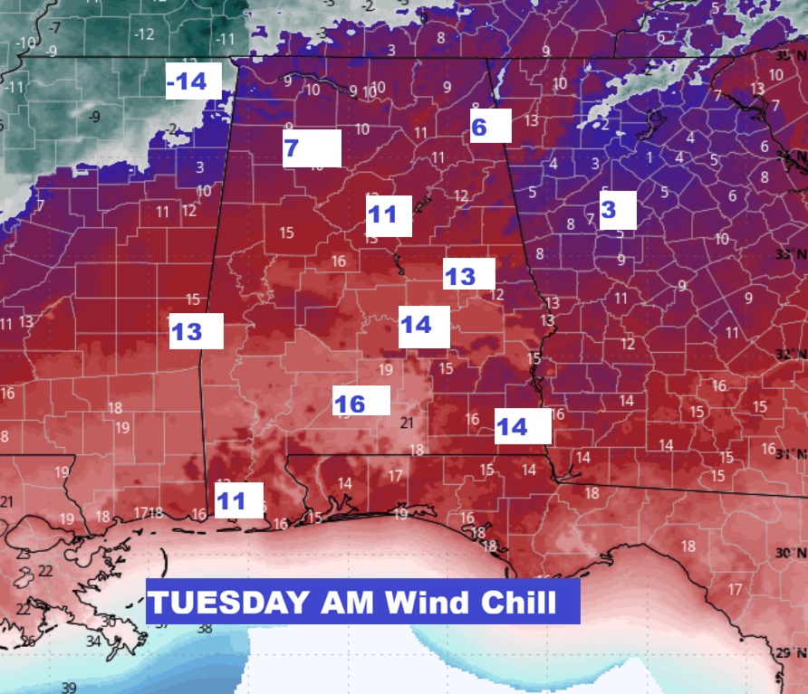
WIND CHILL POTENTIAL: The potential Wind Chill this morning and tomorrow morning will add insult to injury.
NEXT FEW DAYS: Tuesday will not be quite as windy with a high in the lower 40’s perhaps. But, bitter cold nights in the low to mid 20’s all week. AND, listen to this. Another Arctic surge arriving by Saturday will likely be even colder. Coldest air of the season so far.

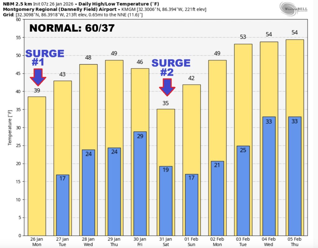
10 Day Model Blend Temperature Trend. Crazy cold week. Butter cold nights. Look at that next Arctic Surge by about Saturday.

Here’s the EURO 16 day Ensemble temperature outlook. (Normal 60/36). Look at that NEXT Arctic surge next Saturday. Even Colder than this first surge. Stupid cold.
SUNDAY MONTGOMERY WIND DAMAGE: A severe thunderstorm in the 11 o’clock hour Sunday morning in Montgomery caused a lot of damage – especially to trees. Power outages were extensive. It was probability straight line wind, but NWS will investigate today. Peak wind at MGM was 48 mph. I had 53 mph in East Montgomery.


.
DAYS TILL SPRING: 53 days!

Thanks for reading this Blog this morning. This morning we are LIVE on the radio from 6 to 9 on NewsTalk 93.1. I’ll have another update for you in the 4 o’clock hour tomorrow morning. Have a nice day.
–Rich