
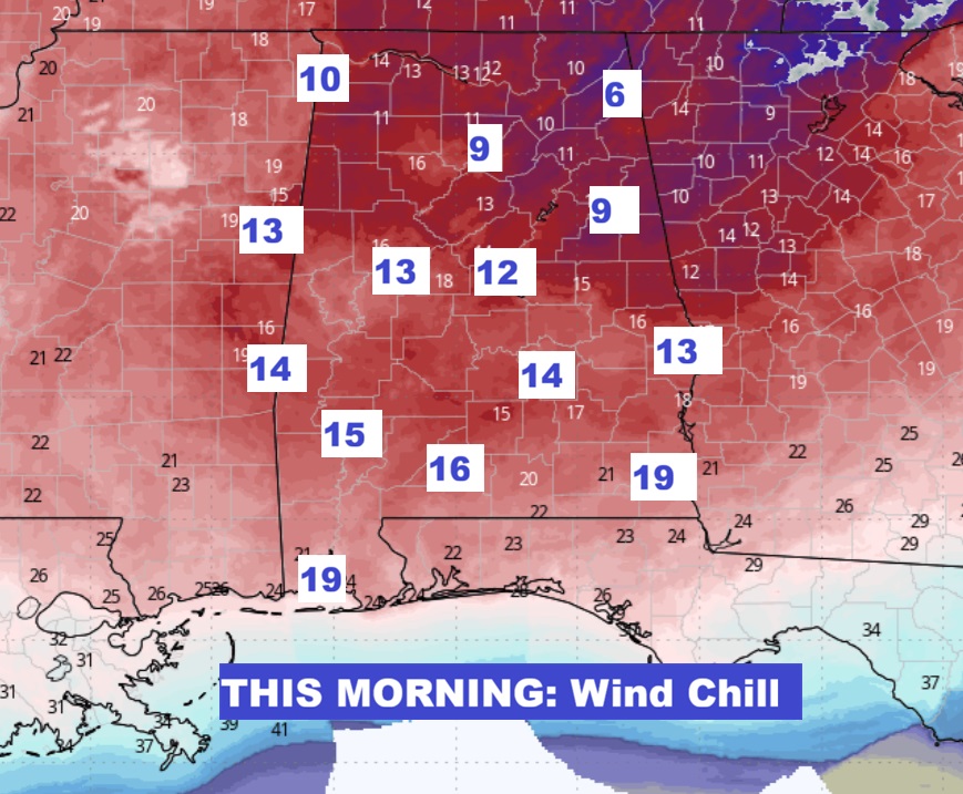
Good Morning! It’s a very cold forecast starting with some brutal uncomfortable morning wind chill with low teens in many spots. Today will be a raw winter’s day. Wind chill will be a big factor. A few showers could pop up late Friday night ahead of another cold front. Widely scattered showers possible. Then, yet another front and potential low pressure development in the Gulf could cause some interesting possibilities pre-dawn Sunday. Could rain mix with some snowflakes over the SE third of the state? Maybe. Probably not. The main point is there would be NO ACCUMULATIONS. The main story over the next several days will be repeated Arctic Incursions with Cold days and Brutally Cold nights. As you’ll see on the 16 day EURO trend, more reasonable temperatures will return by late month. Hang on. Here’s my brief video forecast discussion.
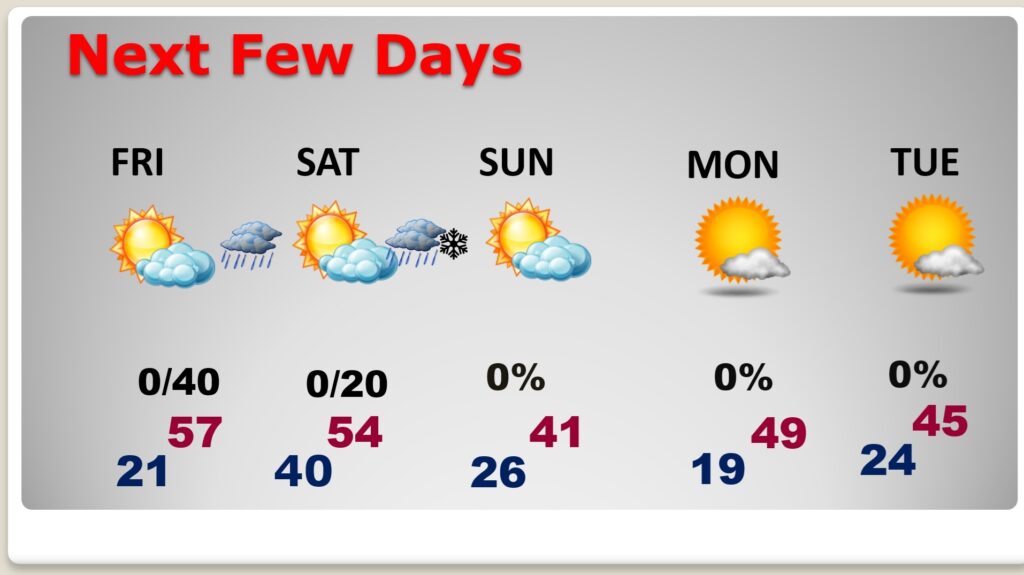
TODAY: Suny, breezy and quite cold. High in the lower 40’s. NW wind gusting as high as 20/25 mph. Wind chill during the day in the 20s/30s. TONIGHT: Clear and very cold. Low 20-22.
MORNING WIND CHILL: Dress in layers. It looks like a very uncomfortable Wind Chill Morning and a very unpleasant day ahead temperature-wise with the breeze.
NEXT FEW DAYS: Yet another front and potential low pressure development in the Gulf could cause some interesting possibilities pre-dawn Sunday. Could rain mix with some snowflakes over the SE third of the state? Maybe. Probably not. The main point is there would be NO ACCUMULATIONS. The main story over the next several days will be repeated Arctic Incursions with Cold days and Brutally Cold nights.
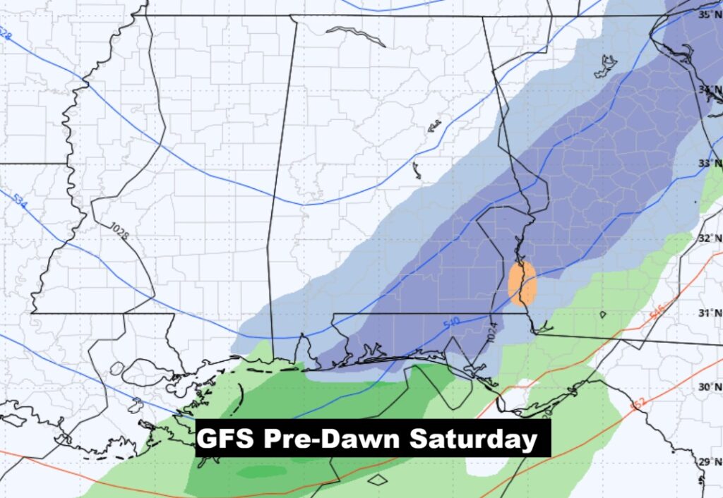
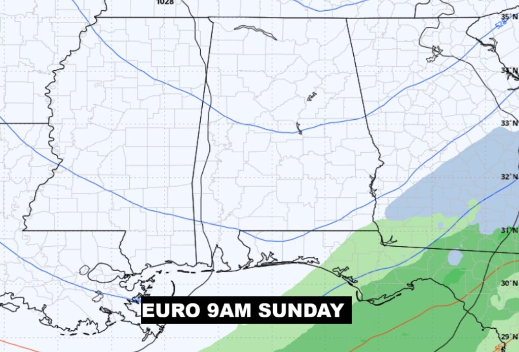
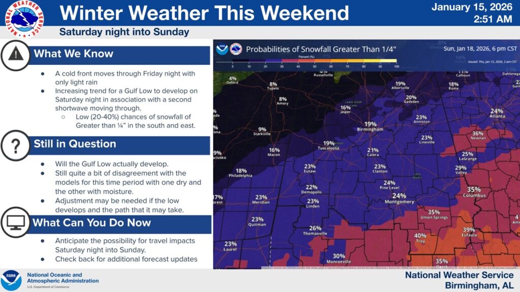
WINTER WEATHER ISSUES PRE-DAWN SUNDAY?: Lots of folks will go crazy speculating on the possibility of of a few raindrops mixing with snowflakes pre-dawn Sunday morning. It all depends on potential low pressure developing in the Gulf. Will it Happen? What about timing? Chances are very tiny. Obviously, there would be no accumulation. Is this a big deal? Absolutely not. Here’s a couple of snapshots of the GFS and EURO models. The GFS is more bullish on the chance of ANY snowflakes.
NWS did a nice job here discussing the complexities of potential snowflakes mixed with raindrops pre-dawn Sunday AM. Notice the tiny probabilities. We’ll know more tomorrow morning. No need to purchase a snow shovel.😊
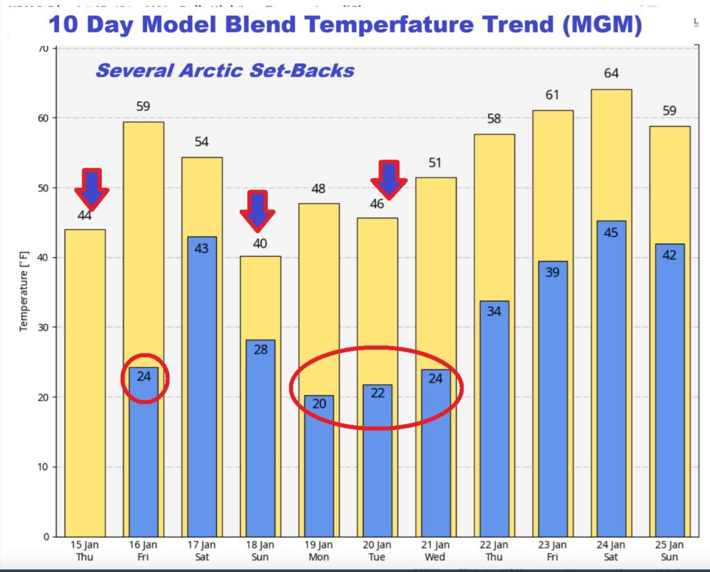
Here’s the model blend 10 day temperature trend. There will multiple Arctic Temperature set-backs.
Here’s a peak at the EURO 16 day Ensemble outlook. No major warming trends are in our future until late in the month.
Thanks for reading this Blog this morning. This morning we are LIVE on the radio from 6 to 9 on NewsTalk 93.1. I’ll have another update for you in the 4 o’clock hour tomorrow morning. Have a nice day.
–Rich