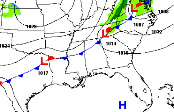
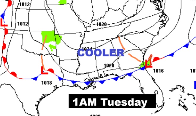
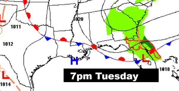
Good morning! Much cooler air is funneling into Alabama. Highs today may not reach 70. (Normal 70/43) Tonight will be quite chilly, but actually near normal. Get ready for a very nice November weekend with cool days and chilly nights. Next week is shaping up to be quite interesting. An approaching front and deep upper through will bring in our next significant rain chance, starting Tuesday, and especially Tuesday night into early Wednesday. It’s early, but we’re hoping for some decent rainfall totals. Right now this does not look like a severe weather event. SHARPLY cooler air will follow the front for the later part of next week. Some nights will fall to the 30’s. It’s too early to say if we’ll get close to freezing. However, the average date of the first freeze is November 18th at MGM. Here’s my brief forecast discussion video.
TODAY: A few morning clouds, but expect abundant cool sunshine. High 69. (Normal 70/43) North wind 10 to 16 mph. Clear skies, chilly tonight. Low 43, (Full Moon)
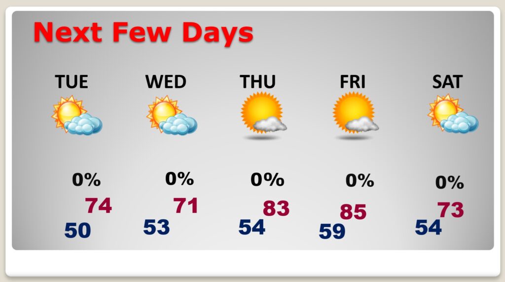
NEXT FEW DAYS: We’re in for a very nice November weekend. Cool days and chilly nights. Low 70’s Saturday. Mid 70’s Sunday. Upper 70’s Monday. Nights mostly in the 40’s. An approaching front and deep upper through will bring in our next significant rain chance, starting Tuesday, and especially Tuesday night into early Wednesday. It’s early, but we’re hoping for some decent rainfall totals.
An approaching front and deep upper through will bring in our next significant rain chance, starting Tuesday, and especially Tuesday night into early Wednesday.
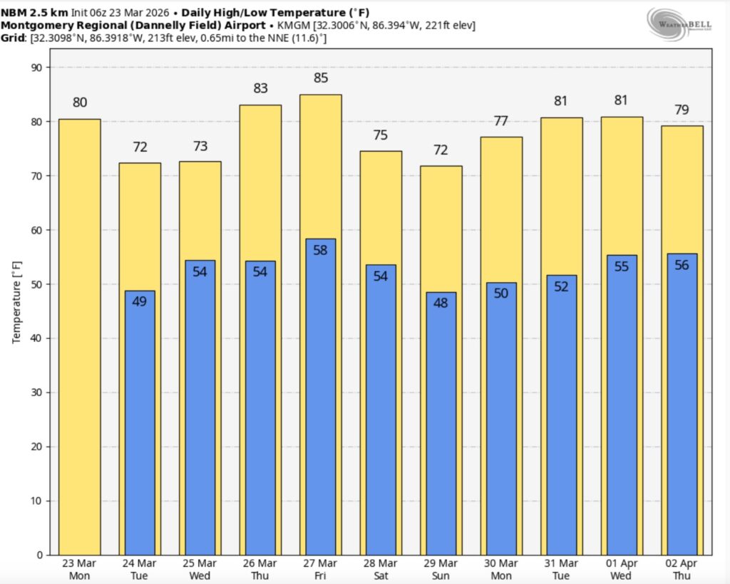
The 10 Day Model Blend Temperature Trend. Looks like the coolest air of the season so far is about a week away on arriving around Thursday the 21st.
.
GLORIOUS RAINDROPS: That rainfall in the early hours of Thursday was amazing and needed. Montgomery (MGM) and Maxwell AFB received .57”, most rainfall in 49 days! Millbrook had .76”, Prattville .56”, and a whopping .61” in East Montgomery at my house. I’m deliriously happy!
DROUGHT MONITOR: Here’s the NEW Drought Monitor map, showing data through Tuesday. It indicates 97% of the state is in a moderate drought or greater. And now, 43% of the state is in a severe or extreme drought. Tuesday’s night’s rain was a drop in the bucket. It was the biggest rain total (.57”) in Montgomery in 49 days.
FULL BEAVER MOON: Moonset this morning $;42. Moonrise this afternoon: 4:27 PM. Moonset Saturday morning 5:56 AM. The moon is officially full at 3:28 PM.
This November’s full moon is a supermoon, meaning it’s closer to Earth in its orbit and appears larger and brighter than usual, according to NASA.
The beaver moon will be the fourth and final supermoon in this series.
.
TROPICAL UPDATE: Tropical Storm Sara, with 45 mph wind, is expected to die over land this weekend as it moves inland over central America causing catastrophic rainfall.
If it somehow survived it’s encounter with land, here’s what the Tropical modes do to it in the Gulf. THIS IS A BIG IF AND QUITE UNLIKELY.
MONTGOMERY TORNADO ANNIVERSARY: This is the anniversary of the famous MONTGOMERY FUN ZONE EF-2 Tornado. It happened at 10:25 AM. The tornado damage path was approximately 6.8 miles long and 250 yards wide at its widest point. The tornado touched down about 1.4 miles southwest of the Shakespeare Festival and tracked northeastward across the Woodmere and Beauvoir Lake Subdivisions. The tornado crossed Interstate 85 at Bell Road and continued northeastward to the Atlanta Highway just west of Taylor Road. Numerous trees were snapped off or downed along the path with minor roof damage to numerous homes. Near the Atlanta Highway, the tornado cross the UAM ball field complex and struck the Montgomery Postal Processing and Distribtuion Center and the Post Office. The main doors of the post offcie were blown in and portions of the roof were lifted off to the north. Numerous trees were snapped off at ground level on the south and west sides of the building. A tractor trailer was completely turned around and moved 30 yards and flipped over. Other postal vehicles and cars in the parking lot were moved or received significant damage. Just to the north, the tornado produced major damage to the Fun Zone Skating Rink. This was a large metal building structure which was nearly totally destroyed. Several vehicles were tossed around and significantly damaged or crushed by debris from the building. As the tornado crossed the Atlanta Highway, several metal power poles were either significantly bent or down.
Thanks for reading the blog. There will be another complete Blog update and video forecast discussion tomorrow morning. This morning, everything is normal including LIVE on the Radio from 6 to 9AM on NewsTalk 93.1 – WACV. Have a nice day!
–Rich