
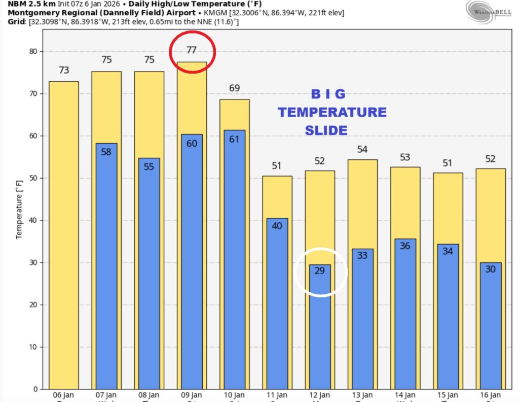
Good Morning! After some morning patchy dense fog this morning, we have a nice day ahead. Today’s high should reach the low to mid 70’s. (Normal 59/37) We’ll be in the 70’s today through Friday. Our next weather maker will bring rain and thunderstorms by Friday and Friday night into Saturday. Some storms could be strong, possibly severe. Much cooler air will follow. Here’s my brief video forecast discussion.
TODAY: DENSE FOG ADVISORY. Areas of dense fog before 10am. Otherwise, Limited sunshine. Mostly cloudy, with a high near 73. Southwest wind 5 to 10 mph, with gusts as high as 20 mph. TONIGHT: Mostly cloudy, with a low around 58.
The Days are getting longer. We have gained 6 minutes and 5 seconds of daylight since thje first day on Winter.
NEXT FEW DAYS:
A nice warming trend is underway with highs in the 70’s Our next weather maker will bring rain and thunderstorms by Friday and Friday night into Saturday. Some storms could be strong, possibly severe. Much cooler air will follow.
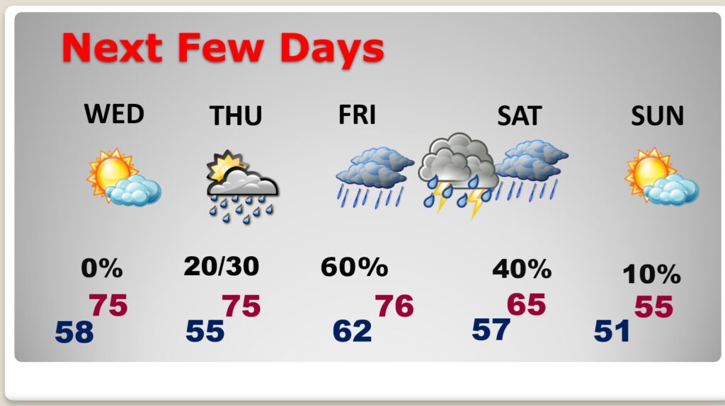
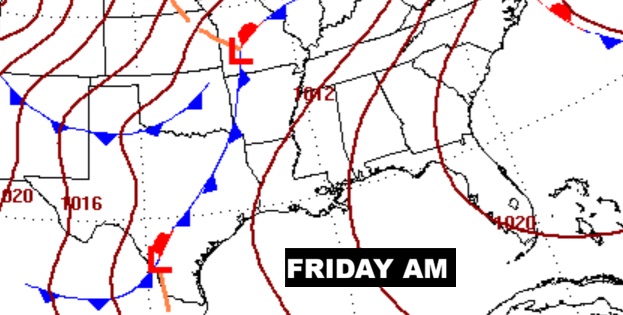
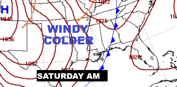
Next big weather maker. Greatest risk of showers and storms Friday night through mid-day Saturday. Some storms strong possibly severe.

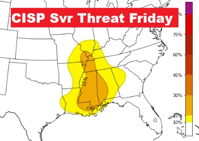
Here’s one of the Severe Weather Experimental models showing the Severe Risk starting Friday night.
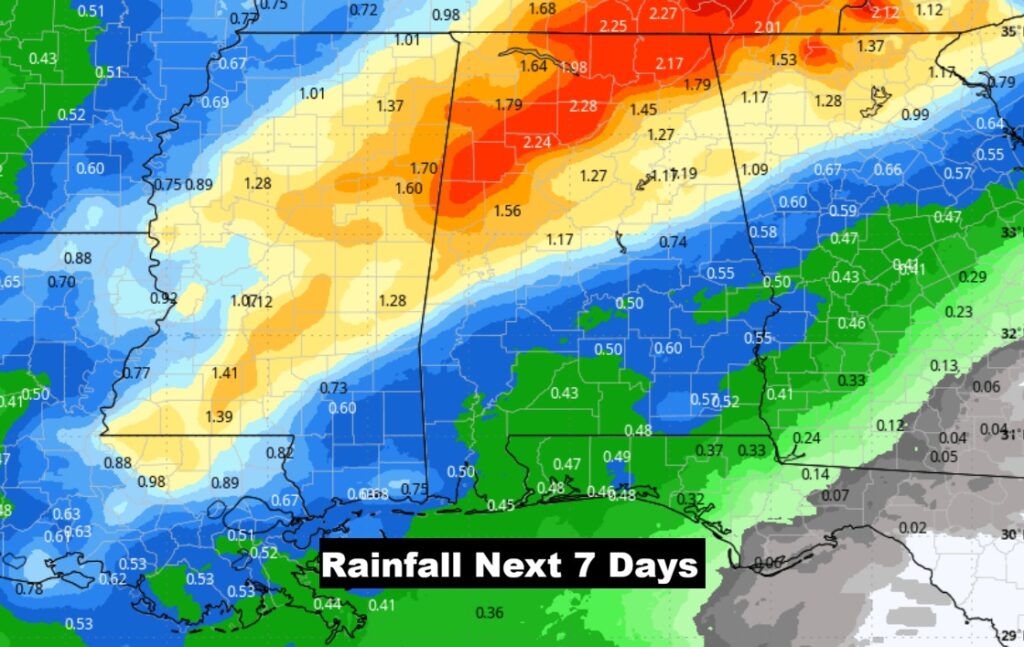
Here’s the expected rainfall next 7 days.
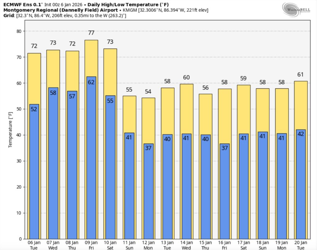
Here’s the model blend 10 day expected rainfall outlook. Warm through Saturday with highs in the 70’s. Then, a big drop. An extended period of much cooler air will follow.
Here’s a peak at the EURO 16 day Ensemble outlook. Winter air will return.
Thanks for reading this Blog this morning. This morning we are LIVE on the radio from 6 to 9 on NewsTalk 93.1. I’ll have another update for you in the 4 o’clock hour tomorrow morning. Have a nice day.
–Rich