
Good Morning! Arctic air has retreated. Mild air has returned. An approaching frontal system will brig scattered showers this afternoon. Showers and storms are likely tonight and first half of the day Saturday. Expect improvement Saturday afternoon and night. Sunday looks dry. Next week looks quite mild and storm-free.
TODAY: Mostly cloudy. Mild. High 67-70.. Risk of showers by afternoon. Showers and storms tonight. (and first half of the day Saturday) Low 58.
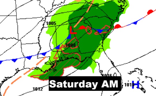
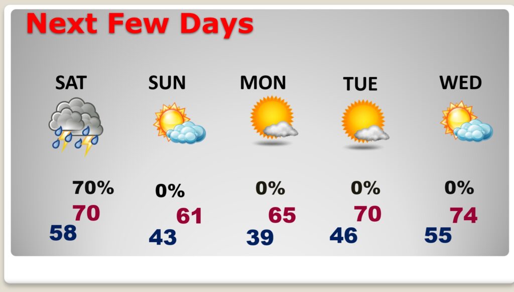
SATURDAY: Scattered showers and storms first half of the day. Afternoon improvement. High 68. Cooler Saturday night. Low 43.
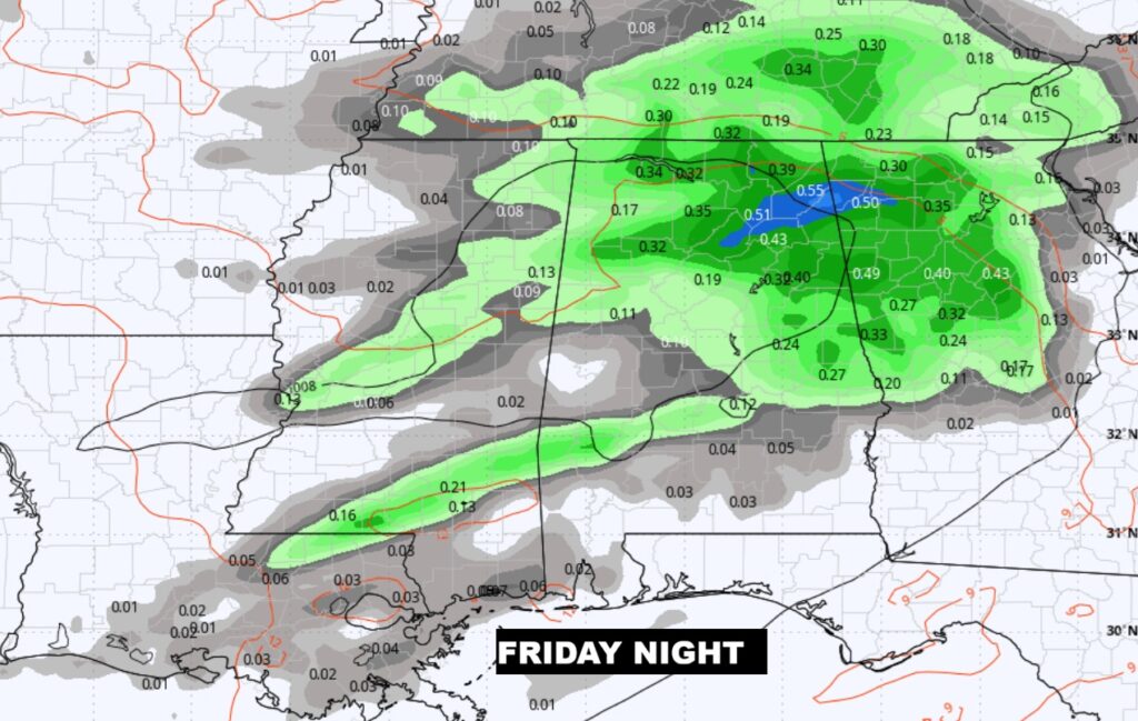
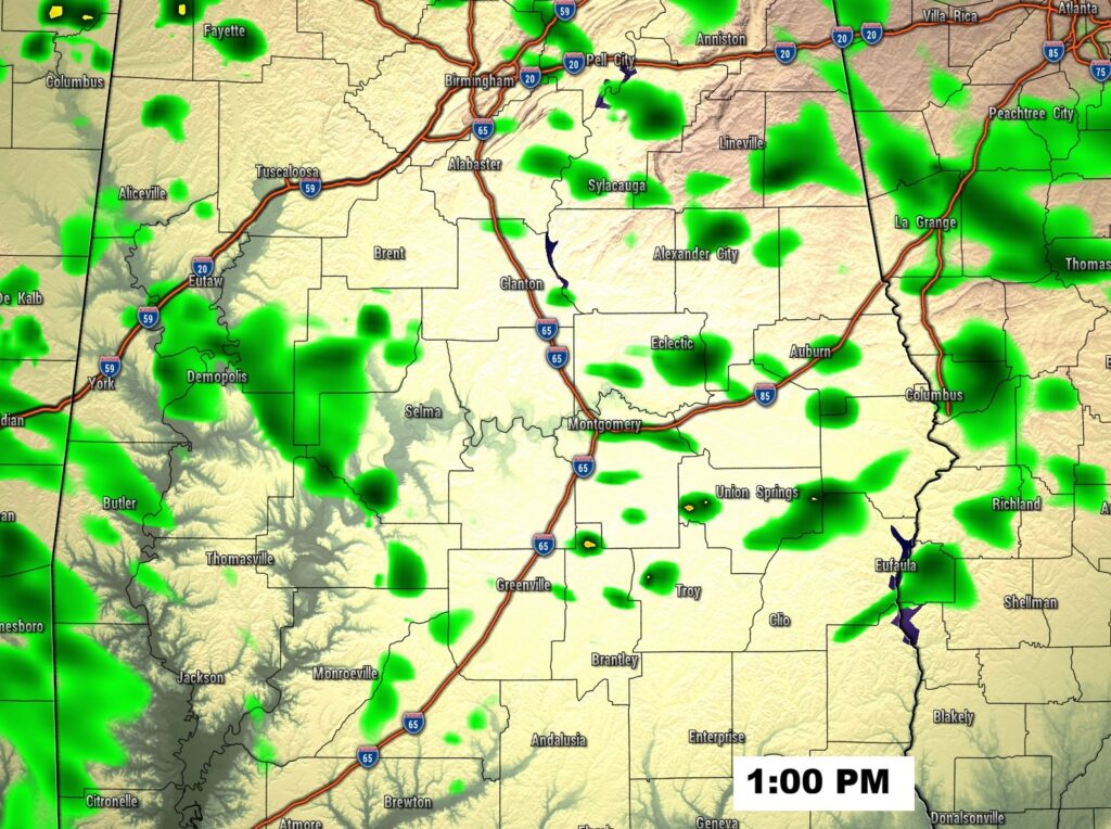
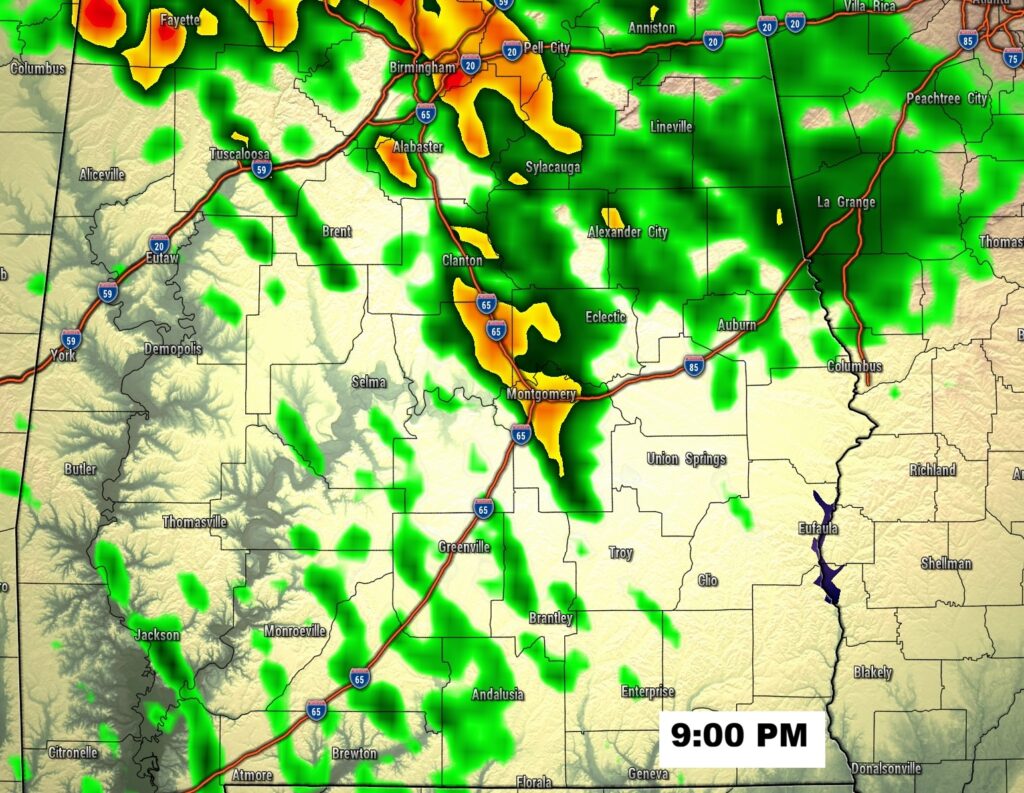
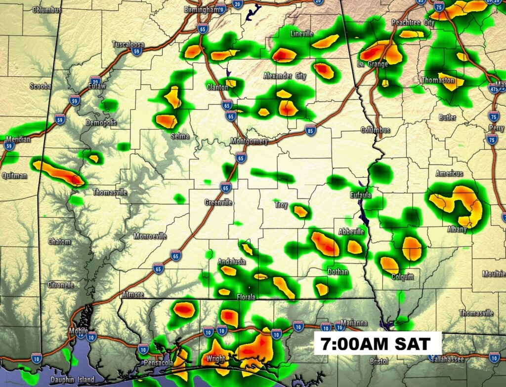
FUTURE RADAR: Risk of showers this afternoon., Showers and thunderstorms tonight.
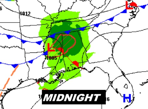
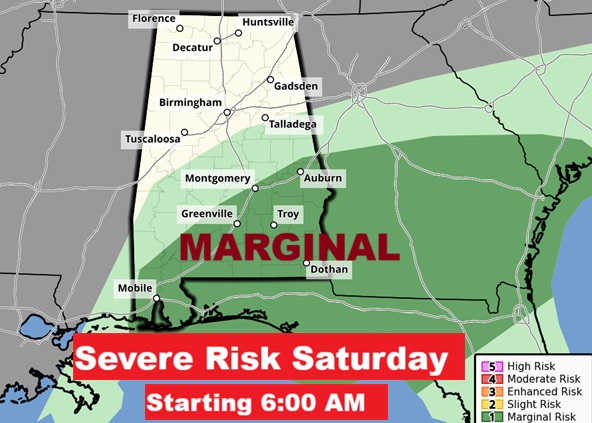
MARGINAL SEVERE RISK: Level 1 Marginal Severe Risk begins at 6AM Saturday and covers all of SE Alabama. Damaging wind gusts are the main risk. A brief tornado or two can’t be ruled out.
NEXT FEW DAYS:
Risk of showers and storms first hall of the day Saturday. Expect improvement Saturday afternoon and night. Sunday looks dry. Next week looks quite mild and storm-free. Highs in the 60’s will continue. Next week looks quite mild and storm-free.
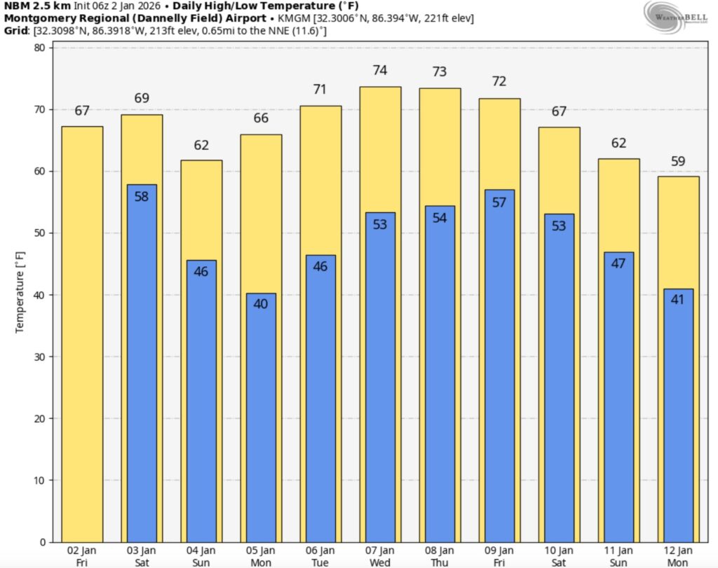
Here’s the 10 Day Model Blend Temperature Trend. There are some warmer days in our future.
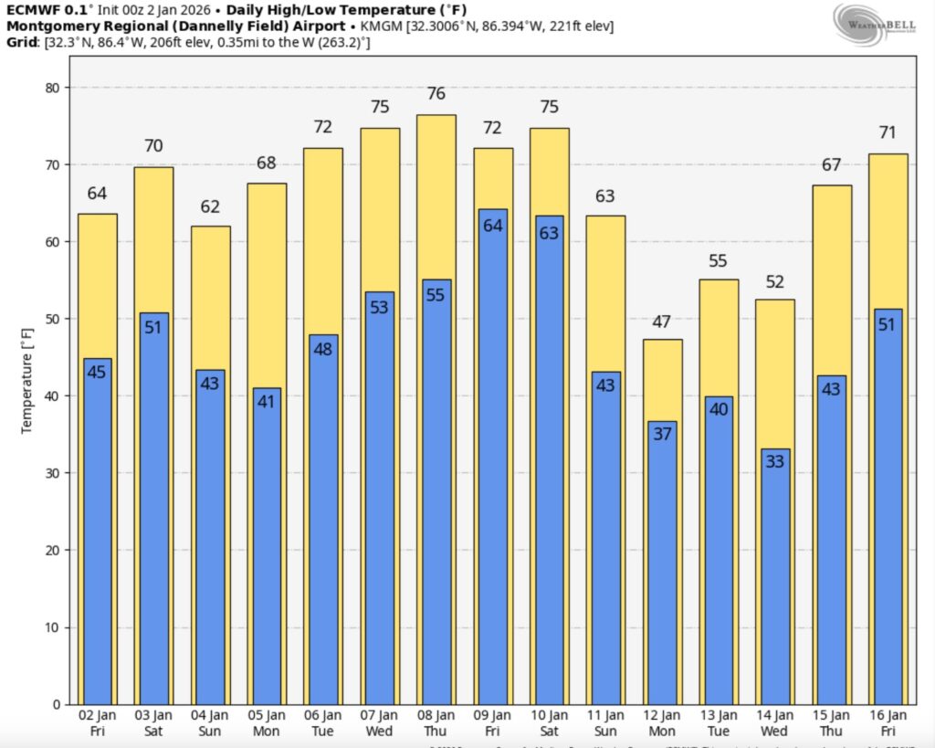
Here’s a peak at the EURO 16 day Ensemble outlook.
FULL MOON:
The full moon in January 2026, known as the Wolf Supermoon occurs on Saturday, January 3, 2026, at 4:03 a.m. EST (10:03 UTC), appearing larger and brighter than usual as it’s a supermoon. This first full moon of the year coincides with the peak of the Quadrantid meteor shower, though its brightness may make fainter meteors harder to see.
Thanks for reading this Blog this morning. I’ll have another update for you in the 4 o’clock hour tomorrow morning. Happy New Year!
–Rich