
Good Morning! Early this morning, the cold front is right on schedule. After six days in the 70’s..stand by for a big reality check as old man winter returns to the Deep south.
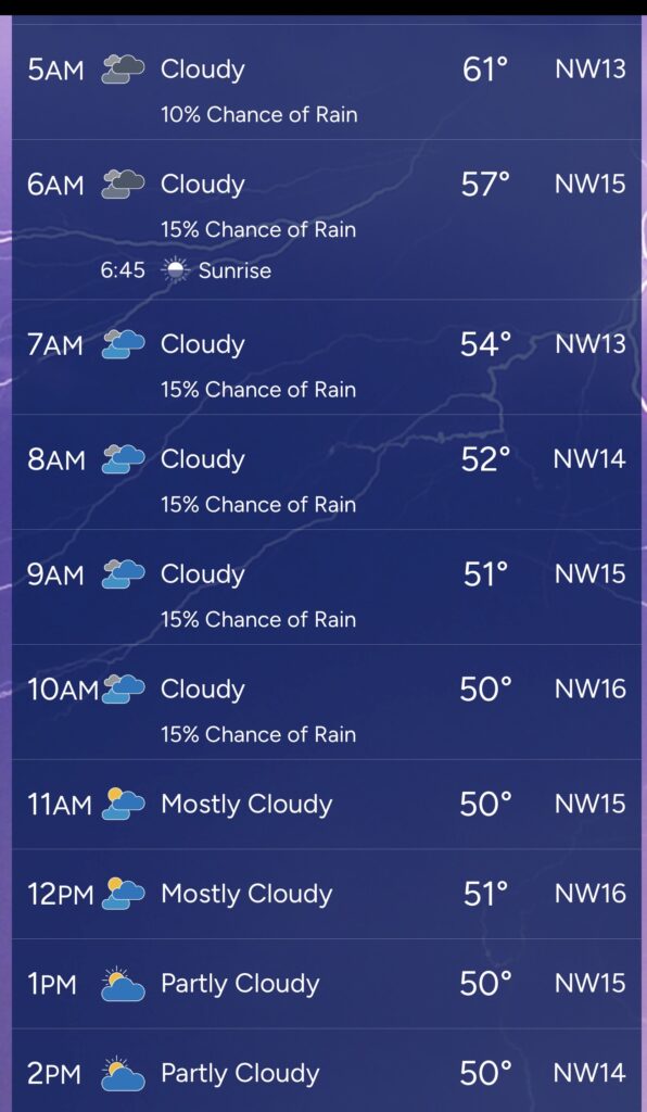
Today will be a day of falling temperatures, falling to the Mid 40’s by sunset NW wind gusting as high as 30 mph will make it seem colder.Tonight we’ll plunge to 26 with wind chill in the teens by morning. Tuesday’s high will only be in the lower 40’s. Wednesday morning looks bitterly cold in the lower 20’s. Expect a late week warm-up. Mid 60’s by Saturday. Scattered showers return Friday and Saturday ahead of the next front.
Here’s my brief video forecast Discussion.
TODAY: Risk of leftover showers early. Windy with falling temperatures. Falling to near 44 by sunset. NW wind gusting as high as 30 mph.
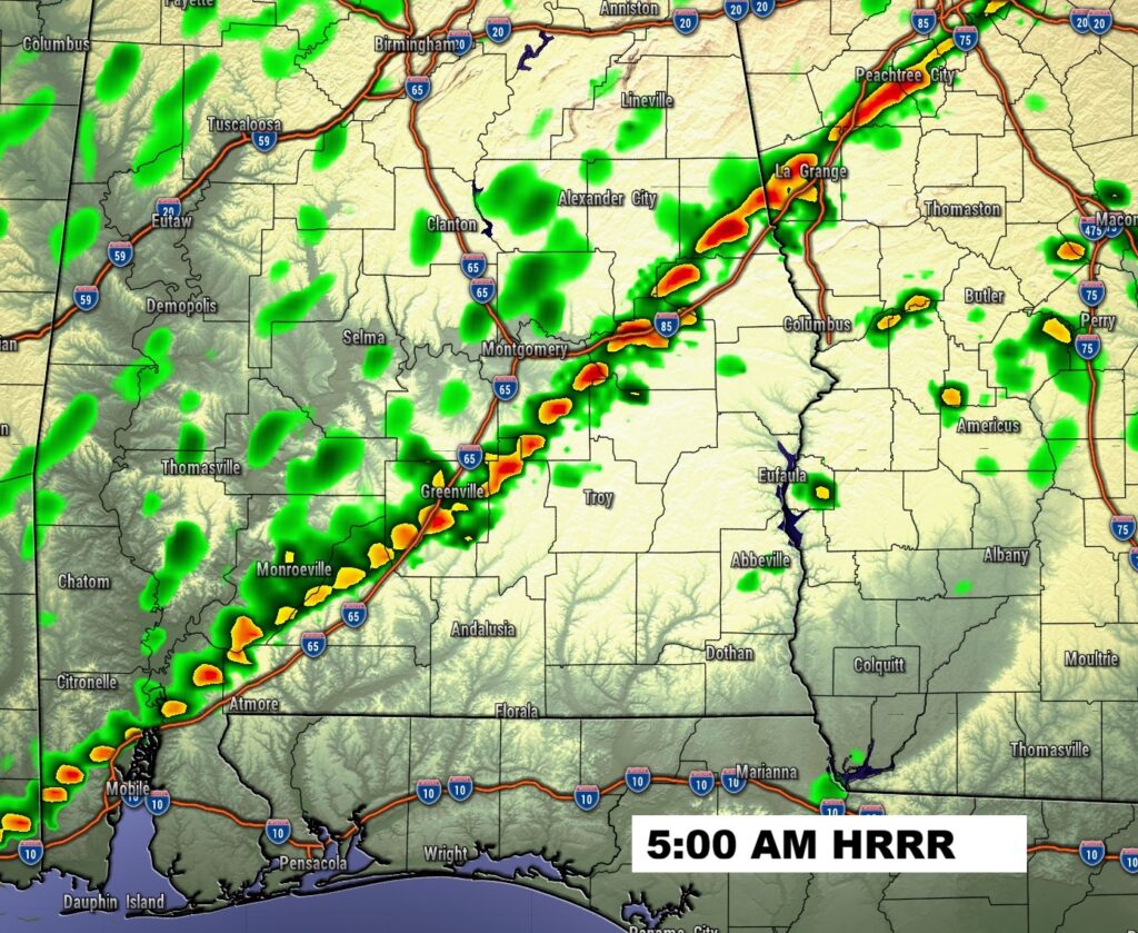
As I type this at 3:15 AM, the cold front is right on schedule – not too far from a Clanton/Selma line. The line of showers shows where the front is located.


Our Weather App documents the drop through lunchtime.
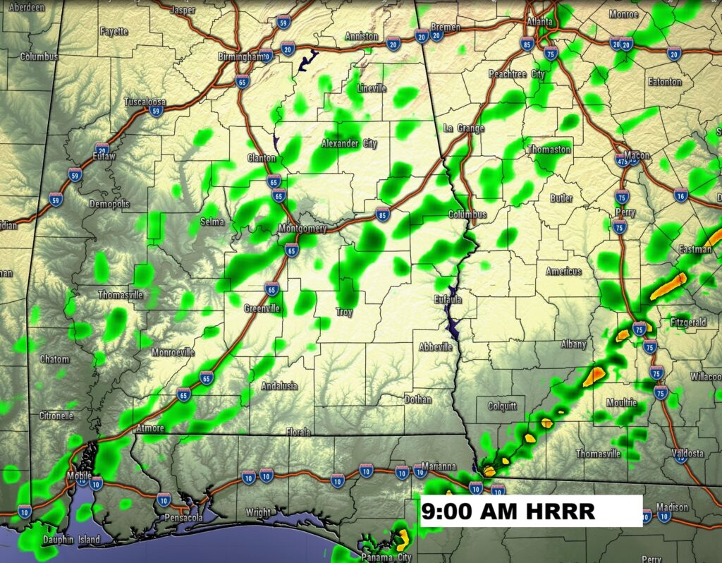
Future radar shows the line of showers racing through much of the area pre-dawn. The risk of a shower continues until mid morning.

TONIGHT: Partly cloudy windy and much colder. Low 26. NW wind gusting to 20 mph. AM wind chill factor in the teens.
Check out the expected Wind Chill tomorrow morning at Dawn. Dress in layers.

NEXT FEW DAYS: Tuesday morning wind chills could reach the mid-teens at Dawn. Tuesday’s high will only be in the lower 40’s. Wednesday morning looks very cold. Lower 20’s. Expect a late week warm-up. Expect mid 60’s by Saturday. Scattered showers return Friday and Saturday ahead of the next front.

Here’s the 10 Day Model Blend Temperature Trend.

Thanks for reading this Blog this morning. This morning we are LIVE on the radio from 6 to 9 on NewsTalk 93.1. I’ll have another update for you in the 4 o’clock hour tomorrow morning. Have a nice day.
–Rich