
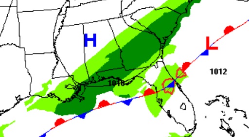
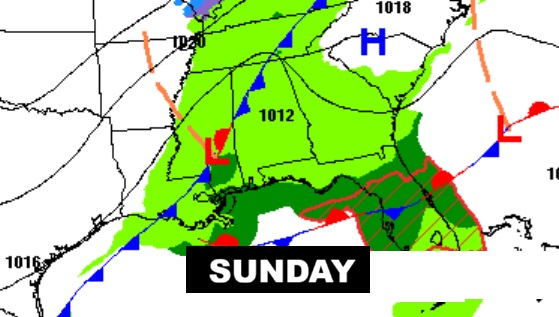
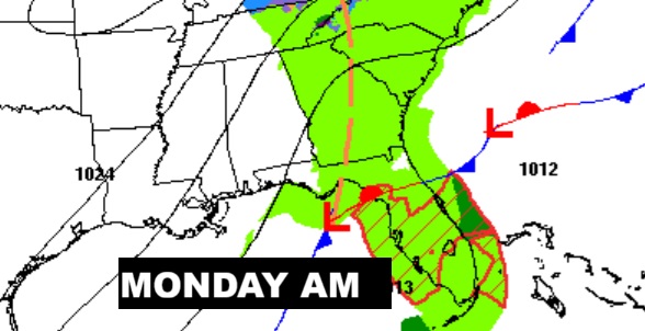
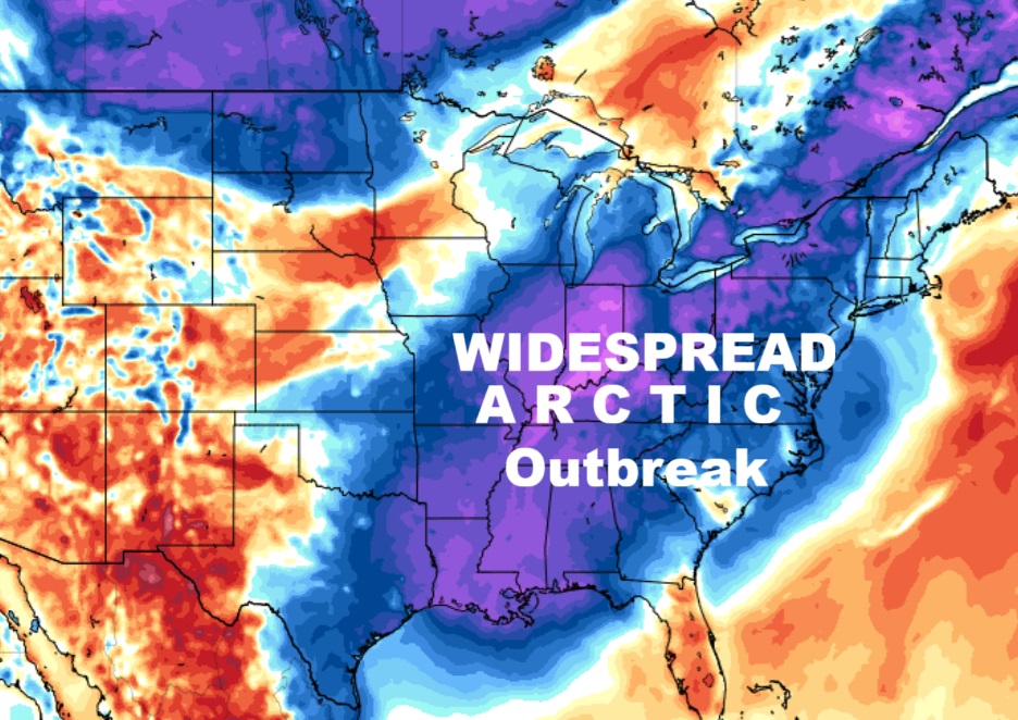
Good Morning! The latest Arctic Blast dominates the entire eastern half of our country. Meanwhile, a parade of low pressure systems, sliding eastward across the Gulf coast is keeping the threat of spotty light rain in our forecast this weekend. Montgomery had .93” Friday. The rain will be light and very spotty at times today, tonight, and through Sunday night. But, there will be many dry hours and rainfall amounts will be tiny. In the meantime, temperatures will continue way below normal. Too cold. But, there is light at the end of the tunnel. Dry, mostly sunny weather is in our future in the week ahead. And, stand by. Temperatures will be well into the 60’s mid to late week.
TODAY: Continued Chilly Spotty light rain at times today and tonight. Hi 53. (Normal 66/44) Mostly cloudy tonight. Isolated showers. Cold. Low 42.
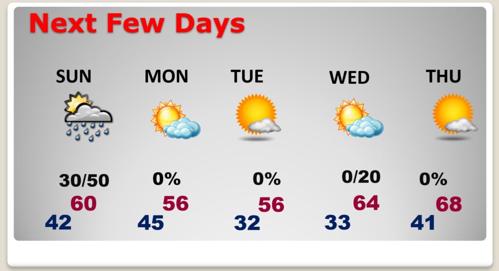
NEXT FEW DAYS: We may tease 60 by Sunday afternoon. Meanwhile, a parade of low pressure systems sliding eastward across the Gulf coast is keeping the threat of spotty light rain in our forecast. The rain will be light and very spotty at times today, tonight, and through Sunday night. But, good news. Much of the week ahead will be mostly sunny. And, we’re in for a nice temperature turn-around. The Arctic air will retreat and we’ll be in the 60’s again Wednesday through Friday.
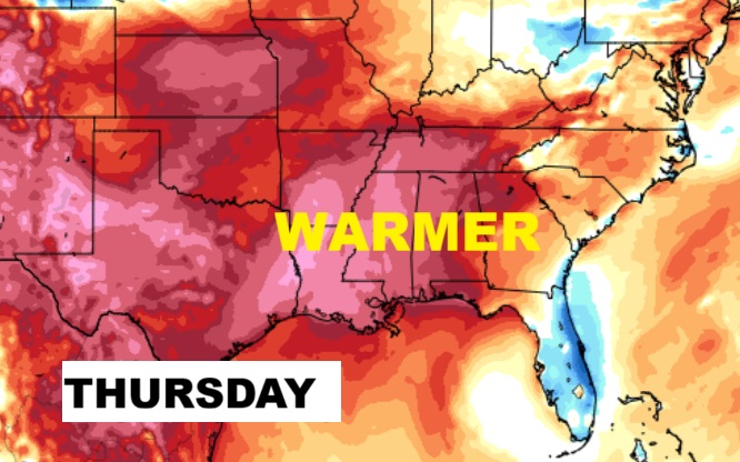
Arctic air will retreat later this week, leading to a big temperature turn-around especially late week.
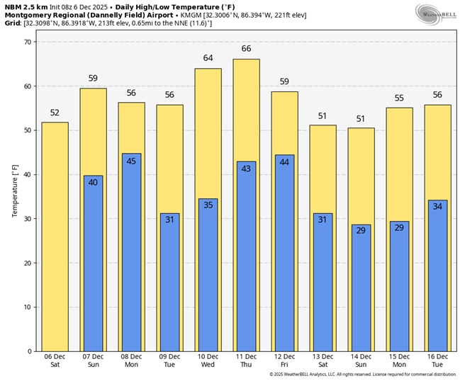
Herse’s the 10 day model blend temperature trend. Look at those much nicer late week numbers.
Thanks for reading this Blog this morning. The next scheduled complete Blog update and Video Forecast Discussion is scheduled for the 4 o’clock hour on Monday morning. Have a great weekend.
-Rich