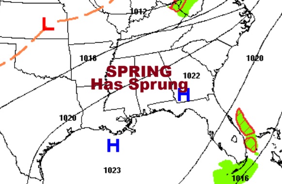
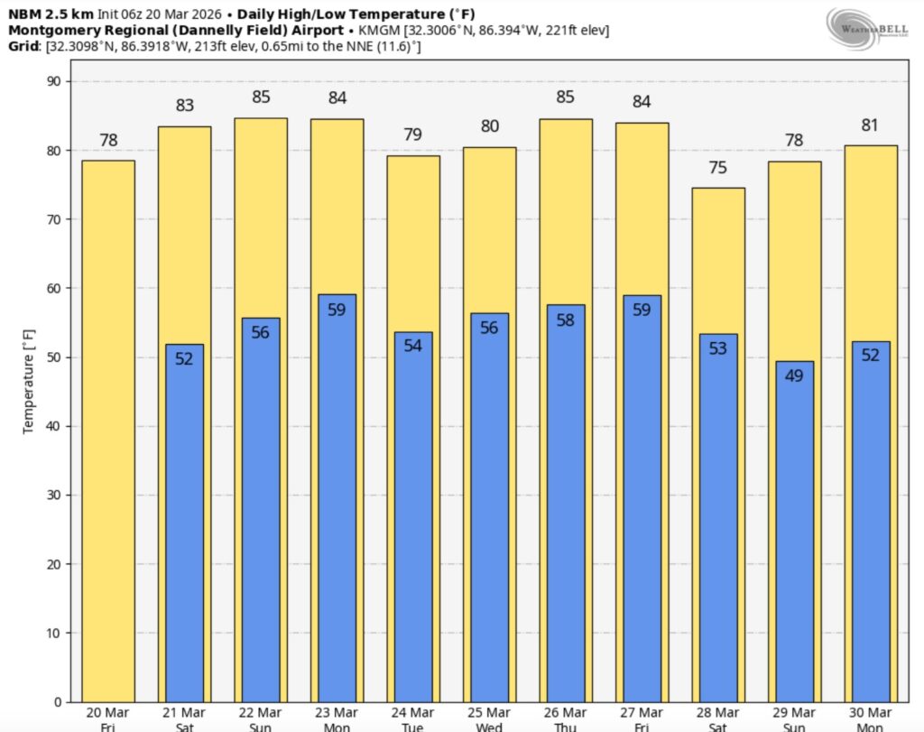
Good morning! Spring Begins this morning at 9:46 AM. It will be a nearly perfect first day of Spring – with a high in the upper 70’s. (Normal 73/47) Nights are moderating as well. Lows in the 50’s. A massive ridge of High pressure in the west is spreading eastward. Highs this weekend will make it into the 80’s. That kind warmth will extend well through next week –80’s daytime 60’s at night. It looks like a dry/storm-free pattern for the next several days – as the Drought expands and grows worse. Here’s my brief video forecast discussion.
TODAY: Mostly sunny . High 78. Light wind.
(Normal 73/47)
TONIGHT: Mostly clear. Low 52
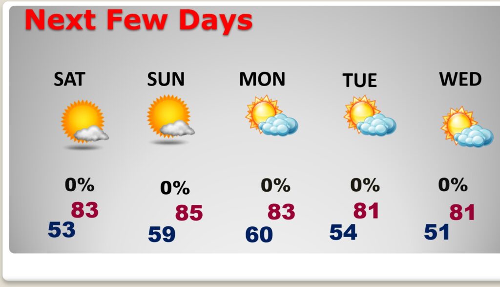
NEXT FEW DAYS: Highs this weekend will make it into the 80’s. That kind warmth will extend well through next week –80’s daytime 60’s at night. It looks like a dry/storm-free pattern for the next several days.
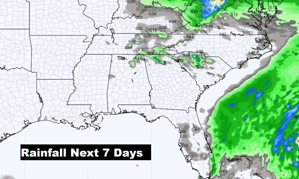
The 7 day rainfall outlook. Not a drop.
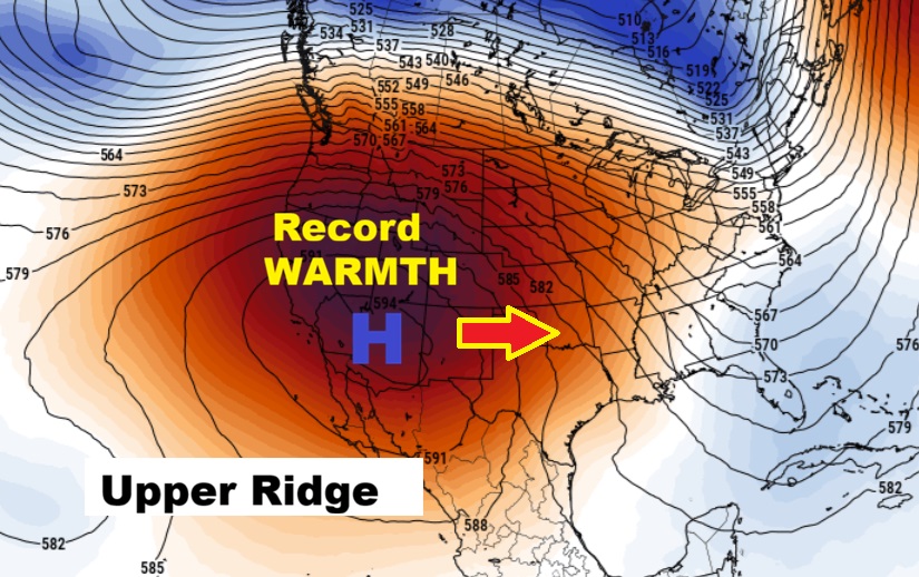
A massive Ridge of Upper Level High Pressure is promoting Extreme Heat in the southwest with All time Record highs for this early in the United States. The warmth is spreading eastward.
The 10 Day model Blend Temperature Trend. A very warm pattern.
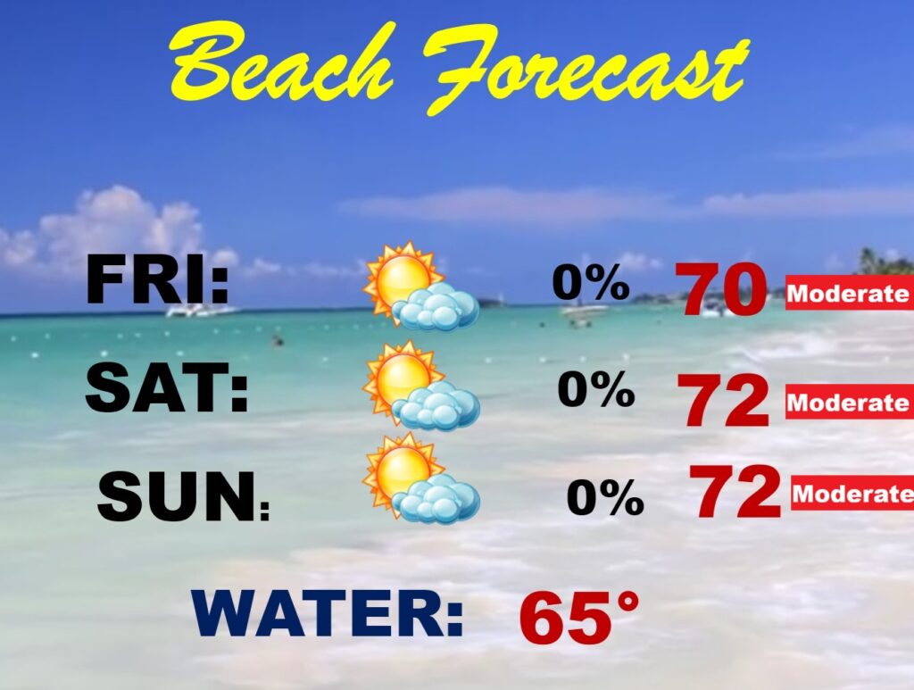
BEACH FORECAST: Spring breakers are happy. It’s a nice pattern. Moderate rip current risk.
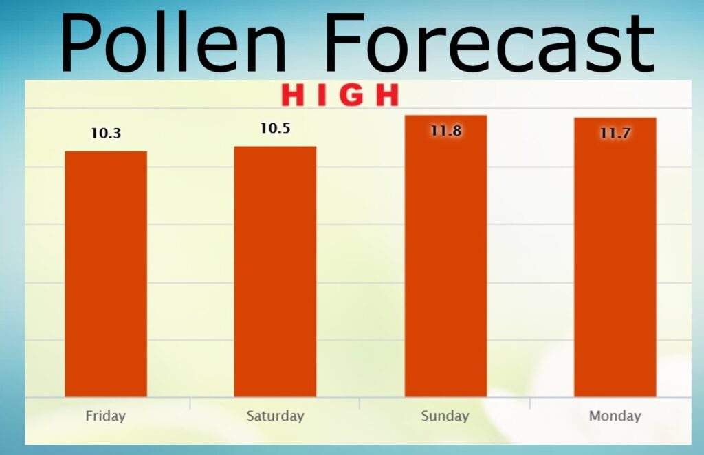
POLLEN FORECAST: High range on the pollen over the weekend and beyond.
Spring officially begins this morning. The equinox is at 9:46 AM CDT.

Thanks for reading this Blog this morning. This morning we are LIVE on the radio from 6 to 9 on NewsTalk 93.1. I’ll have another update for you in the 4 o’clock hour tomorrow morning. Have a nice day.
–Rich
