
Good Morning! An approaching cold front will bring round of showers and maybe a few thunderstorms today and tonight. We’re headed for the mid 60’s today. (Normal 62/39) No severe weather is expected. Friday will be breezy and much cooler behind the front. Saturday will be dry. More isolated showers are possible Sunday. The weekend looks mild with highs mostly in the 60’s. Christmas Week appears quite mild. We will likely be 70 or above on Christmas Day. Right now, Christmas week looks dry. Here’s my brief video forecast discussion .
TODAY: Periods of rain and maybe a few thunderstorms today and tonight. High 65. Low Thursday night 43.


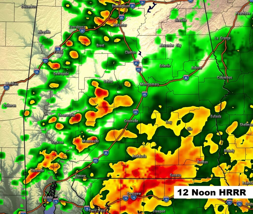
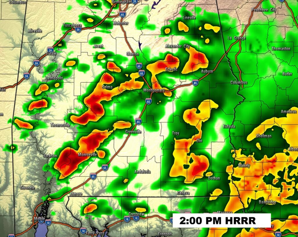
FUTURE RADAR: Periods of showers and storms today and tonight. The 9:00PM Snapshot shows the line of storms along the cold front.

Here’s the expected rainfall from the EURO model.

NEXT FEW DAYS:
Friday will be breezy and much cooler behind the front. Saturday will be dry. More isolated showers are possible Sunday. The weekend looks mild with highs mostly in the 60’s. Christmas Week appears quite mild. We will likely be 70 or above on Christmas Day. Right now, Christmas week looks dry..

The 10 Day model blend temperature trend. The Arctic Flood gates are closed. Christmas week looks very comfortable indeed.

Here’s the 16 day from the EURO model.
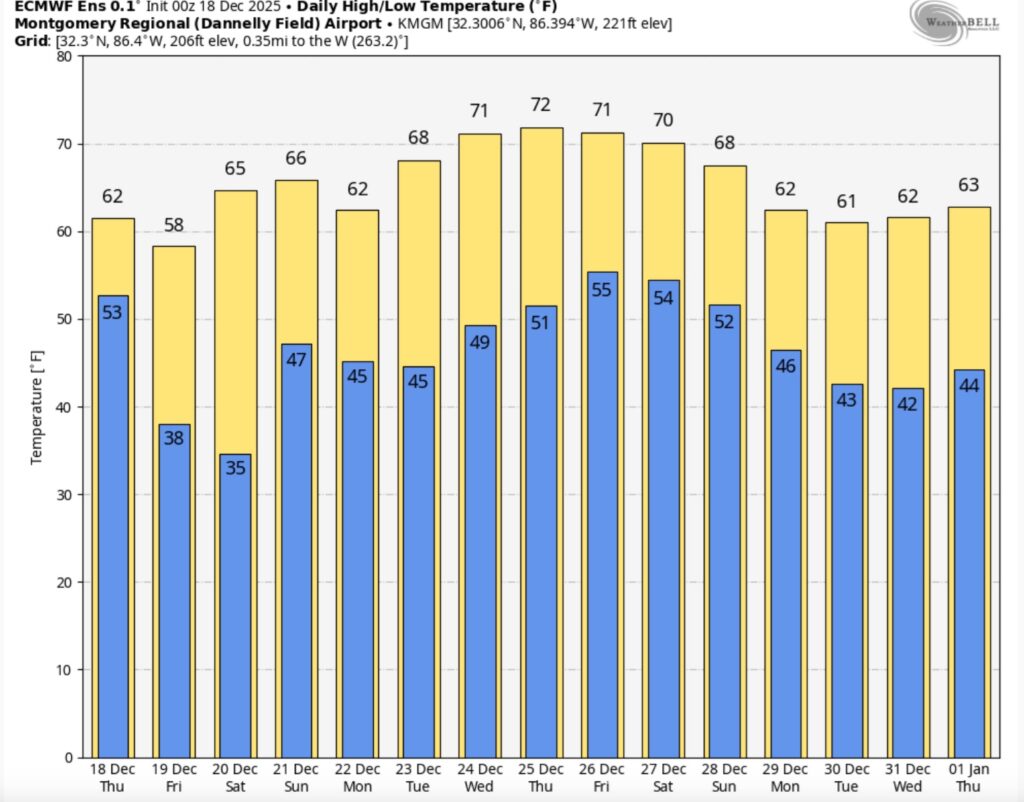
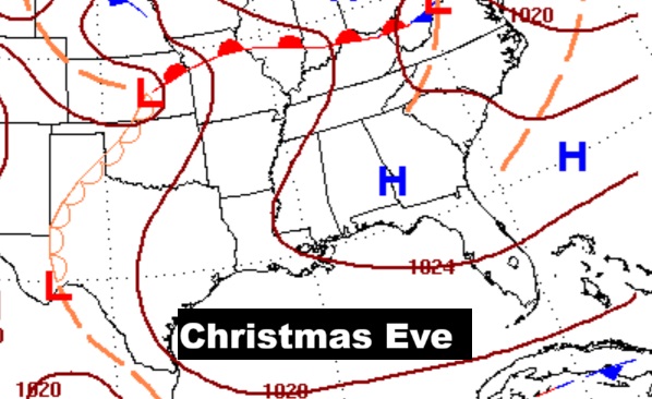
CHRISTMAS FORECAST?: Christmas Week appears quite mild. Most days will be at least ibn the 60’s. We will likely be 70 or above on Christmas Day.


Normal hi/lo on Christmas Day would be 60/38.
As far as the Christmas Day numbers – the Euro Model projects 51/72 The GFS projects 55/71. The Canadian (CMC) has 52/77. The Model Blend has 54/72. All the models have us storm-free and dry.

Christmas Day Records: 82 in 2016 – and 5 in 1983.
Thanks for reading this Blog this morning. This morning we are LIVE on the radio from 6 to 9 on NewsTalk 93.1. I’ll have another update for you in the 4 o’clock hour tomorrow morning. Have a nice day.
–Rich