
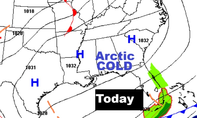
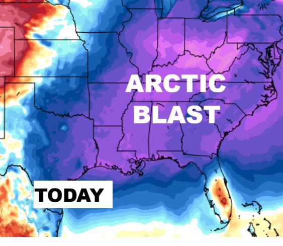
Good Morning! Arctic Blast. It’s an extremely cold Monday morning, with lower 20’s and wind chill in the lower teens. Dress in layers. Expected highs today may only reach the low to mid 40’s, and once again tonight we are headed for the lower 20’s. But, this Arctic Cold will not linger long. A major temperature turnaround will have highs soaring to near 70 by Thursday. Scattered showers will proceed a cold front. Also, on this Blog, I’ll tell you about a significant, remarkable Christmas week spring-like warm-up. Here’s my brief video forecast discussion .
TODAY: Sunny and cold. Hi low to mid 40’s. Not as windy. NW wind 6 to 12 mph. Clear and frigid again tonight. Low 22.
NEXT FEW DAYS:
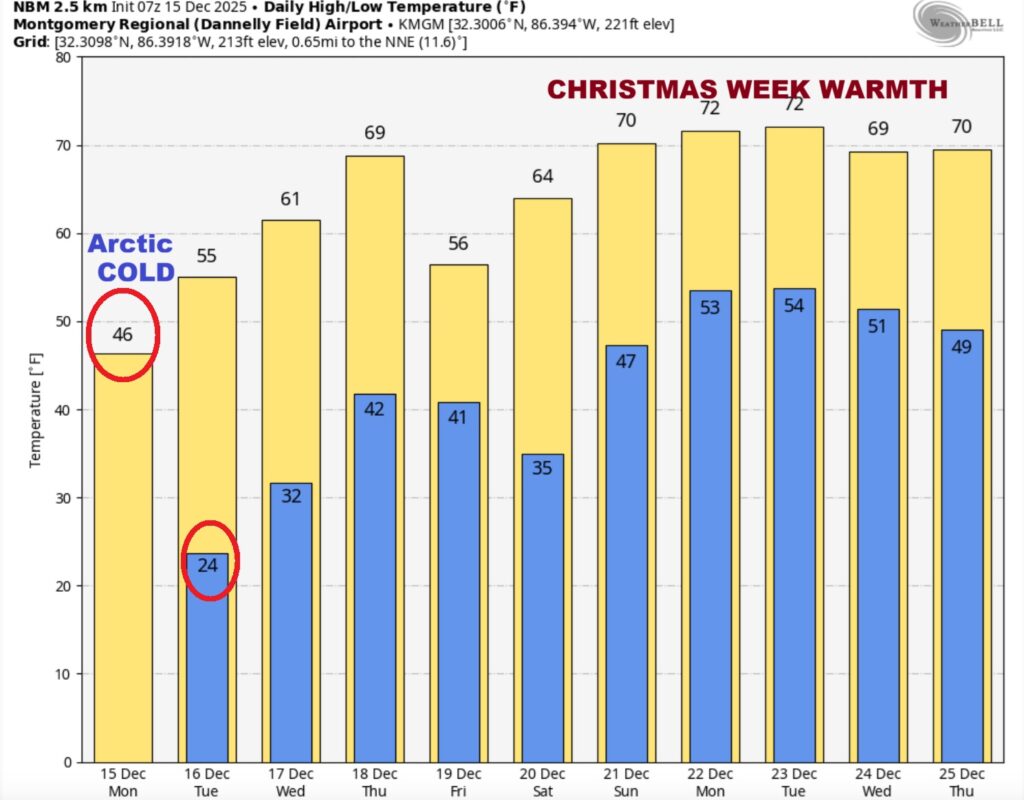
Look for a major recovery to near 70 by next Thursday. The Arctic Cold will not linger long. We’ll be back in the 50’s on Tuesday, the 60’s Wednesday and soaring to near 70 Thursday. Scattered showers will precede a cold front.

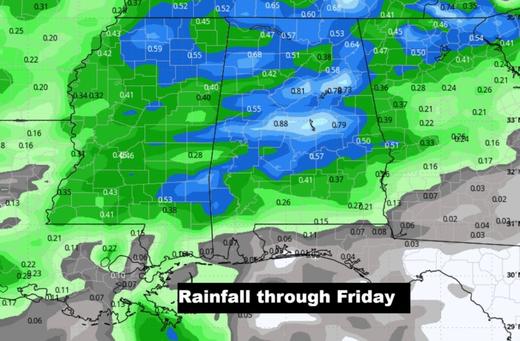
Here’s the expected rainfall map. Showers Thursday and especially Thursday night ahead of a cold front.
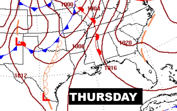
Besides all the wild temperature swings- some of the models are hinting at some potential strong/severe storms on Day 4 – Thursday. ALSO, Christmas Week Dec 20-23 is suspect. “Tis the season for sever weather.

The 10 Day model blend temperature trend. Expect a major warm up this week. And, take a look at Christmas Week.
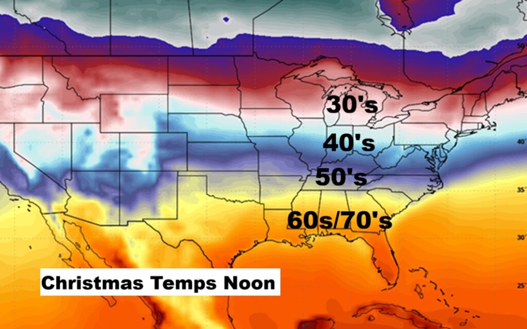
Here’s the 16 day from the Euro model. Shorts and teeshirts Christmas week?

CHRISTMAS FORECAST?: Some of you won’t like this. But, ALL the Global models are indicating a very mild/warm, comfortable Christmas week temperatures.
Normal hi/lo on Christmas Day would be 60/38.

As far as the Christmas Day numbers – the Euro Model projects 52/71 The GFS projects 58/73. The Canadian has 52/73. The Model Blend has 49/70. All the models have us storm-free and dry. So, could Christmas be amazingly mild? Looks storm-free with a sun/cloud mix.
Christmas Day Records: 82 in 2016 – and 5 in 1983.
My dog CHASE- content, enjoying the fire on this Arctic Cold December Monday morning.

Thanks for reading this Blog this morning. This morning we are LIVE on the radio from 6 to 9 on NewsTalk 93.1. I’ll have another update for you in the 4 o’clock hour tomorrow morning. Stay warm! Have a nice day.
–Rich