
For many of you, this is the coldest morning since last February. Here’s a sample of the Lows around Dawn: Prattville and Troy 24, Evergreen 26, Montgomery, Auburn and Greenville 27, Ozark 29 and Andalusia/Opp 32. It will be a chilly Saturday. Dress warm for the area Christmas festivities, like Christmas on the Coosa. The parade starts at 2 in Wetumpka. Today’s high will barely reach 51. We’re headed for another freeze tonight. The low by dawn Sunday will be 32.
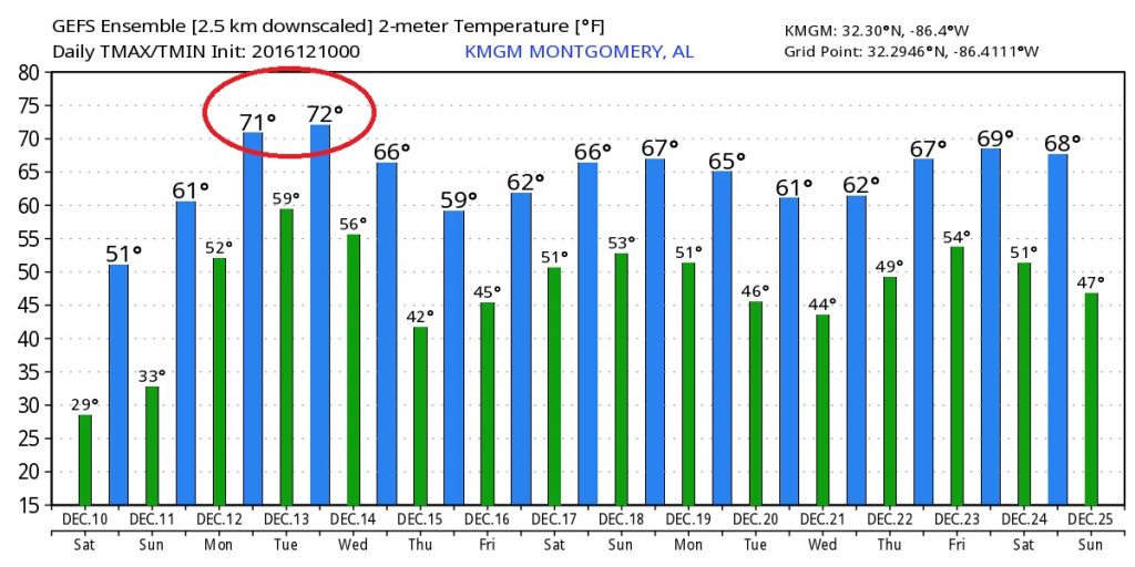
AMAZING QUICK TURNAROUND: If you don’t like the cold, hang on. The arctic air retreats quickly. Temperatures will skyrocket. We’ll be near 60 Sunday and near 70 Monday. In fact temperatures Monday through Wednesday will be downright springlike, before a late week cool down.
16 DAY TEMPERATURE TREND: This is raw model data for temperatures from now until Christmas Day. Remember, when you look at this. Don’t focus on the specific numbers. We’re looking merely at trends. The trends show the remarkable warm up, Sunday – Wednesday. Then cooler toward the end of the week. Notice : there are many ups and downs between now and Christmas, but I don’t see any frigid outbreaks at this point. This is the American long-range global model – GFS.
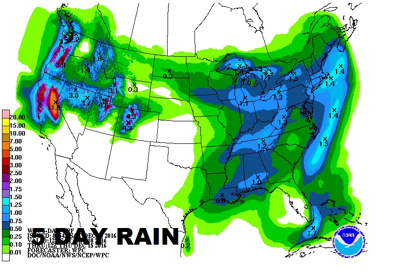
RAIN WILL RETURN: Scattered showers and maybe even some thunderstorms are back on the weather menu Monday through Wednesday, from time to time, as a series of impulses rotate through the area. Rainfall amounts won’t be excessive, but total rainfall for some of us could total 1”+.
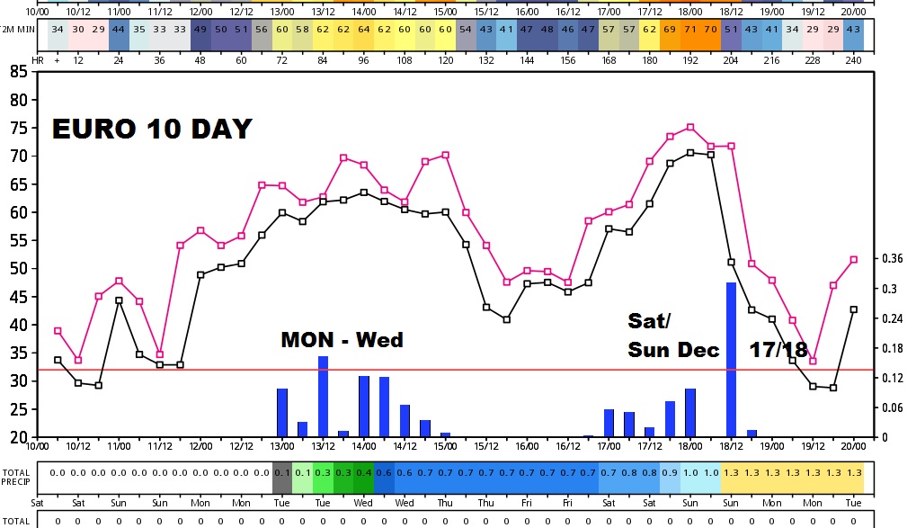
Take a look at this European model update showing the next 10 days. Look at the blue bars on the bottom, indicating rainfall. We will have showers around Monday-Wednesday, and apparently more the following weekend Dec 17/18.
Have a great weekend! Stay warm. No video today. Yourbnext scheduled complete video briefing will be online by 5AM Monday, but there will be blog posts as needed. –Rich