
Crazy, dramatic changes are on the weather menu this weekend. We’ll be in the 70’s today, on Camellia Bowl Saturday. Sunday will become, windy and wet with plunging temperatures. Parts of west and NW Alabama could even see some severe weather. Extreme north Alabama could briefly see some freezing precipitation Sunday.
SATURDAY DETAILS: For most of us today will be a mostly cloudy day. I can’t rule out a few sunbreaks. Temperatures will be amazing. We are headed for the mid 70’s in central Alabama and upper 70’s in the southeast. Could be a few spring-like brief, spotty showers. Rain chances 20%. Tailgating for the Camellia Bowl should be comfortable. Kickoff temp. at 4:30 should be 72°. Upper 60’s by the end of the game.
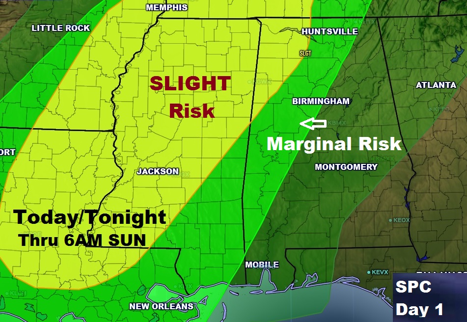
TONIGHT: Most of us here in central and southeast Alabama will stay storm free until about Dawn. But, strong storms in the NW counties could become severe with the threat of damaging winds. A brief spin up tornado or 2 is also possible. Latest severe weather outlook from SPC keeps the marginal severe weather risk generally west of a Birmingham, Selma line, through Dawn tomorrow morning.
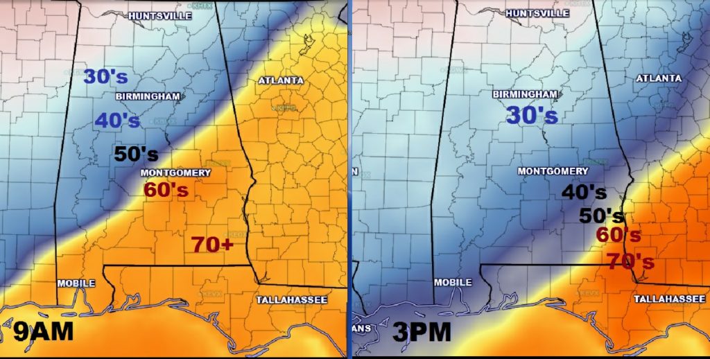
DRAMATIC SUNDAY: A strong arctic front will stab southward during the day. Showers and thunderstorms will move into central Alabama around dawn and spread southeast during the day. A lot of the rain will fall in the colder air behind the front as the temperatures plunge from 60’s in the morning to the 40’s in the afternoon. Northwest winds at 15 to 25 mph will make it seem colder. The temperature maps tell a dramatic story.
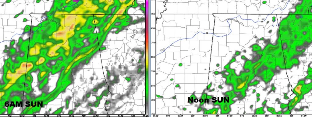
Here’s a couple of Future Radar snapshots at 6AM & Noon Sunday.
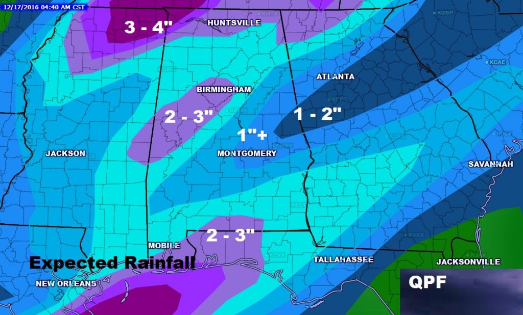
HOW MUCH RAIN?: Many of us will be in the 1 to 2” rainfall category. A few lucky towns will get more across the south and north central counties.
CHRISTMAS WEEK: Looks like I’m going to have to hang on to at least a small chance of spotty showers, here and there Monday through Wednesday…20/30%. Most highs in the 50’s. Rain chances may trend a little higher on Thursdays, as a front moves through. You can get the day to day details on our weather app’s 10 day forecast.
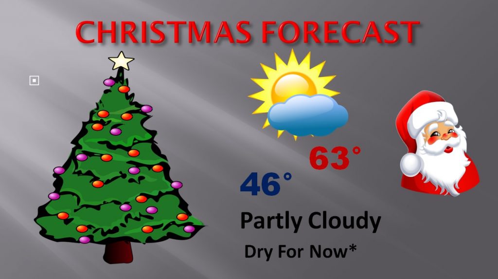
CHRISTMAS DAY: Right now I have Christmas Day dry. BUT, not every model agrees with that. The US GFS model has us wet. I like the Euro model which has us dry. Temperatures will not be too cold or too warm. Here’s my forecast which will be adjusted with time.
DOWNLOAD OUR WEATHER APP: You can stay on top with all these dramatic weather changes on our new weather app which is FREE in the App store. Get all my videos and blog posts, plus 10 day forecast, hourly forecasts, radar and future radar, push alerts for all watches and warnings, and MORE. It’s the only weather app you need on your phone or tablet. Search Rich Thomas Weather Network in the app store. Pass the word to your friends.
Have a nice weekend!