
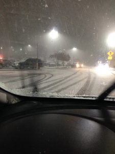
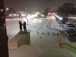
NOWCAST: Heavy snow has been blanketing the Tuscaloosa and Birmingham area through the evening, causing a rash of serious accidents. But, aside from traffic problems, it looks like a winter wonderland. Here’s a couple of snapshots from the Tuscaloosa area.
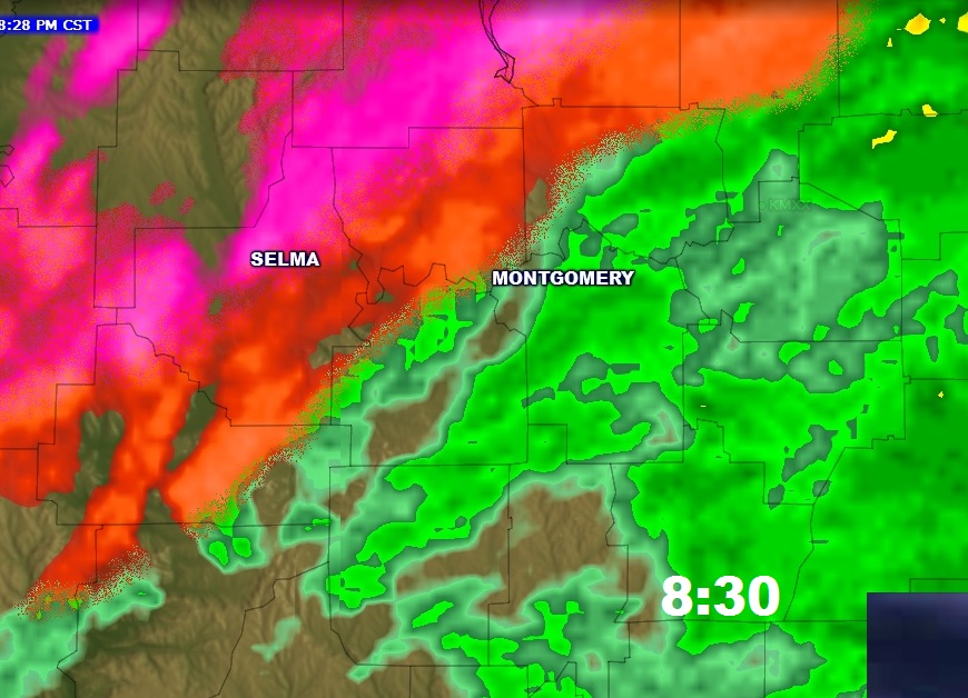
While snow is falling north, mostly a Wintry Mix, made up largely of Sleet continues to invade central Alabama. The temperature at the Prattville airport is now 32 as of 8PM. The freeze line will reach Montgomery within an hour or so, heading southeastward. Travel will quickly become treacherous, as the rain becomes mixed with and then eventually changes to a Wintry Mix, mostly sleet. Rainfall has been rather heavy today. Well over an inch has been reported at the Montgomery airport. East Montgomery 1.46. Overnight, some wet streets and roads will freeze, making travel almost impossible.
ELMORE AND AUTAUGA, CHILTON & COOSA COUNTIES: The EMA in these counties have issued an Impassable Travel Advisory for all roads in their counties from now until Saturday morning. Stay off the roads if you can. Travel reserved for emergency vehicles.
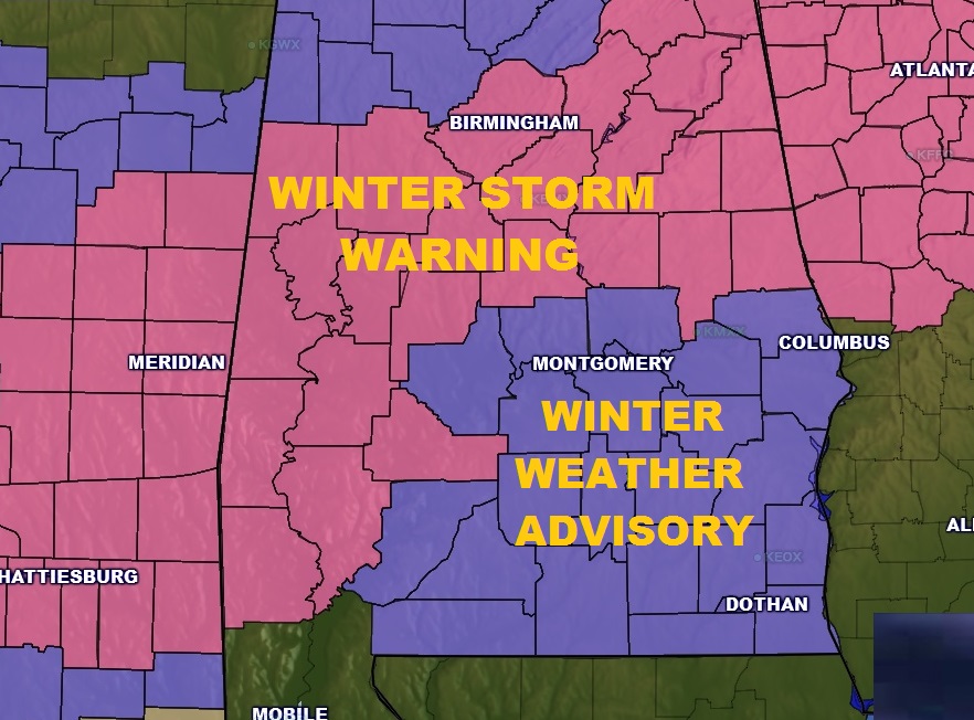
UPDATED ADVISORY & WARNING MAP: Winter Weather Advisory for central and now southeast Alabama, too, and Winter storm Warning farther north starting in Chilton, Coosa, Tallapoosa and Chambers. No change from earlier this afternoon.
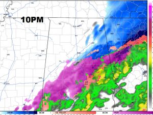
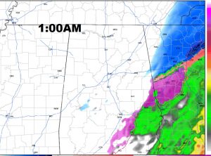
FUTURE RADAR: Shows the freeze line right over Montgomery at 10PM. Concentrated Wintry Mix covering all of central AL. Mostly snow in NE Alabama. By 1:00AM, the back end of the mixed precip is east of the I-65 corridor, exiting eastward toward the Georgia border.
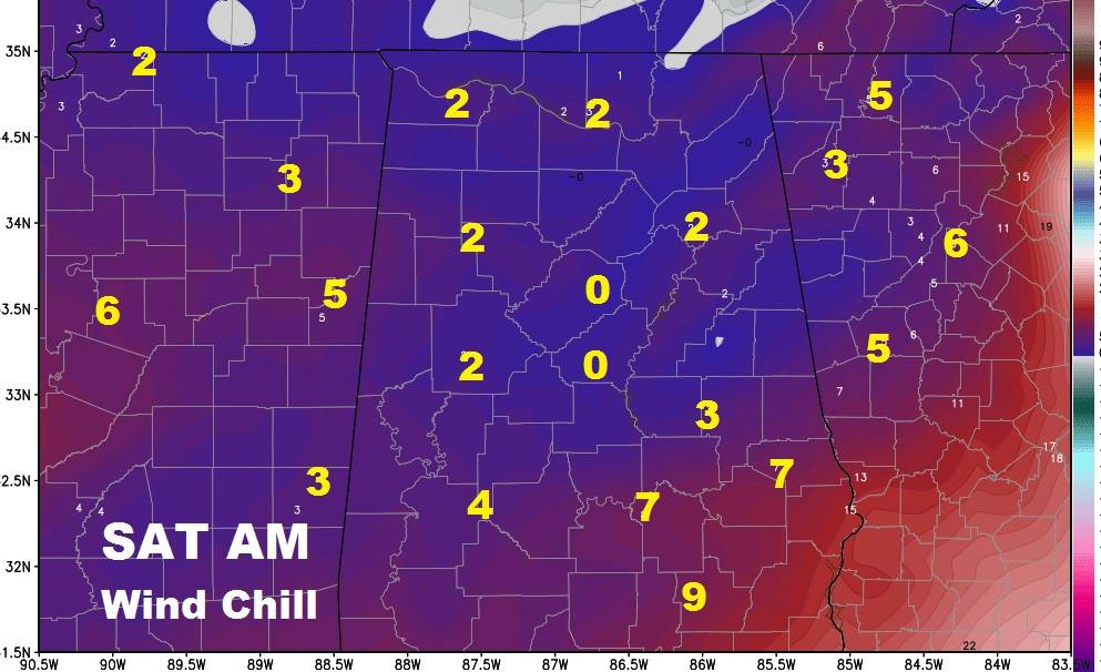
MONTGOMERY AREA FORECAST DETAILS: Winter Weather Advisory until Saturday AM. Rain mixes with sleet. Could mix with some freezing rain after 10.. Then, after Midnight a sleet/snow mix, before ending. Little or no snow/sleet accumulation, but ice accumulation of up to .10 possible. Low by Saturday morning 25. (wind chill single digits) High Saturday 36 with Clearing skies. Low by Sunday morning 21, wind chill factor 10-12°. High Sunday 41.
Check out these projected brutal wind chill numbers for 6AM Saturday Morning!
STAY OFF THE ROADS: Be careful! Stay off the roads if you can! Travel will become very difficult tonight! –Rich