
FRIGID: On this bitter cold Sunday morning, we’re waking up to the coldest temperatures of the season so far. Most morning lows are in the upper teens to near 20, wind chill readings are mostly around 10 around dawn.
Sample of a few morning lows: Montgomery 21, Maxwell AFB 20. Troy, Alex City, Greenville 19. Prattville 18. Auburn is a little colder with 16, and a wind chill of 4.
TODAY: Sunny and cold. NW wind 6-12 mph. High near 40. Low tonight 23.
MONDAY: Sunshine, not as cold. High 49. Low Monday night at 32.
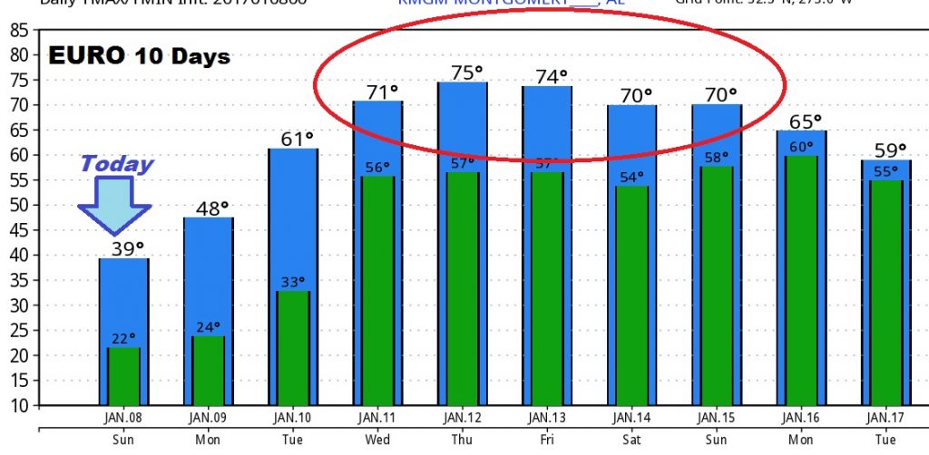
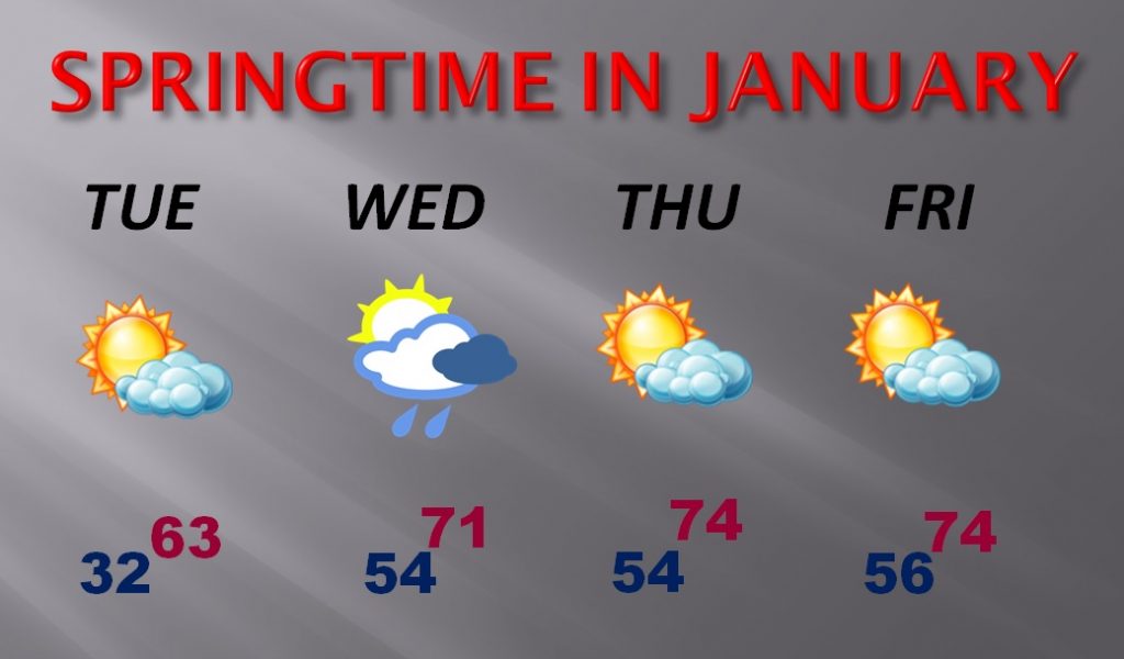
WEEK AHEAD – RAPID WARMING: An amazing warm-up is on tap for the week ahead as Spring-like warmth quickly replaces the winter cold. Highs will surge into the 70’s by Wednesday into the weekend. Lows at night will recover to the 50’s Spotty showers are possible Wednesday, but much of the week ahead will be dry. Here’s a peek at the amazing warm-up on the 10 day Euro model.
Here’s my forecast for the week ahead:
Stay warm! Be ready for another frigid night tonight. My next video will be online tomorrow morning by 5. We’ll look ahead to the next 2 weeks and beyond. Have a great Sunday. -Rich