
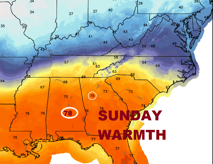
While an epic ice storm continues over America’s heartland, we are still basking in record-warmth. If we reach 78° in Montgomery today, we will have tied or broken a record 4 days in a row. He had 79° yesterday, 81 Friday and 80 Thursday. And, the warmth will continue for a few more days. Meanwhile, Showers and thunderstorms return this week and rainfall amounts could be impressive by the end of the week.
TODAY (Sunday): Patches of dense AM fog, give way to a mostly sunny, very warm day. High 78°. (Record 78 – 1950)
MONDAY (MLK Holiday): Partly sunny very warm. AM Low 55. High 77°.
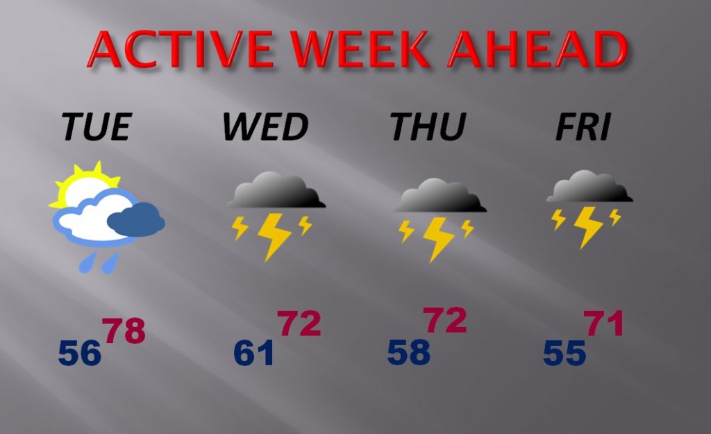
WEEK AHEAD: Spotty showers on Tuesday, lead to much better chance of showers and storms around Wednesday through Friday. Still warm through the end of the week. Right now, it does not appear to be severe. We will continue to monitor.
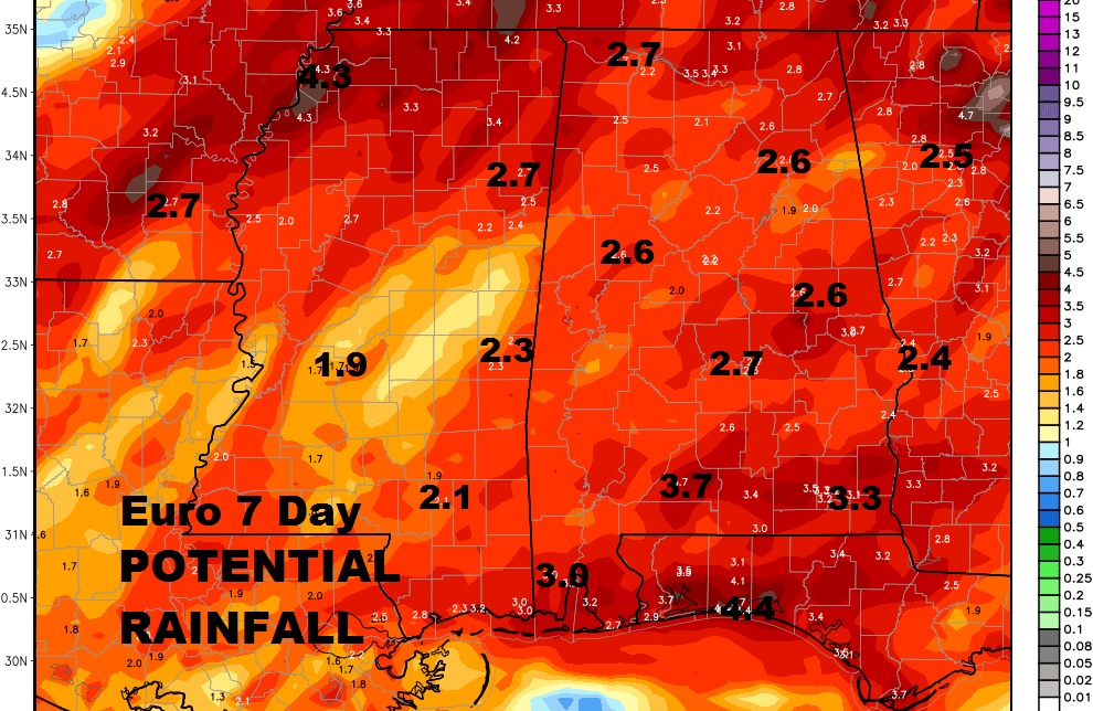
HOW MUCH RAIN?: Amounts, through the end of the week could be rather significant. 2 to 3” in many spots, perhaps. Here’s one model idea on rainfall.
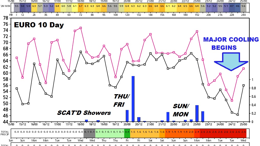
COLDER AIR ON THE HORIZON: In the early part of the next week (Jan 23-25) a trend to much cooler air begins. How much cooler/colder? The jury is out on that question. Stay tuned. Meanwhile, this graph from the Euro model, out 10 days shows a very warm week ahead. Periods of showers and storms through the week and into early next week.
Have a great Sunday and Monday MLK holiday! Our amazing weather continues. Enjoy it while it’s here. Other parts of the country are dealing with a variety of awful winter weather, including ice. Next blog post Monday morning. Next video returns on Tuesday.