
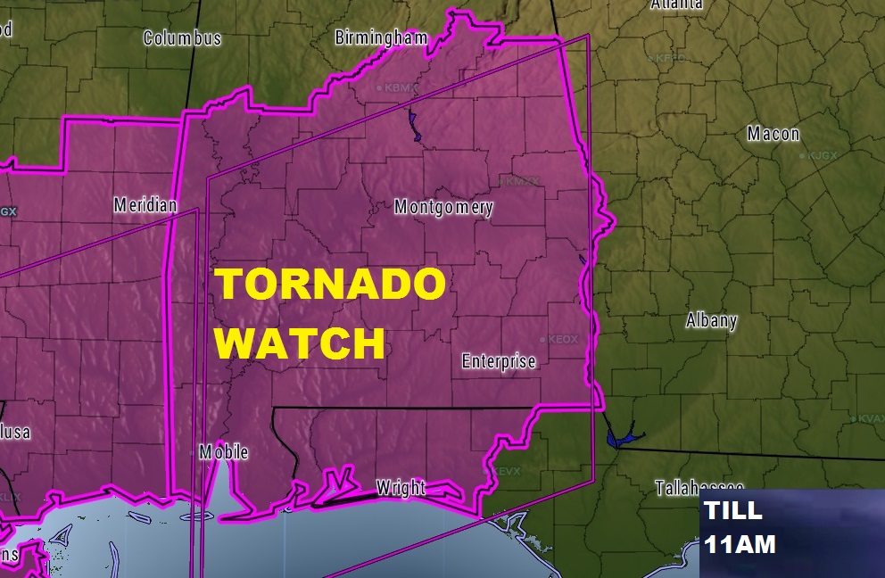
TORNADO WATCH till 11AM: Tornado watch is in effect for all of central and south Alabama through the morning hours. Tornadoes are possible, damaging winds to 60+ mph, and hail up to quarter size. Be weather aware and be ready for warnings for your area. This is only Round 1 of severe weather. Another round will come in tonight. Read details below.
Here’s Future Radar through 7pm — showing a very active round of severe weather through late morning. A lull this afternoon. And, the development moving into the state this evening.
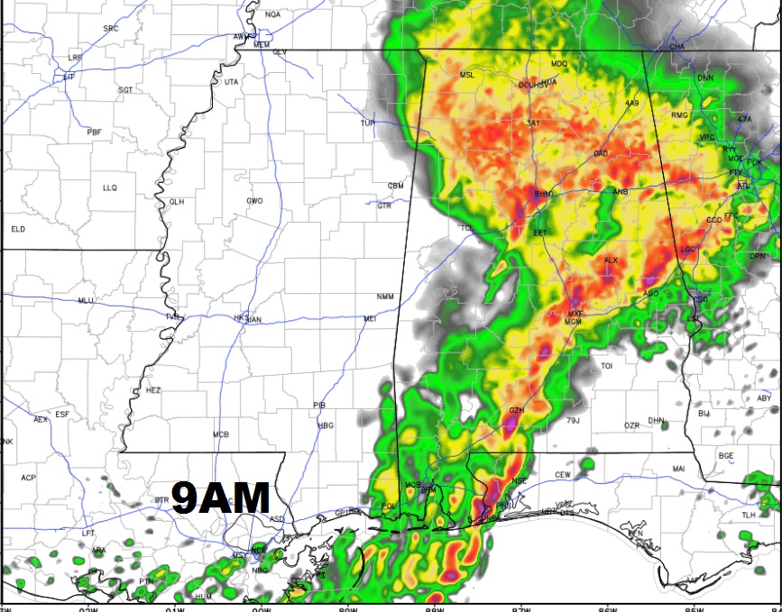
Here’s a 9AM Radar snapshop showing the line of strong/severe storms stretched across the heart of central and south Alabama.
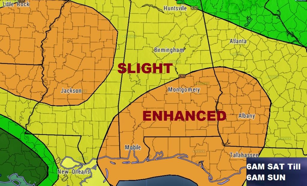
ROUND 2: Details of how the second round of severe weather will unfold, depends on many atmospheric factors which we won’t know until tomorrow. We do know that CAPE, or instability, will be more than adequate, along with directional shear with altitude, or “spin”. Potential exists for supercell thunderstorms, which will rotate and produce tornadoes. The threat develops again by Saturday evening, continuing Saturday night, through Sunday morning. Tornadoes are possible, along with damaging wind gusts 70+ mph and 1”+ in diameter hail. The updated outlook from the Storm Prediction Center shows two Enhanced Risk areas – one from west Alabama into Mississippi. The other Enhanced area covers much of southeast Alabama where there will be an elevated tornado & severe weather risk especially Saturday night.
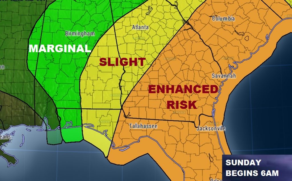
By Sunday morning at 6AM, the new Day 3 outlook from SPC shows a morning “slight” risk covering much of east and southeast Alabama. But late morning, or perhaps around lunchtime, the threat will have shifted east into Georgia and Florida.
STAY WEATHER AWARE: Make sure you have an adequate way of receiving weather watches and warnings. Do NOT depend on outdoor severe weather sirens. You need at least a couple of reliable ways of getting the warnings, like with our weather App, which will alert your of watches and warnings for your particular location. Make sure your weather radio is on and in the alert mode, which can wake you up when there is a warning for your county. A reminder, we will likely be dealing with two distinct rounds of severe weather, unfolding over a long 34 hour time window. Stay alert and have a plan of action. Charge up your cell phones in case power is loss. Be ready to take action if a warning is issued for your area. Watch for later updates as the situation changes and evolves.