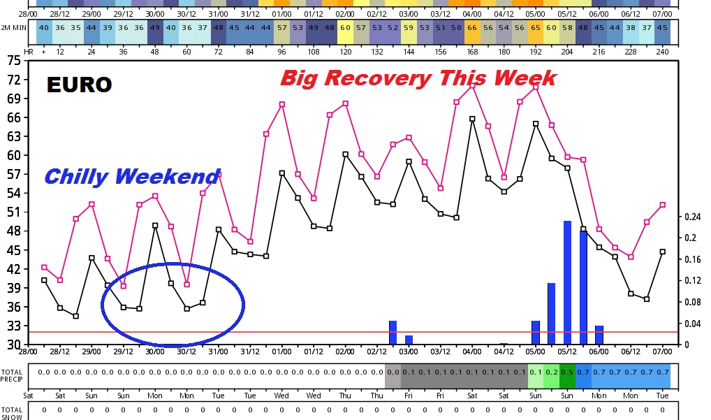
Throw an extra log on the fire, our January Chill will dominate the weekend, and the next three nights and mornings will be back in the low 30’s. It’s the coldest air in about three weeks, but this time, nothing shocking. No wind chills in the teens or single digits.
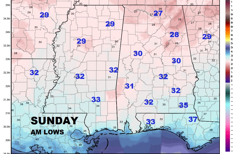
TODAY: A few clouds, mainly sunshine. Hi 54. Mainly clear and cold tonight. Low in the low 30’s Here’s a peek at Sunday morning lows.
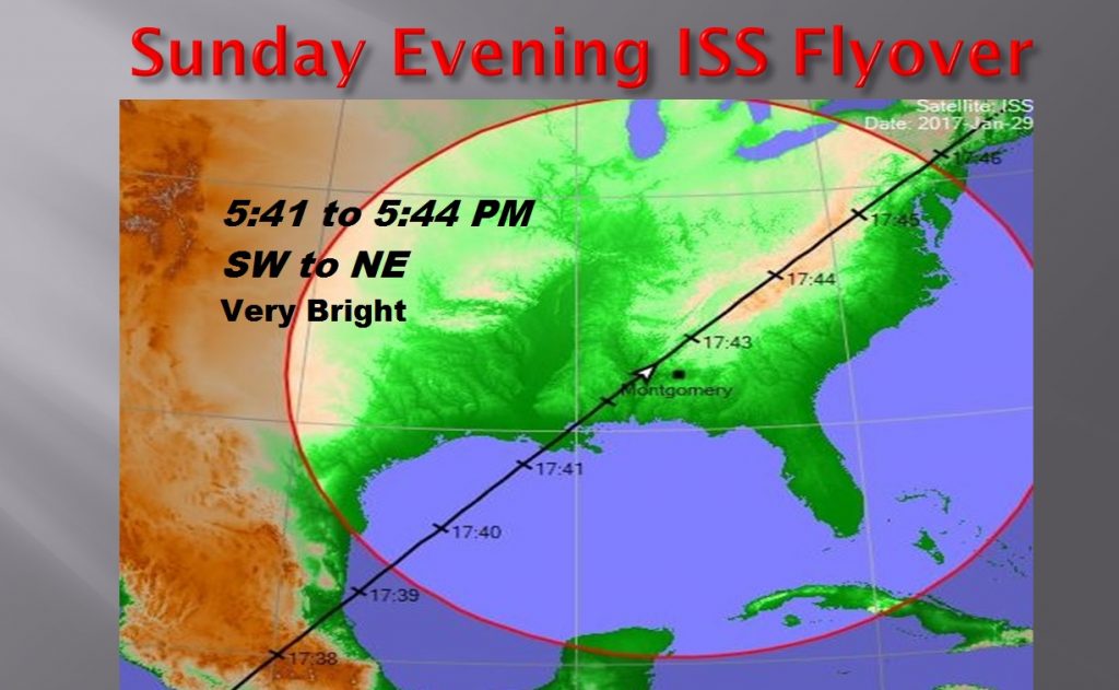
SUNDAY: A few clouds. We’ll call it partly sunny. Hi 56. Low Sunday night 34. Hopefully clouds will not interfere with another great Space Station Sunday evening, the second this week. Look in the SW sky at 5:41, passing overhead at almost 5:43, and heading northeast, at 17,500 mph. Thursday’s night’s Flyover was amazing. It never disappoints.
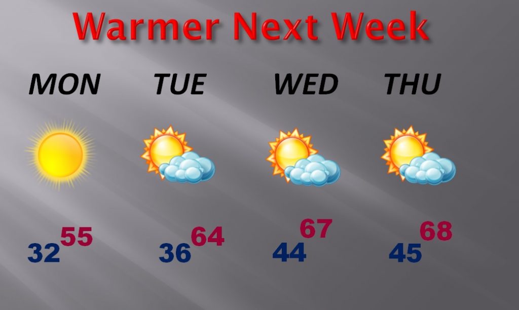
WARMER THIS WEEK: The week ahead will highlight a big temperature recovery. Highs will zoom into the 60’s again Tuesday through Friday. Storm-free weather is expected until next weekend.
MODEL TRENDS: The Euro Model Graph, shows our chill weekend, and cold mornings, but the graph swings sharply upward as we warm into the 60’s mid and late week. This models shows a storm system next weekend somewhere in the Sunday Feb. 5th time frame.
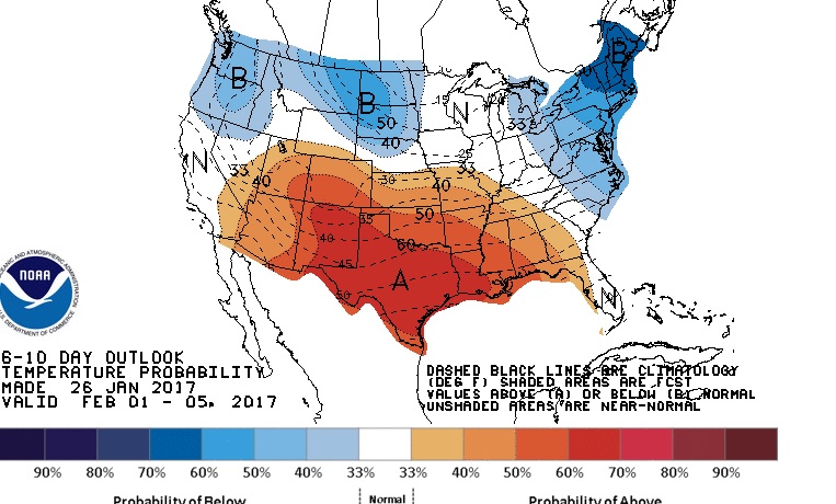
LOOKING AHEAD: Climate prediction center show much of the first few days of February will be mild to warm across the south. Cold air will be bottled up in Canada, but it will be back! The only question is when.
