
After A wild 24 hours of weather across the south, parts of our state could see some more hefty storms before the front moves through and ushers in some chilly air. I’ll walk through the changes. The latest on your warmer weekend forecast. More wild temperature swings, and perhaps another significant storm system next week. Attention morning commuters: dense fog will be a problem in spots this morning. We’ll cover it all on your Wednesday morning weather briefing.
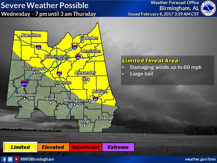
As the cold front sweeps through the state tonight, another round of storms, some of which could become severe with damaging wind gusts and large hail. Greatest threat will be over the northern and east central counties from 7PM in the northwest to about 3AM in the far east.
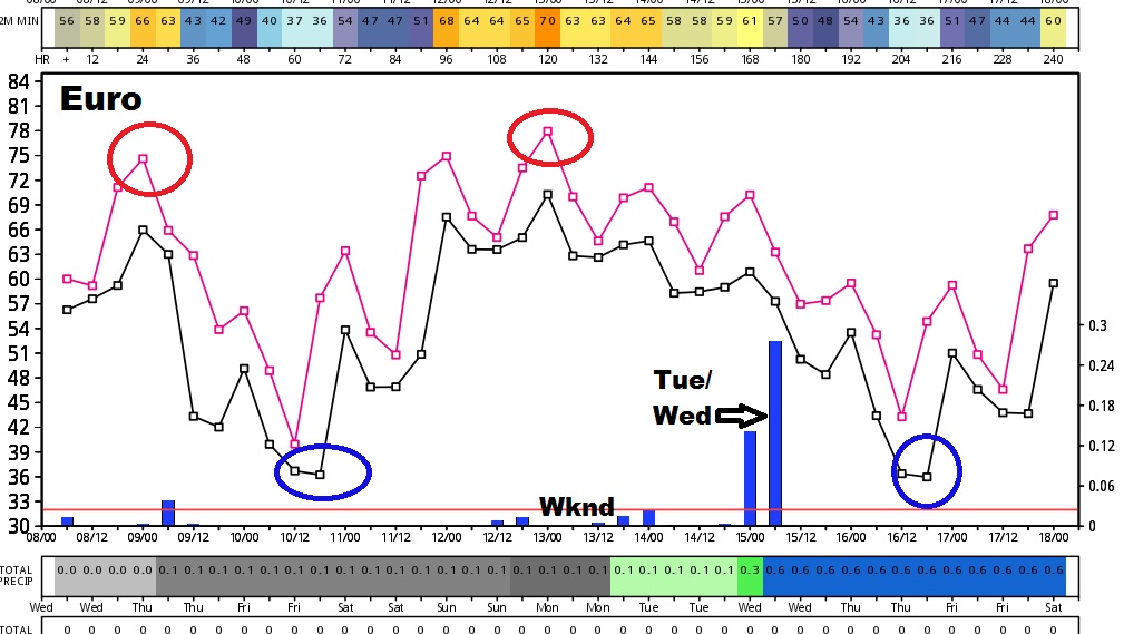
This 10 day graph from the Euro models tells quite a story. Warm today, followed by a huge drop to almost freezing Friday AM. Then, temperatures soar over the weekend. Another BIG storm system middle of next week, followed by yet another significant drop.
I will have a special LIVE Briefing this morning at 10 from the Bluewater Weather Center at 10AM with the latest on tonight’s storm threat across the state. It will stream LIVE on your App, on Your Tube and on our website at richthomasweathernetwork.com. See you at 10. Another video tomorrow morning at 5.