Storm system on the way could bring some strong, possibly severe storms by late tonight. SPC added a severe weather risk for Alabama while you slept. We’ll examine the threat with that storm system, plus the big cool down behind it. Some new wrinkles in the weekend forecast, and yet another storm system on the menu next week. We’ll break down the details in 2 minutes on your Tuesday morning weather briefing on Valentine’s Day.
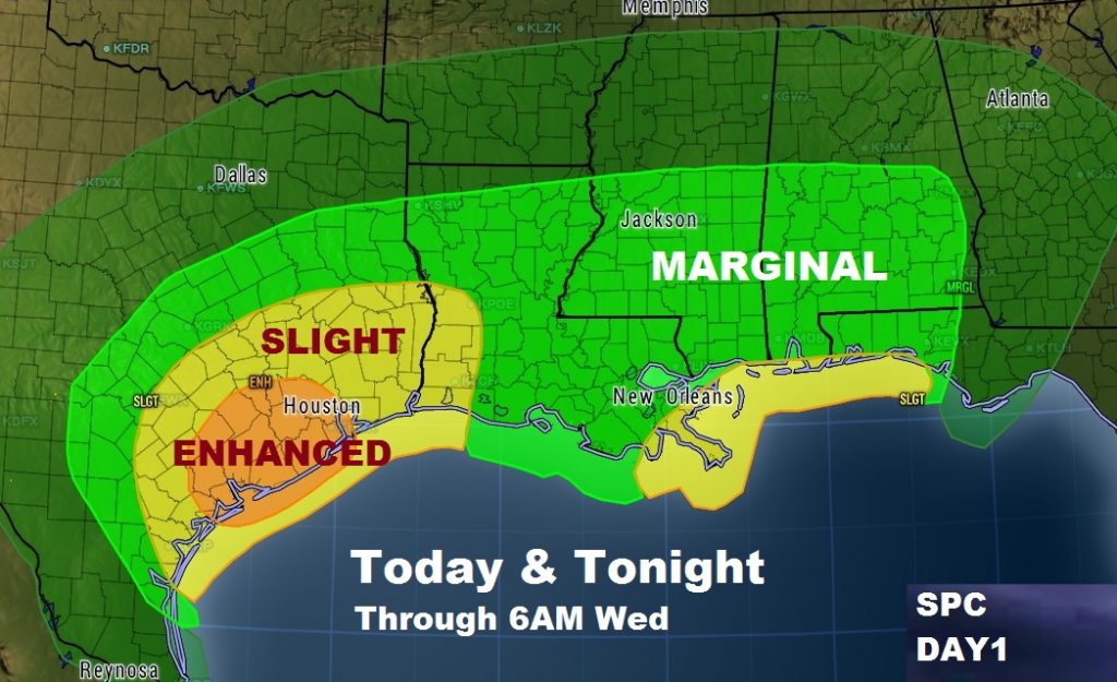
Latest Severe Weather Outlook from SPC has added a Marginal severe weather risk for the southern half of Alabama for tonight. Main threat damaging wind gusts. Tornado threat is not zero, but small. This outlook will be updated by SPC several times during the day. The main threat for most of us comes after Midnight tonight through Wednesday morning.

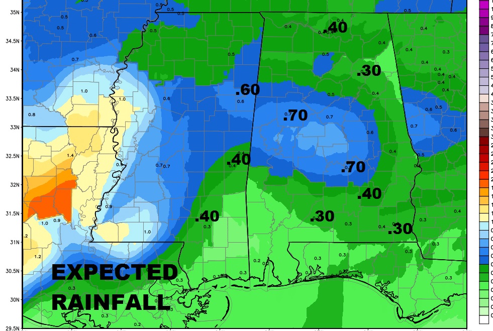
Expected rainfall is not expected to be heavy.

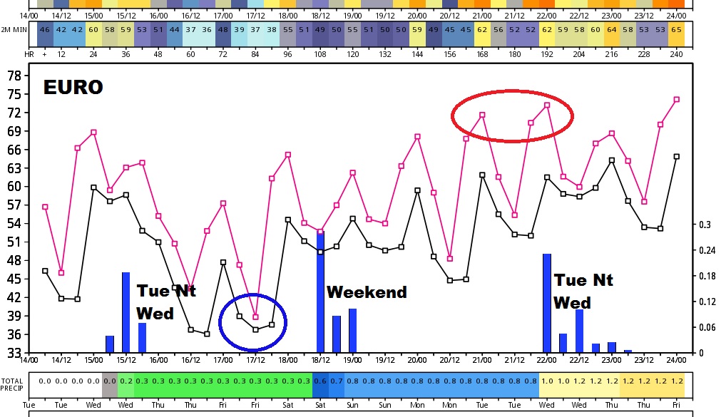
Interesting graph below with the Euro Model Trends out 10 days. Blue bars at the bottom shows the storm system tonight, possible new wrinkle with showers this weekend as a Gulf disturbance brushes by, and a storm system in the early to middle part of next week that needs to be monitored for its possible severe weather implications.

We will have a LIVE Streaming Update from the Bluewater Weather Center at 10AM, with the latest Future Radar and Updated information on SPC regarding tonight’s severe weather threat. Have a n ice Valentine’s Day. I’ll see you on the radio later this morning.
-Rich
