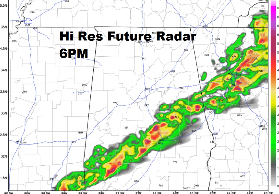
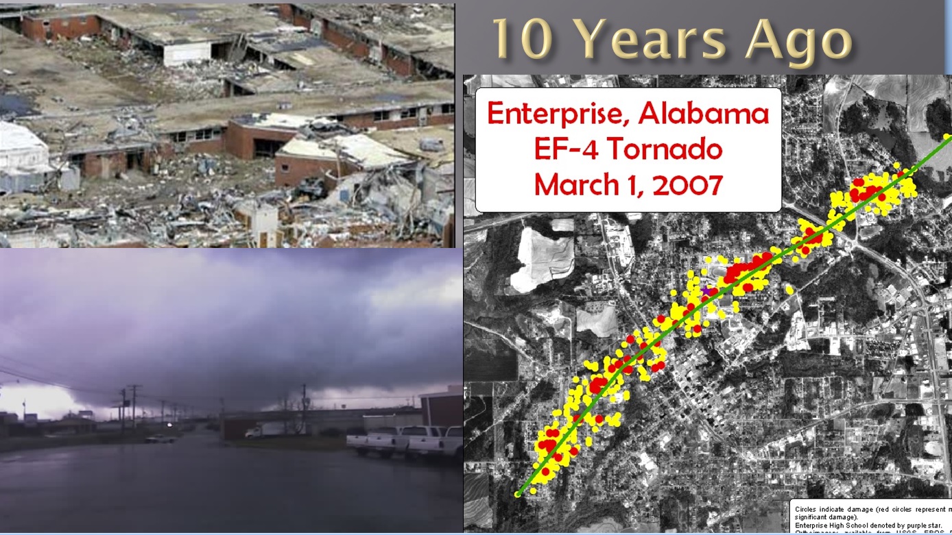
..March will come in like a lion today.. The latest future radar will show you the progress of the squall line crossing the state today with a damaging wind threat. We have the updated Severe Weather threat from the Storm Prediction Center. Another change sharply cooler is on the menu as we approach the weekend. And, more. Another storm threat about 7 days away…as we remember a terrible anniversary from 10 years ago today.
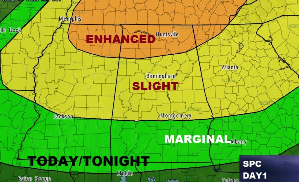
Here’s the updated severe risk from the Storm Prediction Center. It shows the Slight Risk area as far south as Montgomery, and the Marginal Risk through the Wiregrass counties. Damaging winds and Large Hail are the main threats. The tornado threat is low, but not zero. More than 20 tornadoes occurred in the Midwest yesterday and overnight.


Stay in touch with weather developments. Make sure you download our new weather App for your phones and/or tablets today. Be sure to allow push notifications so that we can alert you to watches, warnings and other important information.

