
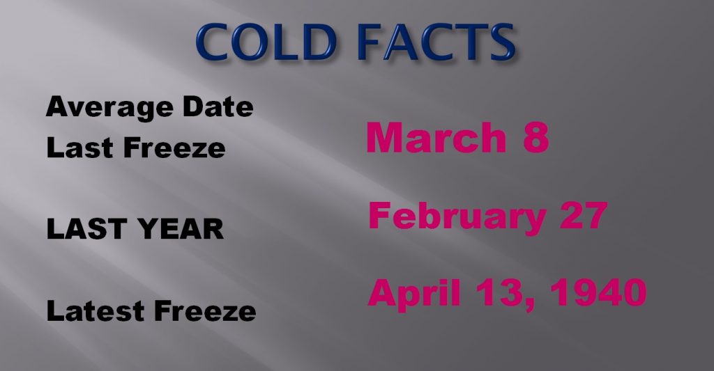
Temperatures are in the 30’s again this morning, although not quite as cold as Friday morning. At Dawn, Readings range from about 33 in Troy, to 34 in Alex City, 37 in Selma, and 38 at Maxwell AFB. Many spots were near or just a tad below freezing on Friday morning, including Prattville, Troy, Selma, and Alex City. For those of you wondering we are getting close to the average date of the last freeze which is March 8. Here are some cold facts below.
TODAY: Sunshine will dominate. A nice day. Near average high temperature in the mid 60’s Not as cold tonight. Low 41.
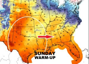
SUNDAY: Southerly winds will allow for a warmer day. Clouds will increase. I’ll call it Partly Sunny. Should be a dry day for most of us. Maybe a few sprinkles near the Mississippi border. High near 70. Low Sunday night 54. Map shows the warm-up heading eastward from the southern Plains.
MONDAY: Partly sunny. Highs in the mid 70’s. Scattered showers should hold off till Monday night as a frontal system approaches.
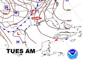
TUESDAY STORM SYSTEM: Showers and thunderstorms dominate the Tuesday forecast. Best chance for stronger storms will be towards Tuesday evening/Tuesday night. The jury is out on the severe weather threat, but it certainly possible that a severe weather threat will be added by SPC as we get closer to Tuesday.
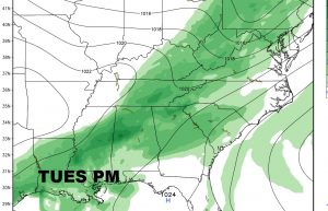
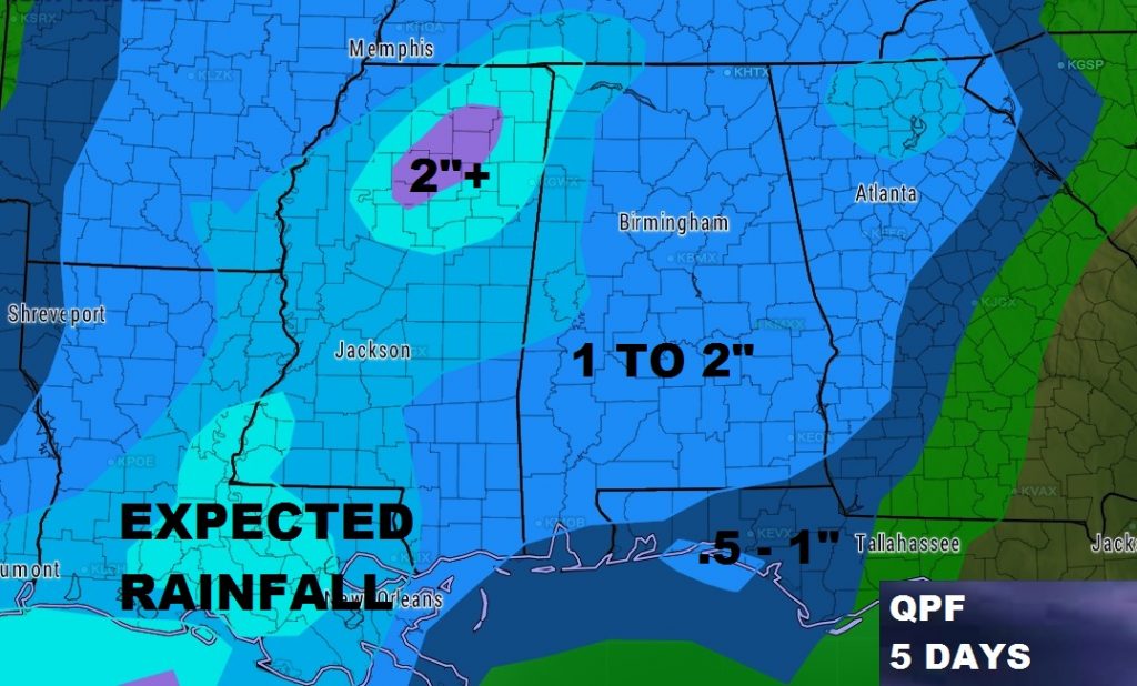
By Wednesday morning the front will have reached the coast as we trend cooler again, briefly for a couple of days but not cold. Total expected rainfall should be in the 1 to 2” range.
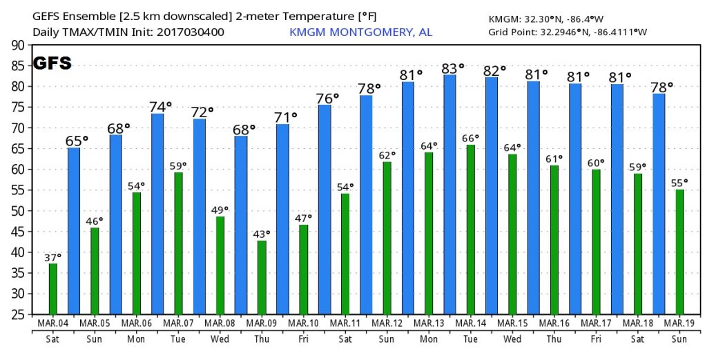
Cold weather fans won’t like this. The US GFS model, temperature trend out 16 days shows and amazing string of warm day toward the middle of March.
Hope you have a great weekend! My next video is scheduled for Monday morning, online at or before 5.
-Rich