
Briefly, today will be a warmer day with more clouds around, but mostly dry, in all but the far west counties. Monday’s temperatures will soar into the 70’s. And, rain and thunderstorms are on the menu for Tuesday and Tuesday night, but right now, it appears any severe weather threat is relatively small. We should get a good soaking, though.
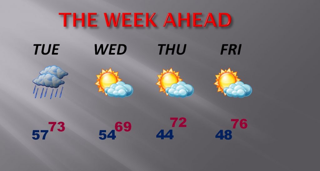
TODAY: Mostly cloudy. Not as cool. High 68-70°. Tonight’s low 54.
MONDAY: Partly sunny, warmer. High 75°. Scattered showers possible Monday night. Low 57.
TUESDAY: Showers and thunderstorms, especially by Tuesday afternoon & Tuesday night. High 73° Low Tuesday night. 57.
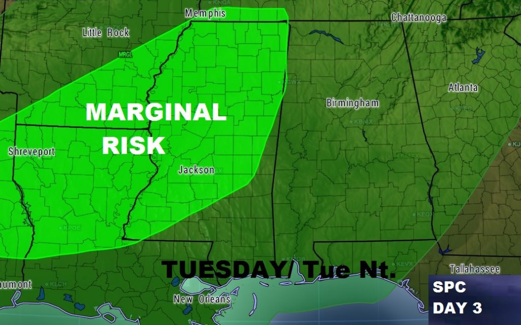
SEVERE THREAT?: This, of course may change, but right now Alabama is not included in the Tuesday Severe Threat. The Marginal Severe weather risk, for the moment begins at the Mississippi state line.
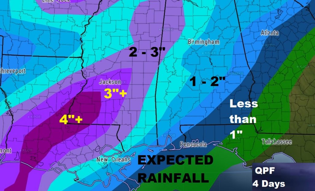
EXPECTED RAINFALL: For many of us it appears 1-2” is a good bet. Heavier amounts appear likely in the western counties and to our neighboring states west of Alabama.
WEEK AHEAD: After the Tuesday storm system, temperatures don’t cool off much at all. In fact, temperatures will rebound late week and into the weekend.
CLOCKS CHANGE NEXT WEEKEND: We have 1 more week on standard time. We go back to Daylight Saving Time next Sunday morning at 2AM. Today, sunrise was at 6:07. Sunset at 5:46PM.
I’ll have the next complete weather video/briefing for you tomorrow morning. My alarm goes off at 2, your video will be online at or before 5. Have a great Sunday!
–Rich