Good Morning! Southerly winds are bringing in warmer temps today. We’ve got a storm system approaching for tomorrow. I’ll update you on timing, rainfall amounts, and if we can expect any severe weather. Looks like we’ll be dealing with a series of disturbances next 10 days. Signs of a very active March. I’ll break it down for you on your Monday morning personal weather briefing.
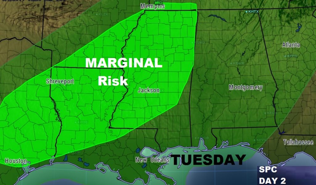
As of now, Alabama is not included in the SPC Severe Weather Risk for Tuesday. That could change, and we will monitor. As of now the Marginal Risk begins at the Mississippi line.

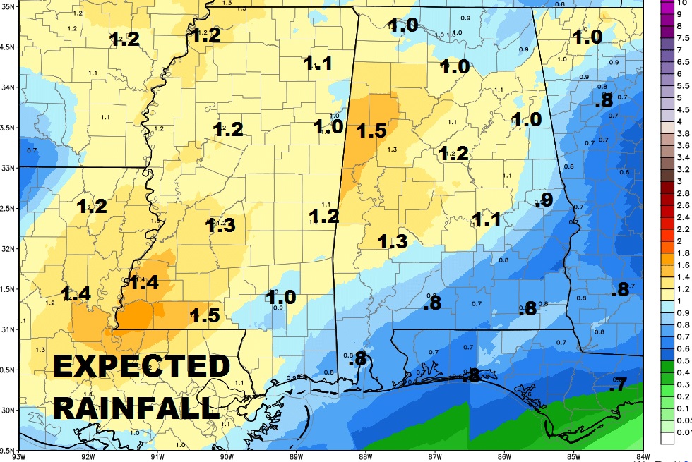
So far, expected rainfall with this system is not expected to be excessive.

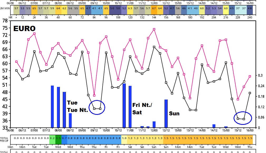
The Euro model out 10 days suggests a very active time as a series of disturbances race through the area in a fast flow aloft.

This is the weekend we Spring Forward back to Daylight Saving Time, late Saturday night, early Sunday AM.

