Good Morning… Today it’s Alabama’s turn to deal with a severe weather threat. For most of us the strongest threat will be tonight. On this video, I have the latest from the Storm Prediction Center, outlining the threat, plus the latest Future Radar. Timing is everything, and it looks like we’ll be in between storm systems this weekend, before the next potent system arrives on our doorstep Sunday night/Monday. I’ll bring you up to date on it all with your 2 minute personal weather briefing.
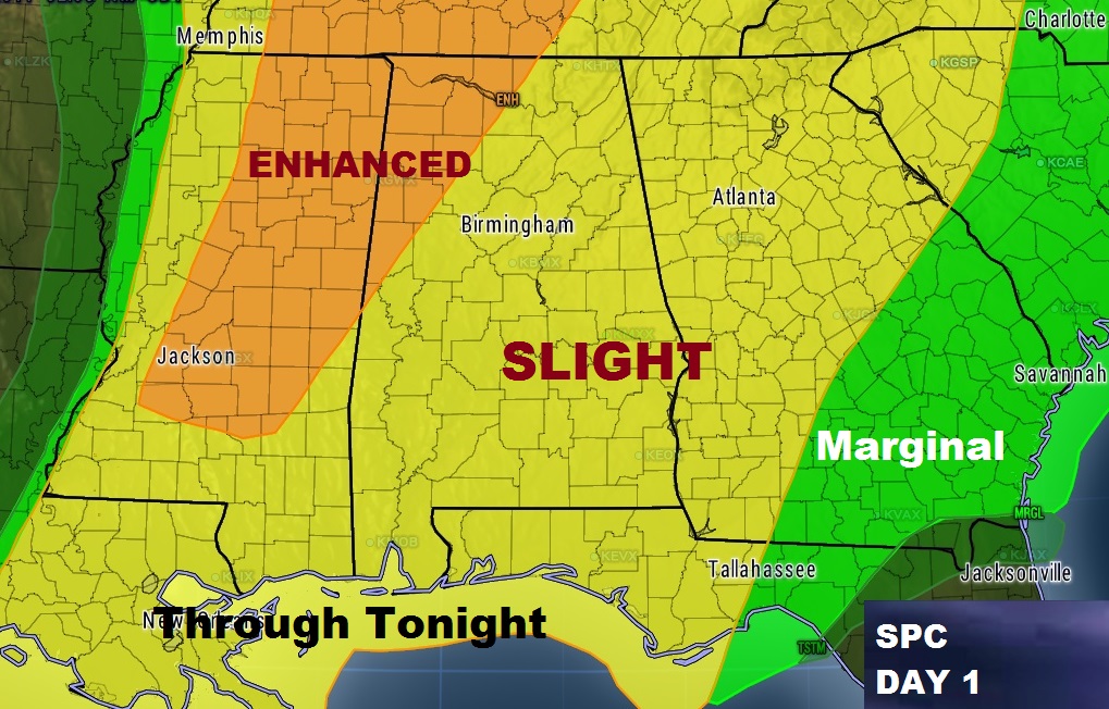
Here’s the updated Severe Risk for today from SPC. For most of us the main risk will be Damaging Thunderstorm Wind Gusts. But, the tornado threat is not zero. And, the stronger risk of a tornado or two is in the Enhanced Risk area covering NW Alabama.
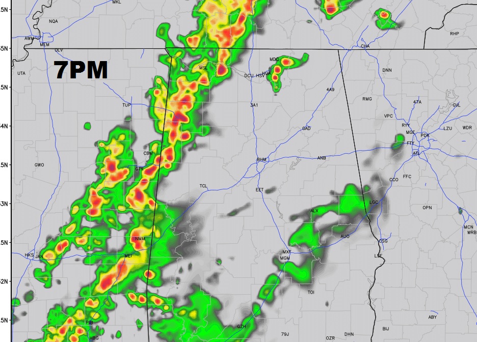
Here’s a future radar snapshot at 7PM tonight. Squall line moving through NW and west Alabama will advance across the state through the night. Damaging wind gusts is the main threat.
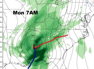
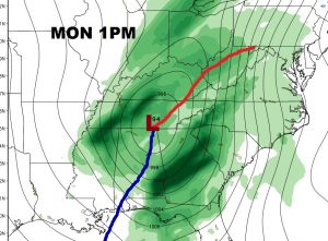
The next “big Ticket” storm system arrives at our door step Sunday night into Monday. Again, severe weather is NOT out of the question.