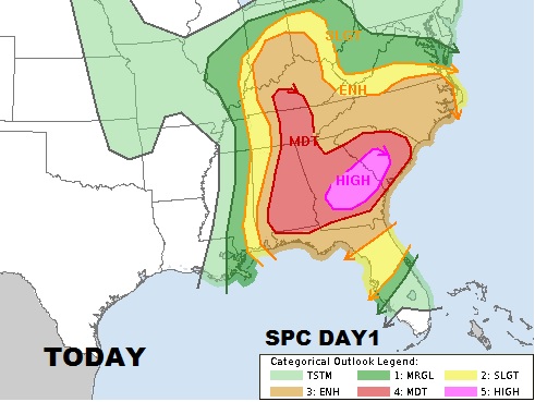
Round 1 of severe weather came in between 1:30AM and 5 for most of us. Round 2 from about 9:30 till Noon. Are we done? NO. There will be additional “waves” as our severe risk continues later this afternoon and this evening as a “dry line: and frontal system approaches. In the meantime, with clouds breaks across west and central AL, the ground is heating up which will destabilize the atmosphere even more for the next round. Still – damaging winds, and tornadoes, perhaps long-track destructive tornadoes, and hail which could be as large as baseball size. The expected window still could extend till 8-9PM tonight.
SPC has continued the Moderate Severe risk for most of Alabama and has now issued a rare High risk for much of Georgia and part of SC.

New PDS tornado watch till 7PM tonight takes in SE AL and Georgia and SC. Other new watches will be required for the entire area later this afternoon/evening

